
San Diego River facts for kids
Quick facts for kids San Diego River |
|
|---|---|

Looking upstream near mouth
|
|

Location of the mouth of the San Diego River in California
|
|
| Country | United States |
| State | California |
| Region | San Diego County |
| Physical characteristics | |
| Main source | Cuyamaca Mountains 5 miles (8 km) northwest of Julian, California 3,750 ft (1,140 m) 33°07′09″N 116°39′00″W / 33.11917°N 116.65000°W |
| River mouth | Mission Bay Community of Ocean Beach, San Diego, California 13 ft (4.0 m) 32°45′37″N 117°12′45″W / 32.76028°N 117.21250°W |
| Length | 52 mi (84 km) |
| Basin features | |
| Basin size | 420 sq mi (1,100 km2) |
The San Diego River is a river in San Diego County, California. It starts high up in the Cuyamaca Mountains, near the town of Julian. From there, it flows southwest until it reaches the El Capitan Reservoir. This is the biggest reservoir in the river's watershed.
After the El Capitan Dam, the river flows west through cities like Santee and San Diego. It even passes through Mission Trails Regional Park, which is one of the largest city parks in America. Finally, the river empties into the Pacific Ocean near Mission Bay, forming an estuary.
Contents
A River's Journey and Its Changing Path
The San Diego River is about 52 miles (84 km) long. It flows from its starting point, called the headwaters, all the way to the ocean. Along its path, many smaller streams and creeks join it. These are called tributaries.
Some of the main tributaries include:
- Oak Canyon Creek
- Spring Canyon Creek
- Forester Creek
- Los Coches Creek
- San Vicente Creek
- Wildcat Canyon Creek
- Chocolate Creek
- Conejos Creek
- Sand Creek
- Isham Creek
- Boulder Creek
- Cedar Creek
- Ritchie Creek
- Dye Canyon Creek
- Iron Springs Canyon Creek
- Temescal Creek
- Sentenac Creek
- Coleman Creek
- Baily Creek
- Jim Green Creek
- Boring Creek
- Marriette Creek
- Jim Green Creek
- Eastwood Creek
- Baily Creek
There are also four other reservoirs in the river's watershed. Cuyamaca Reservoir is on Boulder Creek. San Vicente Reservoir gets its water from San Vicente Creek. Lake Jennings and Lake Murray were made by building dams across canyons.
How the River's Course Has Shifted
The San Diego River has changed where it flows many times. Before 1821, it usually flowed into San Diego Harbor. But in the fall of 1821, a big flood changed its path overnight. Most of the water then went into what was called False Bay, which is now Mission Bay. Only a small stream still flowed into the harbor.
The river sometimes flowed back into San Diego Harbor, like in 1849 and 1856. Because the river carried a lot of mud and sand, it started to fill up San Diego Bay. This threatened to ruin the bay as a harbor for ships. So, in 1853, the government built a dirt wall, called a levee. This levee was meant to send the river's water into Mission Bay instead of the harbor.
However, heavy rains later that year broke part of the levee. The river went back to its old path into the harbor. The worst flood in this area happened in 1862. It was so big that Mission Valley was completely covered in water. Houses in Old Town were flooded because strong winds pushed water from the bay back up the river. This flood was special because it stayed at its highest level for over 24 hours.
In 1876, the levee was rebuilt. Since then, the river has not flowed into San Diego Bay. Instead, it has added a lot of mud and sand to the San Diego River delta in Mission Bay during floods.
Controlling the River with Dams and Jetties
In 1935, the El Capitan Dam was built about 27 miles up the San Diego River. This dam greatly reduced the amount of mud and sand flowing into the bay. An earlier dam was even topped by floodwaters in 1916.
Later, in 1948, the Mission Bay and San Diego River jetties were built. Jetties are long structures that stick out into the water. They help control the flow of water and keep the entrance to the bay clear. By 1951, the river levees were connected to these jetties. This made sure that all the ocean's tides were kept in a new, specific channel. The channels were fully finished by 1955.
Protecting the San Diego River
Two important groups work to protect the San Diego River.
The San Diego River Park Foundation started in 2001. This group works to protect the river's water, wildlife, and natural beauty. They also help people enjoy the river through recreation. They want to connect the community with the river's culture and history.
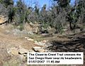
The San Diego River Conservancy was created by the California Legislature. This government agency works to save, fix, and improve the San Diego River area. They buy and manage land to protect nature and offer fun activities. Their goals include protecting wildlife, wetlands, water quality, and historical sites. A big goal is to create a long park and hiking trail. This trail would go along the entire river, from its start in the Cuyamaca Mountains all the way to the Pacific Ocean.
Images for kids
-
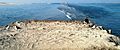
Mouth
-
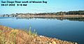
Channel south of Mission Bay
-
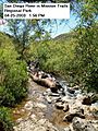
Crossing in Mission Trail Regional Park
-
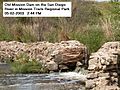
Old Mission Dam in Mission Trails Regional Park
-
Coast to Crest Trail crosses river near headwaters


