
Missouri water resource region facts for kids
The Missouri water resource region is like a giant puzzle piece on the map of the United States. It's one of 21 big areas that the United States Geological Survey (USGS) uses to organize and study all the water. Think of it as a huge neighborhood for rivers and streams!
Each of these big areas, called a region, includes all the land where water flows into a major river, or a group of rivers. The Missouri region is special because it mainly covers the area drained by the mighty Missouri River. It also includes the Saskatchewan River Basin (the part that's in the U.S.) and some smaller "closed basins" where water doesn't flow out to the ocean.
This region is huge, covering about 520,960 square miles (1,349,200 square kilometers). That's bigger than many countries! It includes all of Nebraska and parts of Colorado, Iowa, Kansas, Minnesota, Missouri, Montana, North Dakota, South Dakota, and Wyoming.
The USGS gives each of these big regions a special 2-digit code. The Missouri region's code is 10. Inside this huge region, there are 30 smaller areas, called sub-regions. These sub-regions have 4-digit codes, from 1001 all the way to 1030.

Contents
Understanding Water Sub-regions
Imagine the Missouri River region as a big tree. The main trunk is the Missouri River itself, and the branches are all the other rivers and streams that flow into it. Each of these branches, or even smaller twigs, represents a sub-region.
These sub-regions help scientists and water managers understand how water moves across the land. They can study how much rain falls in each sub-region, how much water flows in its rivers, and how people use that water. This helps them manage water resources better for everyone.
What's in a Sub-region?
Each sub-region is basically a smaller "drainage area." This means it's the land where all the rain and snowmelt eventually flow into a specific river or part of a river. For example, the "Upper Yellowstone subregion" (code 1007) includes all the land where water flows into the upper part of the Yellowstone River.
These sub-regions can be quite large themselves, sometimes covering thousands of square miles! They often cross state lines, meaning a single river basin might be shared by several states.
Why are Sub-regions Important?
Studying water in these smaller chunks helps us:
- Protect Water Quality: If there's pollution in one sub-region, it's easier to track where it came from and fix it.
- Manage Floods and Droughts: Knowing how much water is in each sub-region helps predict floods or prepare for droughts.
- Plan for Water Use: Farmers, cities, and industries all need water. Understanding the water resources in each sub-region helps make sure there's enough for everyone.
- Protect Wildlife: Many animals depend on healthy rivers and wetlands. Managing water by sub-regions helps protect their homes.
Examples of Sub-regions
To give you an idea of these sub-regions, here are a few examples from the Missouri water resource region:
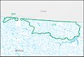
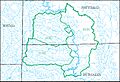
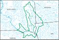
- Saskatchewan subregion (1001): This small part covers the Saskatchewan River Basin that reaches into the United States, mostly in Montana.
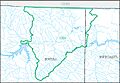
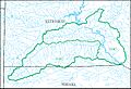
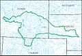
- Missouri Headwaters subregion (1002): This is where the Missouri River officially begins, formed by the joining of the Gallatin, Jefferson, and Madison Rivers in Montana and Wyoming.
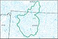
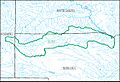
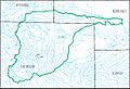
- Upper Yellowstone subregion (1007): This area in Montana and Wyoming includes the upper part of the Yellowstone River before it meets the Bighorn River.
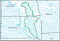
- North Platte subregion (1018): This covers the North Platte River Basin, which flows through Colorado, Nebraska, and Wyoming.
- Kansas subregion (1027): This area includes the Kansas River Basin in Kansas, Nebraska, and Missouri, but it doesn't include the Republican and Smoky Hill River Basins that flow into it.
Each of these 30 sub-regions plays a vital role in the overall health and flow of the Missouri water resource region.
Images for kids
-
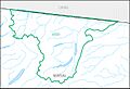
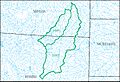
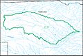
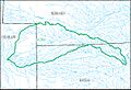
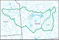
HUC1001
-
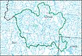
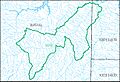
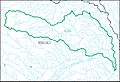
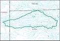
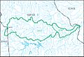
HUC1002
-
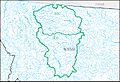
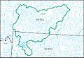
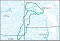
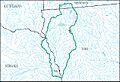
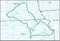
HUC1003
-
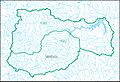
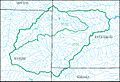
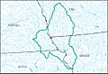
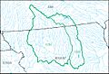
HUC1004
-
HUC1005
-
HUC1006
-
HUC1007
-
HUC1008
-
HUC1009
-
HUC1010
-
HUC1011
-
HUC1012
-
HUC1013
-
HUC1014
-
HUC1015
-
HUC1016
-
HUC1017
-
HUC1018
-
HUC1019
-
HUC1020
-
HUC1021
-
HUC1022
-
HUC1023
-
HUC1024
-
HUC1025
-
HUC1026
-
HUC1027
-
HUC1028
-
HUC1029
-
HUC1030


