Mito, Ibaraki facts for kids
Quick facts for kids
Mito
水戸市
|
|||||||||
|---|---|---|---|---|---|---|---|---|---|

|
|||||||||
|
|||||||||
 |
|||||||||
| Country | Japan | ||||||||
| Region | Kantō | ||||||||
| Prefecture | Ibaraki | ||||||||
| Area | |||||||||
| • Total | 217.32 km2 (83.91 sq mi) | ||||||||
| Population
(January 2024)
|
|||||||||
| • Total | 268,036 | ||||||||
| • Density | 1,233.370/km2 (3,194.41/sq mi) | ||||||||
| Time zone | UTC+9 (Japan Standard Time) | ||||||||
| - Tree | Prunus mume | ||||||||
| - Flower | Bush clover (hagi) | ||||||||
| - Bird | White wagtail | ||||||||
| Phone number | 029-224-1111 | ||||||||
| Address | 1-4-1 Chūō, Mito-shi, Ibaraki-ken 310−8610 | ||||||||
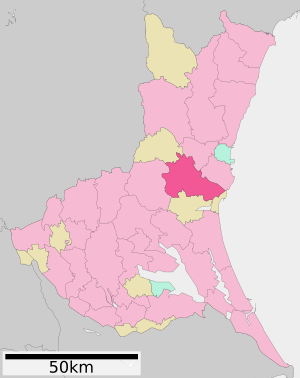
Mito (水戸市, Mito-shi) is a major city in Japan. It is the capital city of Ibaraki Prefecture. Mito is located in the northern part of the Kantō region. As of January 2024, about 268,036 people live in Mito. The city covers an area of about 217.32 square kilometers.
Contents
- Exploring Mito's Geography
- Mito's Growing Population
- A Look at Mito's History
- Mito's Economy and Jobs
- Learning and Education in Mito
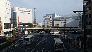
- Getting Around Mito: Transportation
- Mito's Media Outlets
- Fun Places to Visit in Mito
- Mito's Professional Sports Teams
- Mito's Sister Cities
- Famous People from Mito
- Images for kids
- See also
Exploring Mito's Geography
Mito is in the middle of Ibaraki Prefecture. Mito Station is about 10 kilometers away from the Pacific Ocean. The Naka River flows from the north to the east of the city and into the ocean. Just south of the city is Lake Senba, a popular spot for fun activities. A main street goes west from Mito Station, with homes mostly to the south and west.
Neighboring Cities and Towns
Mito is surrounded by several other places in Ibaraki Prefecture:
- Hitachinaka
- Kasama
- Naka
- Ibaraki
- Ōarai
- Shirosato
Mito's Climate and Weather
Mito has a climate with warm summers and cold winters. Sometimes, there is light snowfall. The average temperature in Mito is about 13.6°C each year. The city gets about 1353.8 mm of rain every year. September is usually the wettest month. August is the warmest month, with temperatures around 25.2°C. January is the coldest, with temperatures around 3.0°C.
| Climate data for Mito (1991−2020 normals, extremes 1897−present) | |||||||||||||
|---|---|---|---|---|---|---|---|---|---|---|---|---|---|
| Month | Jan | Feb | Mar | Apr | May | Jun | Jul | Aug | Sep | Oct | Nov | Dec | Year |
| Record high °C (°F) | 23.8 (74.8) |
24.3 (75.7) |
25.9 (78.6) |
31.0 (87.8) |
33.4 (92.1) |
34.5 (94.1) |
38.4 (101.1) |
38.4 (101.1) |
36.8 (98.2) |
33.1 (91.6) |
26.2 (79.2) |
25.0 (77.0) |
38.4 (101.1) |
| Mean daily maximum °C (°F) | 9.2 (48.6) |
9.8 (49.6) |
13.0 (55.4) |
17.8 (64.0) |
22.0 (71.6) |
24.5 (76.1) |
28.5 (83.3) |
30.0 (86.0) |
26.4 (79.5) |
21.2 (70.2) |
16.3 (61.3) |
11.4 (52.5) |
19.2 (66.6) |
| Daily mean °C (°F) | 3.3 (37.9) |
4.1 (39.4) |
7.4 (45.3) |
12.3 (54.1) |
17.0 (62.6) |
20.3 (68.5) |
24.2 (75.6) |
25.6 (78.1) |
22.1 (71.8) |
16.6 (61.9) |
10.8 (51.4) |
5.6 (42.1) |
14.1 (57.4) |
| Mean daily minimum °C (°F) | −1.8 (28.8) |
−1.2 (29.8) |
2.1 (35.8) |
7.0 (44.6) |
12.5 (54.5) |
17.0 (62.6) |
21.0 (69.8) |
22.2 (72.0) |
18.6 (65.5) |
12.5 (54.5) |
5.9 (42.6) |
0.5 (32.9) |
9.7 (49.5) |
| Record low °C (°F) | −12.0 (10.4) |
−12.7 (9.1) |
−9.0 (15.8) |
−3.5 (25.7) |
−0.1 (31.8) |
7.3 (45.1) |
10.2 (50.4) |
12.7 (54.9) |
7.9 (46.2) |
−0.5 (31.1) |
−4.7 (23.5) |
−8.2 (17.2) |
−12.7 (9.1) |
| Average precipitation mm (inches) | 54.5 (2.15) |
53.8 (2.12) |
102.8 (4.05) |
116.7 (4.59) |
144.5 (5.69) |
135.7 (5.34) |
141.8 (5.58) |
116.9 (4.60) |
186.3 (7.33) |
185.4 (7.30) |
79.7 (3.14) |
49.6 (1.95) |
1,367.7 (53.85) |
| Average snowfall cm (inches) | 4 (1.6) |
6 (2.4) |
1 (0.4) |
0 (0) |
0 (0) |
0 (0) |
0 (0) |
0 (0) |
0 (0) |
0 (0) |
0 (0) |
1 (0.4) |
12 (4.7) |
| Average precipitation days (≥ 0.5 mm) | 5.5 | 6.0 | 10.5 | 11.3 | 12.2 | 13.0 | 12.5 | 9.4 | 11.8 | 12.0 | 8.0 | 5.9 | 118.1 |
| Average relative humidity (%) | 63 | 63 | 66 | 70 | 74 | 81 | 82 | 81 | 81 | 79 | 75 | 68 | 74 |
| Mean monthly sunshine hours | 195.4 | 174.3 | 182.7 | 183.5 | 186.1 | 137.8 | 150.8 | 179.4 | 138.7 | 140.6 | 153.7 | 178.0 | 2,000.8 |
| Source: Japan Meteorological Agency | |||||||||||||
Mito's Growing Population
The number of people living in Mito has grown steadily over the last 100 years. This shows that Mito is a city that continues to attract residents.
| Historical population | ||
|---|---|---|
| Year | Pop. | ±% |
| 1950 | 141,154 | — |
| 1960 | 162,160 | +14.9% |
| 1970 | 195,818 | +20.8% |
| 1980 | 239,742 | +22.4% |
| 1990 | 260,456 | +8.6% |
| 2000 | 261,562 | +0.4% |
| 2010 | 268,750 | +2.7% |
| 2020 | 270,685 | +0.7% |
A Look at Mito's History
People from the Yamato group first settled in Mito around the 4th century CE. Later, a warlord named Baba Sukemoto built a castle here. Mito Castle was controlled by different families over time.
The Tokugawa Family and Mito
In 1603, the Tokugawa Ieyasu family took control of Mito Castle. Ieyasu's son, Tokugawa Yorifusa, became the head of Mito. His family was one of three special branches that could provide a new leader for Japan if needed. During this time, Mito became famous for the Mito School. This was a group of smart thinkers who studied Confucian ideas. They also looked at Western learning to help Japan grow stronger. They believed this would show how special Japan was. The Kōdōkan was a very important school during this period.
Mito as a Modern City
Mito officially became a city on April 1, 1889. It was one of the first 31 cities in Japan. With about 25,000 people, it was chosen as the capital of Ibaraki Prefecture. By 1900, a train line, the Jōban Line, connected Mito to Tokyo. By 1910, people in Mito had telephones and electric lights. Sadly, a large part of the city was destroyed in an air raid during World War II on August 2, 1945.
After the war, Mito grew by adding nearby villages between 1955 and 1958. More areas were added in 1992 and 2005. In 2001, Mito was named a "special city." This gave it more power to make its own local decisions. In 2011, the city was badly damaged by the 2011 Tōhoku earthquake and tsunami. Many houses were destroyed, but only two people lost their lives. On April 4, 2020, Mito became a "core city," which gave it even more local control.
Mito's Economy and Jobs
Mito is mainly a center for business and government in its region. Most of the big factories in Ibaraki are in other cities like Tsukuba and Hitachi. Mito has a good tourism industry. Many visitors come to see the beautiful Kairaku-en gardens and museums about the Tokugawa family.
Learning and Education in Mito
Mito has many schools for students of all ages.
- Ibaraki University
- Tokiwa University
- Tokiwa Junior College
- The city government runs 32 public elementary schools and 15 public middle schools.
- There is one public elementary school and one public middle school run by the national government.
- Mito also has one private elementary school and two private middle schools.
- For high school, there are seven public high schools and seven private high schools.
- Two high schools offer night and online classes.
- The prefecture also runs six special education schools for students with disabilities.
- Ibaraki Korean Primary, Middle and High School, a school for Korean students, is also in the city.
Getting Around Mito: Transportation
Mito has good transportation options, especially by train and highway.
Train Travel
![]() JR East - Mito Line / Jōban Line
JR East - Mito Line / Jōban Line
- Uchihara - Akatsuka - Kairakuen - Mito
![]() JR East – Suigun Line
JR East – Suigun Line
- Mito
![]() Kashima Rinkai Railway Ōarai Kashima Line
Kashima Rinkai Railway Ōarai Kashima Line
- Mito - Higashi-Mito - Tsunezumi
Major Highways
 Jōban Expressway – Mito Interchange
 Kita-Kantō Expressway – Mito Minami Interchange
 Higashi-Mito Road – Mito-Oarai Interchange
 National Route 6
 National Route 50
 National Route 51
 National Route 118
 National Route 123
 National Route 124
 National Route 245
 National Route 349
 National Route 400
Mito's Media Outlets
- Ibaraki Shimbun (Newspaper)
- Ibaraki Broadcast System (Radio and TV)
Fun Places to Visit in Mito
Mito has many interesting places to explore.
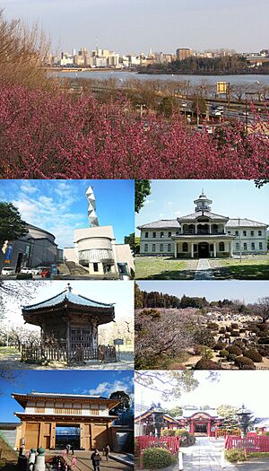
- Kairaku-en is a famous Japanese garden. It is one of the Three Great Gardens of Japan. Tokugawa Nariaki built it in 1842. The park is well-known for its ume (plum) trees. Many people visit in spring to see the beautiful plum blossoms during the Ume Festival. In summer, Mito also has the Mito Koumon Festival.
- Art Tower Mito
- The Museum of Modern Art, Ibaraki
- Ibaraki Prefectural Museum of History
- Kōdōkan School
- Lake Senba
- Mito Castle
- Mito Municipal Botanical Park
- Tokiwa Jinja
Mito's Professional Sports Teams
Mito is home to several professional sports teams.
- Mito HollyHock, a soccer team in the J. League
- Ibaraki Robots, a basketball team in the B. League
- Malva FC, a futsal team in the F. League
Mito's Sister Cities
Mito has special relationships with other cities around the world and in Japan. These are called sister cities.
 Anaheim, California, United States (since December 21, 1976)
 Chongqing, China (friendship city since June 6, 2000)
 Tsuruga, Japan (since October 10, 1964)
Famous People from Mito
Many notable people have come from Mito.
- Tatsuro, musician and singer of Mucc
- Satochi, musician and drummer of Mucc
- Ayase Ueda, footballer
- Yuko Suzuhana, musician
- Hiroyuki Watanabe, actor
- Mika Katsumura, actress
- Saya Hiyama, news anchor
- Yokoyama Taikan, artist
- Nakamura Tsune, artist
- Stomu Takeishi, musician
- Aritomo Gotō, IJN admiral
- Takeo Kurita, IJN admiral
- Kinji Fukasaku, movie director
- Takashi Koizumi, movie director
- Teru Shimada, actor
- Yutaka Nakajima, actor
- Shin’ichirō Ikebe, musician
- Mayumi Gojo, singer
- Nobuo Tobita, voice actor
- Megumi Nakajima, voice actress, singer
- Azusa Tadokoro, voice actress, singer
- Mitoizumi Masayuki, sumo wrestler
- Musōyama Masashi, sumo wrestler
- Miyabiyama Tetsushi, sumo wrestler
- Takashi Yagihashi, chef
- Sugiura Shigemine, World War 2 fighter pilot
- Hitachiyama Taniemon, sumo wrestler
- Hidenori Shoji, video game music composer
Images for kids
-
Ume Festival at Kairaku-en Park
See also
 In Spanish: Mito (Ibaraki) para niños


