Montello, Nevada facts for kids
Quick facts for kids
Montello, Nevada
|
|
|---|---|
 |
|
| Country | United States |
| State | Nevada |
| County (United States) | Elko |
| Area | |
| • Total | 0.41 sq mi (1.07 km2) |
| • Land | 0.41 sq mi (1.07 km2) |
| • Water | 0.00 sq mi (0.00 km2) |
| Elevation | 4,892 ft (1,491 m) |
| Population
(2020)
|
|
| • Total | 66 |
| • Density | 160.58/sq mi (61.96/km2) |
| Time zone | UTC-8 (Pacific (PST)) |
| • Summer (DST) | UTC-7 (PDT) |
| ZIP code |
89830
|
| FIPS code | 32-48400 |
| GNIS feature ID | 2583943 |
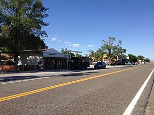
Montello is a small desert village located in Elko County, Nevada, in the United States. It is a quiet community and home to Montello Elementary School, which is part of the Elko County School District. In 2018, about 50 people lived in Montello. The area around Montello is mostly used for cattle ranching.
Montello is also part of the Elko Micropolitan Statistical Area. It is officially recognized as a census-designated place (CDP), which is a special area defined by the government for gathering population data.
Contents
History of Montello
The first people settled permanently in the Montello area in 1869. The town of Montello was officially started in 1904. It became an important "division point" for the Southern Pacific Railroad. A division point was a place where trains would stop for maintenance and where train crews would change.
Railroad and Growth
Montello grew because of a new railroad line called the Lucin Cutoff. This line was built across the Great Salt Lake in Utah. It allowed trains to bypass an older division point town called Terrace, Utah. Many of the first houses in Montello were actually moved there from Terrace and another nearby town, Kelton, Utah.
Montello was first named "Bauvard." In 1912, its name was changed to Montello. The word "Montello" comes from Italian and means "little mountain." An early Italian settler likely gave it this name.
Peak Years and Decline
Montello was at its busiest in the 1910s and early 1920s. At its peak, about 800 people lived there. The town's main business was the railroad. However, Montello also served as a meeting place for local ranchers. It was also a place where supplies were sent to the nearby mining camp of Delano.
Montello started to shrink in the late 1920s. The railroad began to hire fewer people. A big fire in 1925 also destroyed many businesses in the town. The biggest reason for Montello's decline was the railroad's change from steam trains to diesel trains. This happened in the 1940s and early 1950s. Diesel trains did not need the same service facilities as steam trains. Because of this, the Southern Pacific Railroad removed its facilities in Montello in the 1950s.
Recent Events: The 2017 Flood
In February 2017, Montello experienced a flood after a very wet winter. Roads like Nevada State Route 30, Nevada State Route 233, and U.S. Highway 93 had to be closed. Some parts of the roads were washed away. Train traffic also had to be sent on different routes.
Geography of Montello
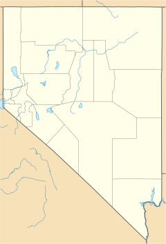
Montello is located in the eastern part of Elko County. It is found along Nevada State Route 233. The town is about 23 miles (37 km) northeast of Interstate 80 near Oasis. It is also about 11 miles (18 km) southwest of the Utah border. Elko, which is the main city of the county, is about 100 miles (160 km) to the west.
The U.S. Census Bureau states that the Montello CDP (the census-designated place) covers an area of about 1.0 square kilometer (0.41 sq mi). All of this area is land. There is no separate information available for the village itself.
Population Information
The United States Census Bureau includes Montello as part of a larger census-designated place (CDP). This means that the population numbers released by the census apply to the entire CDP, not just the small village of Montello alone.
| Historical population | |||
|---|---|---|---|
| Census | Pop. | %± | |
| 2020 | 66 | — | |
| U.S. Decennial Census | |||
See also
 In Spanish: Montello (Nevada) para niños


