Morar, Moidart and Ardnamurchan National Scenic Area facts for kids
Quick facts for kids Morar, Moidart and Ardnamurchan National Scenic Area |
|
|---|---|

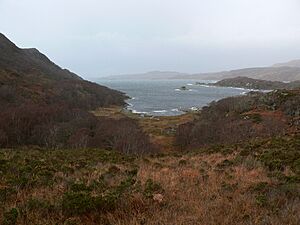
Glenuig Bay.
|
|

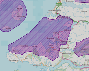
Location and extent of the Morar, Moidart and Ardnamurchan NSA.
|
|
| Location | Highland, Scotland |
| Area | 369.6 km2 (142.7 sq mi) |
| Established | 1981 |
| Governing body | NatureScot |
The Morar, Moidart and Ardnamurchan National Scenic Area (NSA) is a special place in the western Scottish Highlands. It covers the beautiful coastlines of three peninsulas: Ardnamurchan, Moidart, and Morar. This area is one of 40 such places in Scotland.
These areas are chosen because they have amazing natural beauty. The goal is to protect them from building projects that might spoil their look. The Morar, Moidart and Ardnamurchan NSA is very large. It covers about 36,956 hectares (that's like 91,320 football fields!). A big part of this area, 19,736 hectares, is actually ocean below the low tide mark.
While NSAs are mainly about protecting beautiful views, they often have other cool features too. These can include important history, interesting rocks (geology), or special wildlife. Sometimes, other protection rules overlap with the NSA rules. For example, this NSA includes several Natura 2000 sites, which are important for nature across Europe.
Why Was This Area Protected?
After World War II, people in Scotland started thinking about how to protect their amazing landscapes. A group led by Sir Douglas Ramsay suggested protecting five key areas. These were called "national park direction areas." This meant the government could check local building plans to make sure they didn't harm the landscape.
Later, in 1978, more areas were found to be special. The western parts of Lochaber, which include Morar, Moidart, and Ardnamurchan, were among them. So, in 1981, the "national park direction areas" were changed to "national scenic areas." The boundaries for this NSA are still the same as they were mapped in 1978.
Even though NSAs help protect the land, they don't have their own special park teams like big national parks do. Local councils, like the Highland Council here, are in charge of managing them.
Exploring the Landscape and Scenery
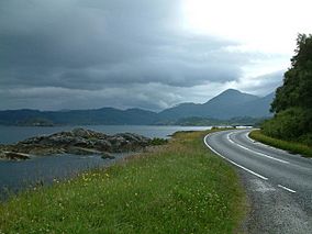
The Morar, Moidart and Ardnamurchan area has a very varied and interesting coastline. Its beauty is made even better by the mountains in the background. But it's the coastal parts that are truly outstanding.
This coastal area has four main parts, each with its own feel. They all work together and offer great views of the nearby islands, like the Small Isles. Many parts of this area, including the Arisaig and Ardnish peninsulas, are hard to reach by road. Some parts of Ardnamurchan's north coast can only be reached by narrow, dead-end roads.
This area is also full of history! It has strong links to the Jacobite rising of 1745. Loch nan Uamh is where Charles Edward Stuart (also known as Bonnie Prince Charlie) first landed in Scotland. A line of beech trees called the Seven Men of Moidart remembers this historical event. The beautiful old ruins of Castle Tioram also add to the area's stunning views.
Special Places for Wildlife
This NSA is home to many important plants and animals. Because of this, several parts of it have extra protection.
A small part of the NSA is in the Moidart and Ardgour Special Protection Area. This area is protected because it's a vital breeding ground for golden eagles.
There are also six Special Areas of Conservation (SACs) here. These are protected under a European program called Natura 2000:
- The Ardnamurchan Burns SAC protects several small rivers (called burns) on the Ardnamurchan peninsula. These burns are home to special freshwater pearl mussels.
- The Loch Moidart and Loch Shiel Woods SAC covers woodlands and muddy areas. It's an important place for otters.
- The Sound of Arisaig SAC protects underwater sandbanks.
- Kentra Moss is part of the Claish Moss and Kentra Moss SAC. This is a very important area of blanket bog, which is a type of wetland. Kentra Moss is special because it's a rare kind of raised bog, full of different Sphagnum mosses. It also shows how a bog can change into a saltmarsh.
- Glen Beasdale SAC is at the northern end of the NSA. It's protected for its freshwater pearl mussels, otters, and oak woodlands.
- The sea areas outside the NSA are protected as the Inner Hebrides and the Minches SAC. This is because they are important for harbour porpoises.
Some beautiful gardens and designed landscapes in the area are also listed in the Inventory of Gardens and Designed Landscapes in Scotland. These include the grounds of Arisaig House, Kinlochmoidart, and Eilean Shona.
 | Bessie Coleman |
 | Spann Watson |
 | Jill E. Brown |
 | Sherman W. White |


