
Moundridge, Kansas facts for kids
Quick facts for kids
Moundridge, Kansas
|
|
|---|---|

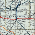
Location within McPherson County and Kansas
|
|

|
|
| Country | United States |
| State | Kansas |
| County | McPherson |
| Township | Mound |
| Founded | 1876 (Christian) |
| Incorporated | 1887 (Moundridge) |
| Area | |
| • Total | 1.61 sq mi (4.17 km2) |
| • Land | 1.57 sq mi (4.06 km2) |
| • Water | 0.04 sq mi (0.11 km2) |
| Elevation | 1,467 ft (447 m) |
| Population
(2020)
|
|
| • Total | 1,974 |
| • Density | 1,226/sq mi (473.4/km2) |
| Time zone | UTC-6 (CST) |
| • Summer (DST) | UTC-5 (CDT) |
| ZIP code |
67107
|
| Area code | 620 |
| FIPS code | 20-48800 |
| GNIS ID | 2395116 |
Moundridge is a city in McPherson County, Kansas, United States. In 2020, about 1,974 people lived there. Two important companies, Grasshopper (which makes lawn mowers) and Bradbury Group (which makes equipment for shaping metal), have factories in Moundridge.
Contents
History of Moundridge
How Moundridge Began
For thousands of years, the Great Plains of North America were home to many different groups of Native Americans. Later, from the 1500s to the 1700s, France claimed a large part of North America. In 1762, France secretly gave this land to Spain.
In 1802, Spain gave most of the land back to France. Then, in 1803, the United States bought a huge area of land from France. This was called the Louisiana Purchase. Most of what is now Kansas was part of this big purchase.
Kansas Becomes a State
In 1854, the Kansas Territory was created. This was a step toward Kansas becoming a state. In 1861, Kansas officially became the 34th state in the United States. Six years later, in 1867, McPherson County was formed. This county includes the land where Moundridge is today.
Founding the City
The community that would become Moundridge was first started in 1876. It was called Christian back then. In 1887, the town was officially named and became a city called Moundridge. It got this name because the town is built on higher ground, like a small mound or ridge.
Early Settlers and Farming
Between 1874 and 1880, many Mennonites moved to the United States from South Russia. About 10,000 of them came to the U.S. and 8,000 went to Canada. They found that the land in central Kansas was very similar to their homelands.
These settlers were skilled in a type of farming called dryland farming. They also knew a lot about milling flour. In 1873, they brought winter wheat to Kansas. This type of wheat quickly became very important, and Kansas became known as a top wheat-producing state. You can learn more about these early settlers at museums in nearby Hillsboro and Goessel.
Language Changes
Most of the first settlers in McPherson County spoke German. Many of them spoke only German. But as cars became common and people needed to do business with English-speaking citizens, speaking German became less important. During World War I and World War II, more and more people started using English. By the early 1940s, church leaders rarely gave sermons in German. Today, only a few German religious books are available, mostly for older people.
Geography
Moundridge covers an area of about 1.41 square miles (3.65 square kilometers). All of this area is land.
Population and People
| Historical population | |||
|---|---|---|---|
| Census | Pop. | %± | |
| 1890 | 443 | — | |
| 1900 | 557 | 25.7% | |
| 1910 | 626 | 12.4% | |
| 1920 | 733 | 17.1% | |
| 1930 | 870 | 18.7% | |
| 1940 | 864 | −0.7% | |
| 1950 | 942 | 9.0% | |
| 1960 | 1,214 | 28.9% | |
| 1970 | 1,271 | 4.7% | |
| 1980 | 1,453 | 14.3% | |
| 1990 | 1,531 | 5.4% | |
| 2000 | 1,593 | 4.0% | |
| 2010 | 1,737 | 9.0% | |
| 2020 | 1,974 | 13.6% | |
| U.S. Decennial Census | |||
2020 Census Information
In 2020, the 2020 United States census counted 1,974 people living in Moundridge. There were 820 households and 475 families. Most of the people (about 92.4%) were white. About 5% of the population was Hispanic or Latino.
About 19% of the people were under 18 years old. About 31% were 65 years old or older. The average age in Moundridge was 47.3 years.
2010 Census Information
In 2010, there were 1,737 people living in the city. The population density was about 1,232 people per square mile. Most residents (96.9%) were White. About 3.4% of the population was Hispanic or Latino.
The median age in the city was 46.6 years. About 21.6% of residents were under 18. About 27.6% were 65 or older.
Economy
Moundridge is home to two important companies:
- The Grasshopper Company makes mowers and other lawn care tools. It started in 1969 and its main office is in Moundridge. Its parent company is Moridge Manufacturing, which began in 1958.
- The Bradbury Group also has its main office in Moundridge. It was founded in 1959. This company is one of the largest makers of rollforming equipment in the world. They have 10 locations and many different brands.
Education
The public schools in Moundridge are part of the Moundridge USD 423 school district. The city has a high school/middle school and an elementary school.
Transportation
Interstate I-135 runs along the northeast side of Moundridge. Highway US 81 also goes through the city. Moundridge has a small airport called Moundridge Municipal Airfield. It is about one mile (1.6 km) east of the city center.
Notable people
- Laurie Koehn, a professional basketball player
Images for kids
-
1915 Railroad Map of McPherson County

See also
 In Spanish: Moundridge para niños
