Mount Adams (New Zealand) facts for kids
Quick facts for kids Mount Adams |
|
|---|---|

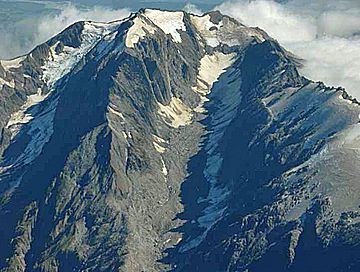
Mount Adams from the south-east, Escape Glacier at left, Siege Glacier (partially covered in rock debris) at centre. Late summer conditions.
|
|
| Highest point | |
| Elevation | 2,208 m (7,244 ft) |
| Prominence | 754 m (2,474 ft) |
| Geography | |
| Parent range | Southern Alps |
| Topo map | Topo50 BW17 – Harihari NZMS 260: I35 Whataroa |
| Climbing | |
| Easiest route | New Zealand Alpine Grade 1 |
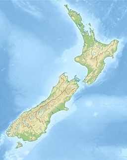
Mount Adams is a tall mountain located in the West Coast area of New Zealand's South Island. Its peak is about 19 kilometers (12 miles) south of a town called Harihari. Mount Adams stands at an impressive height of 2,208 meters (7,244 feet).
This mountain is found west of the main ridge of the Southern Alps. Water from Mount Adams flows into the Whataroa and Poerua rivers. Both of these rivers travel west until they reach the Tasman Sea. You can also find two smaller glaciers on the mountain's south-eastern slopes. These glaciers are called the Escape Glacier (about 2.1 km long) and the Siege Glacier (about 3.6 km long). They help drain the ice cap at the mountain's summit.
Weather at Mount Adams
The West Coast region, where Mount Adams is located, gets a lot of rain. It's one of the wettest places in the world! While there are no rain gauges directly on Mount Adams, we can look at nearby areas.
For example, a rain gauge in the Whataroa valley, about 10 km (6 miles) southwest of the mountain, records a lot of rain. This spot, only 60 meters (197 feet) above sea level, gets an average of 5,690 millimeters (224 inches) of rain each year. Sometimes, it can even get up to 320 millimeters (13 inches) in just one day!
Higher up on Mount Adams, the rainfall is likely even greater. Another rain gauge, located 42 km (26 miles) northeast of Mount Adams in the Cropp River area, is at 860 meters (2,822 feet) above sea level. This spot records an average of 10,690 millimeters (421 inches) of rain annually. It has even seen daily rainfall as high as 695 millimeters (27 inches).
How Mount Adams Was Formed
Mount Adams is located near a very important geological feature called the Alpine Fault. This fault line runs along the lower northwestern slopes of the mountain. The Alpine Fault is the boundary where two huge pieces of the Earth's crust, called tectonic plates, meet. These are the Pacific and Indo-Australian plates.
The mountain itself is mostly made of a type of rock called schist. This rock formed a very long time ago, during the Permian–Triassic periods. The closer you get to the Alpine Fault, the more this rock has changed due to heat and pressure. This process is called metamorphism.
On October 6, 1999, a huge landslide happened near the northern peak of Mount Adams. About 10 to 15 million cubic meters of rock slid down into the Poerua River, which is about 1,790 meters (5,870 feet) below. This created a natural dam, 120 meters (394 feet) high, which formed a lake that stretched 1.2 kilometers (0.75 miles) upstream.
The dam broke six days later during heavy rain. People were worried about a lot of damage, but luckily, it wasn't as bad as feared. Still, a lot of coarse gravel was washed downstream, and the river's path changed in some places.
Visiting Mount Adams
Mount Adams is special because it's one of the few mountains with glaciers that you can reach relatively easily from a main road on the West Coast. This makes it possible to visit the summit as a weekend trip.
The usual way to reach the top starts from a hidden parking spot off State Highway 6 (SH6). From there, you follow Dry Creek/Little Man River to a steep ridge where a marked path begins. The marked path ends at the tree line. After that, you continue climbing over tussock grass, rocks, and eventually the glacier at the summit.
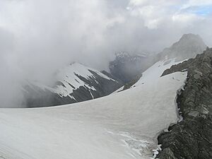
Even though this route isn't considered technically difficult for experienced climbers, it does involve some challenges. You'll need to cross rivers multiple times and travel off-track both along the river and above the tree line. When you reach the glacier, you'll need special equipment like an ice axe and crampons (spikes for your boots).
The total climb from the highway to the summit involves gaining about 2,100 meters (6,890 feet) in elevation. Most groups take two days to climb to the summit and return to SH6. However, very fit and experienced climbers might be able to do it in one very long summer day.
 | Audre Lorde |
 | John Berry Meachum |
 | Ferdinand Lee Barnett |


