West Coast Region facts for kids
Quick facts for kids
West Coast
Te Tai Poutini
|
|
|---|---|
|
Region
|
|
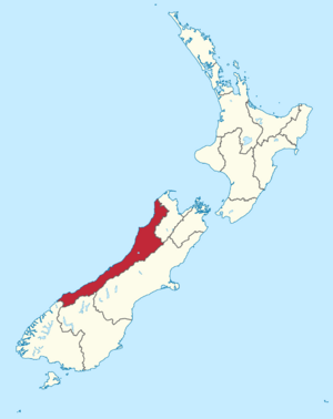
West Coast Region in New Zealand
|
|
| Country | New Zealand |
| Island | South Island |
| Seat | Greymouth |
| Constituent territorial authorities | |
| Government | |
| • Type | Regional council |
| • Body | West Coast Regional Council |
| Area | |
| • Land | 23,245.65 km2 (8,975.20 sq mi) |
| Population
(June 2023)
|
|
| • Total | 32,900 |
| GDP | |
| • Total | NZ$ 2.101 billion (2021) |
| • Per capita | NZ$ 64,063 (2021) |
| HDI (2021) | 0.914 very high · 11th |
The West Coast is a special area in New Zealand. It is located on the west side of the South Island. Its Māori name is Te Tai Poutini, which means "The Coast of Poutini". Poutini is a Taniwha, a mythical water guardian in Māori stories.
This region is managed by the West Coast Regional Council. The main towns here are Westport, Greymouth, and Hokitika. The West Coast is one of the most remote parts of New Zealand. It has the fewest people, with only about 32,900 residents.
The West Coast has a very long and interesting history. The land itself is ancient, with lots of coal found naturally. The first people to live here were the Kāi Tahu around 1200 AD. They valued the area for its rich supply of pounamu (greenstone). Kāi Tahu traded this valuable stone all over New Zealand.
Later, when Europeans arrived, the region became famous for its large amounts of gold. Many people came here, including thousands of Irish Catholics after the Irish Famine. Today, these groups, along with the Kāi Tahu, make up most of the population. The West Coast is also the only region in New Zealand where coal mining is still a big industry.
Contents
Understanding the West Coast Name
Some people in New Zealand use the name Westland to talk about the entire West Coast area. This includes places like Grey District, Buller District, and even Fiordland. Westland was also the name of a short-lived province from 1873 to 1876.
It is important to know that Fiordland is on the west coast of the South Island, but it is part of the Southland Region, not the West Coast Region. People who live on the West Coast are often called "Coasters".
Exploring West Coast Geography
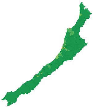
The West Coast stretches for 600 kilometers from Kahurangi Point in the north to Awarua Point in the south. It covers a large area of 23,276 square kilometers. To the west is the Tasman Sea, which can have very rough waves. To the east are the towering Southern Alps. Much of the land is rugged, but most people live on the flat coastal areas.
The region is split into three local government areas. From north to south, these are Buller, Grey, and Westland.
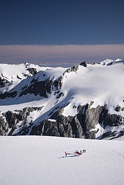
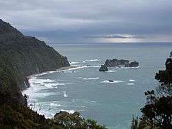
The West Coast is very beautiful. It has wild coastlines, tall mountains, and lots of native bush. Much of this is native temperate rain forest. It is one of the few places in New Zealand where large areas of lowland forest still exist. In other parts of the country, these forests were mostly cleared for farms and towns.
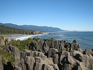
Some of the amazing places to visit include the Haast Pass, Fox and Franz Josef Glaciers, Hokitika Gorge, Lake Brunner, the unique Pancake Rocks at Punakaiki, the Oparara Arches, and the Heaphy Track.
The region gets a lot of rain. This is because of the wind coming from the northwest and the high Southern Alps. When the moist air hits the mountains, it rises and cools, causing heavy rain. This is called orographic precipitation. On the other side of the mountains, the Canterbury Plains are much drier because the mountains block the rain.
West Coast History and Heritage
The West Coast is the traditional home of the Ngāi Tahu people. They greatly valued the region for the greenstone (pounamu) found there.
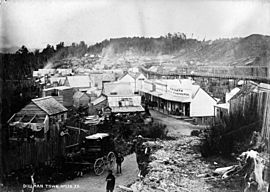
Europeans did not visit the region often until 1864. That year, two Māori men, Ihaia Tainui and Haimona Taukau, found gold near the Taramakau River. By the end of 1864, about 1,800 gold seekers had arrived. Many of them settled around Hokitika. In 1866, Hokitika was briefly the most populated town in New Zealand.
From 1853, the region was divided between Nelson Province and Canterbury Province. In 1873, the Canterbury part of the region became its own province, called the Westland Province. This provincial system ended in 1876.
The West Coast Gold Rush happened between 1864 and 1867. It led to many gold rush towns, like Ōkārito. Ōkārito was once the biggest town on the West Coast, but it quickly became almost empty as miners moved on. After the gold rush, the population decreased, but the main towns that exist today were already established.
After greenstone and gold, coal became the next important mineral. Coal was found near the Buller River in the 1840s, and serious mining began in the 1860s. By the 1880s, coal mining was the region's main industry. Mines were found throughout the northern part of the region, especially around Westport. Many of these mines operated until the mid-1900s, and some are still active today.
Timber has also been a major industry for a long time. However, in recent years, there has been a focus on balancing logging with protecting the forests. Most of the region's land is managed by the Department of Conservation. The West Coast has some of the best remaining native forests and many rare animals. Ecotourism, which means tourism focused on nature, is now an important industry. It works well with the efforts to protect the environment.
West Coast Population and Communities
The West Coast region covers about 23,245 square kilometers. It has an estimated population of about 32,900 people. This makes it the least populated of New Zealand's sixteen regions. It is also the most sparsely populated, with only about 1.4 people per square kilometer.
| Ethnicity | Population |
|---|---|
| New Zealand European |
29,964
|
| Māori |
4,491
|
| Pasifika |
540
|
| Asian |
1,335
|
| MELAA |
180
|
| Other |
723
|
In the 2023 New Zealand census, the West Coast Region had 33,390 people. This was an increase of 1,815 people since the 2018 census. The average age was 48.1 years. About 16.3% of the people were under 15 years old, and 22.6% were 65 or older.
The main ethnic groups were 89.7% European/Pākehā, 13.5% Māori, and 4.0% Asian. People can identify with more than one ethnicity. About 12.0% of the people were born outside New Zealand.
When asked about religion, 53.2% said they had no religion. About 35.1% were Christian. Other religions included Māori religious beliefs, Hindu, Muslim, and Buddhist.
The median income for people 15 years and older was $26,400. About 48.1% of people were employed full-time.
Main Towns and Settlements
There are only four towns on the West Coast with more than 1,000 people. These are Greymouth, Westport, Hokitika, and Runanga. Reefton also counts as an urban area.
During the gold rush, Hokitika had over 25,000 people and more than 100 pubs! Today, you can visit Shantytown, which is a recreation of an early New Zealand settlement.
| Urban area | Population (June 2023) |
% of region |
|---|---|---|
| Greymouth | 8,340 | 25.3% |
| Westport | 4,250 | 12.9% |
| Hokitika | 3,120 | 9.5% |
| Runanga | 1,230 | 3.7% |
| Reefton | 910 | 2.8% |
| Gloriavale | 700 | 2.1% |
| Dobson | 620 | 1.9% |
| Franz Josef | 530 | 1.6% |
| Karamea | 410 | 1.2% |
| Carters Beach | 310 | 0.9% |
Other towns and settlements include:
West Coast Regional Council
The West Coast region is governed by the West Coast Regional Council. The current leader of the council is Peter Haddock.
Council Members
The people who serve on the council are:
- Brett Cummings
- Allan Birchfield
- Andy Campbell
- Frank Dooley
- Mark McIntyre
- Peter Ewen
West Coast Economy and Industries
The total value of all goods and services produced in the West Coast region was estimated at NZ$2,373 million in 2022. This is about 0.7% of New Zealand's total economy. The average income per person in the region was about $72,127 in the same year.
The West Coast's economy grew strongly in 2022, even though it is a smaller region.
The main industries here include:
- Mining: For coal and alluvial gold.
- Forestry: Growing trees and processing wood.
- Fishing: Including catching whitebait.
- Tourism: People visiting the beautiful natural areas.
- Farming: Especially dairy farming.
Dairy farming has grown a lot. In 2019–2020, there were 150,000 milking cows on the West Coast. These cows produced milk solids worth $365 million. The local dairy company, Westland Milk Products, is still independent.
Other industries include making and selling greenstone jewellery, collecting sphagnum moss, and gathering stones for gardens. The famous Monteith's brewery is also in Greymouth.
The West Coast has even been named one of the "Top 10 Coastal Drives of the World" by Lonely Planet.
West Coast Flora and Fauna
The West Coast is home to special wildlife. It has the only nesting place in New Zealand for the kōtuku (white heron). This rare bird is so special that it appears on the New Zealand $2 coin. You can visit the Waitangiroto Nature Reserve near Whataroa to see them.
More than 80% of the land on the West Coast is managed by the Department of Conservation. Much of this land is part of National Parks. These include parts of Kahurangi National Park, Paparoa National Park, parts of Arthur's Pass National Park, Westland National Park, and parts of Aspiring National Park. The South Westland World Heritage Area is also here. These parks have many common plants and animals, as well as unique species like the kiwi.
West Coast Transport and Travel
There are four main roads that lead into the West Coast Region.
- The main road running along the coast is State Highway 6. It connects to the Tasman District in the north and Otago in the south.
- Two roads connect to the Canterbury area to the east: State Highway 7 through Lewis Pass and State Highway 73 through Arthur's Pass.
The Midland railway line is the only train line into the region. It connects to Christchurch through Arthur's Pass. The TranzAlpine train service runs daily between Christchurch and Greymouth. There are also freight lines for goods.
You can also fly into the region. Air New Zealand has daily flights between Christchurch and Hokitika. Sounds Air flies between Wellington and Westport.
Images for kids
See also
 In Spanish: Región de West Coast para niños
 | Roy Wilkins |
 | John Lewis |
 | Linda Carol Brown |


