Mount Cairnes facts for kids
Quick facts for kids Mount Cairnes |
|
|---|---|

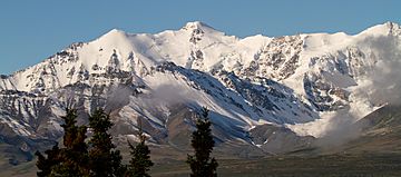
Mount Cairnes, north aspect
|
|
| Highest point | |
| Elevation | 2,810 m (9,220 ft) |
| Prominence | 1,990 m (6,530 ft) |
| Parent peak | Mount Maxwell (3020 m) |
| Listing |
|
| Geography | |
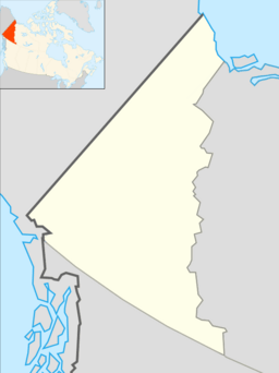
| Location | Kluane National Park and Reserve Yukon, Canada |
| Parent range | Saint Elias Mountains |
| Topo map | NTS 115.B.16 |
Mount Cairnes is a tall mountain peak in the Saint Elias Mountains of Yukon, Canada. It stands 2,810-metre (9,220-foot) high. This mountain is located right on the edge of Kluane National Park.
You can find Mount Cairnes about 44 km (27 mi) west of Haines Junction. It's also 18 km (11 mi) southeast of Kluane Lake. If you drive on the Alaska Highway between these two places, you might be able to see it! The closest taller mountain is Mount Maxwell, which is 27.7 km (17.2 mi) to the southwest.
The mountain was officially named Mount Cairnes on February 3, 1981. It honors DeLorme Donaldson Cairnes (1879-1917), who was a famous geologist. His relative, Clive Elmore Cairnes (1892-1954), also worked as a geologist for the Canadian government.
What's the Weather Like on Mount Cairnes?
Mount Cairnes has a subarctic climate. This means it has very long, cold, and snowy winters. The summers, however, are usually mild.
During winter, temperatures can drop below −20 °C. With the wind, it can feel even colder, sometimes below −30 °C! The snow and ice that melt from the mountain flow into streams. These streams then join the Kaskawulsh River.
 | Leon Lynch |
 | Milton P. Webster |
 | Ferdinand Smith |


