Mount Dagelet facts for kids
Quick facts for kids Mount Dagelet |
|
|---|---|

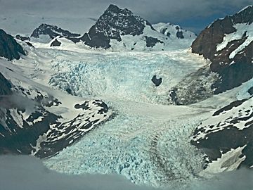
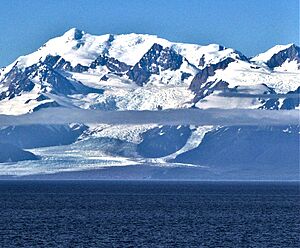
Mt. Dagelet and La Perouse Glacier
|
|
| Highest point | |
| Elevation | 9,800+ ft (2,990+ m) |
| Prominence | 1,404 ft (428 m) |
| Isolation | 2.5 mi (4.0 km) |
| Parent peak | Mount Crillon (12,726 ft) |
| Geography | |
| Location | Glacier Bay National Park Hoonah-Angoon Alaska, United States |
| Parent range | Fairweather Range Saint Elias Mountains |
| Topo map | USGS Mount Fairweather C-4 |
| Climbing | |
| First ascent | 1933 |
| Easiest route | Mountaineering |
Mount Dagelet is a tall mountain in Alaska, United States. It is about 9,800+ ft (2,990+ m) high. This mountain is part of the Fairweather Range and the Saint Elias Mountains.
You can find Mount Dagelet inside Glacier Bay National Park. It is 4.6 mi (7 km) south of Mount Crillon. It is also 4 mi (6 km) northwest of Mount La Perouse. The mountain rises very steeply from the ocean in less than nine miles.
The mountain got its name in 1874 from William Healey Dall. He worked for the U.S. Geological Survey. The name honors Joseph Lepaute Dagelet, a French astronomer and mathematician. He explored this coast in 1786 with Lapérouse. The first people to climb Mount Dagelet were W. S. Child, C. S. Houston, and H. A. Carter. They reached the top on July 29, 1933.
Weather and Climate
Mount Dagelet has a subarctic climate. This means it has very cold, snowy winters. The summers are cool, not hot.
Weather systems from the Gulf of Alaska hit the Fairweather Range. The mountains force the air upwards. This causes a lot of rain and snow to fall. This process is called orographic lift.
Temperatures can drop very low, sometimes below −20 °C. With the wind, it can feel even colder, below −30 °C. This cold weather helps keep the La Perouse Glacier nearby. Water from melting glaciers and rain flows into the Gulf of Alaska.
The best time to visit or climb Mount Dagelet is from May to July. The weather is usually better during these months.
 | Selma Burke |
 | Pauline Powell Burns |
 | Frederick J. Brown |
 | Robert Blackburn |


