Mount French (Alberta) facts for kids
Quick facts for kids Mount French |
|
|---|---|

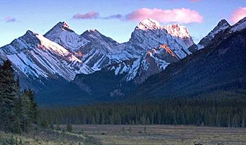
Mount French (right of center under cloud) seen from the north. Mount Murray to left of center.
|
|
| Highest point | |
| Elevation | 3,244 m (10,643 ft) |
| Prominence | 470 m (1,540 ft) |
| Parent peak | Mount Sir Douglas (3411 m) |
| Listing | Mountains of Alberta |
| Geography | |
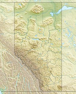
| Location | Alberta, Canada |
| Parent range | Spray Mountains Canadian Rockies |
| Topo map | NTS 82J/11 |
| Geology | |
| Age of rock | Cambrian |
| Type of rock | sedimentary rock |
| Climbing | |
| First ascent | 1921 by M. Morton Jr., H.S. Hall Jr., Edward Feuz Jr. |
| Easiest route | Difficult Scramble/Mountaineering |
Mount French is a tall mountain in the Canadian Rockies in Alberta, Canada. It stands 3,244-metre (10,643-foot) high. You can find it in Peter Lougheed Provincial Park, which is part of Kananaskis Country. Mount French is the second highest peak in the Spray Mountains range. The highest peak in this range, Mount Sir Douglas, is about 3.0 km (1.9 mi) to the west. You can see Mount French from Alberta Highway 742, also known as the Smith-Dorrien/Spray Trail.
Contents
History of Mount French
How Mount French Got Its Name
Mount French was named in 1915 by Morrison P. Bridgland. He was a Dominion Land Surveyor, which means he helped map out land for the Canadian government. He named the mountain after Sir John French.
Sir John French was a very important military leader. He was the Commander-in-chief of the British Forces during the first part of World War I (from 1914 to 1915). In 1922, he was given the special title of the first Earl of Ypres.
First Climbers and Official Name
The first time anyone successfully climbed Mount French was in 1921. M. Morton Jr. and H.S. Hall Jr. made the climb. They had a guide named Edward Feuz Jr. to help them.
The mountain's name was officially accepted in 1924. This was done by the Geographical Names Board of Canada.
Geology of Mount French
How the Mountain Formed
Mount French is made of sedimentary rock. This type of rock forms from layers of sand, mud, and tiny bits of sea creatures that settle at the bottom of ancient seas. These layers were laid down over millions of years, from the Precambrian to the Jurassic periods.
Later, a huge event called the Laramide orogeny happened. This was when big forces pushed the Earth's crust. This caused the sedimentary rock to be pushed up and over younger rock layers, forming the mountains we see today.
Glaciers Around the Peak
There are several glaciers near Mount French. The French Glacier is right on the west side of the peak. To the south, you'll find the Haig Glacier. This is the largest single glacier in all of Kananaskis Country. On the east side of Mount French, there is another glacier called the Smith-Dorrien Glacier.
Climate Around Mount French
Weather Conditions
Mount French is in a subarctic climate zone. This means the area has very cold and snowy winters. The summers are usually mild, not too hot.
Temperatures can drop really low, sometimes below −20 °C (which is about -4 °F). When you add in the wind, it can feel even colder, sometimes below −30 °C (about -22 °F). So, it's a chilly place in winter!
 | Chris Smalls |
 | Fred Hampton |
 | Ralph Abernathy |


