Mount Ivy, New York facts for kids
Quick facts for kids
Mount Ivy, New York
|
|
|---|---|

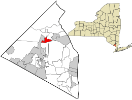
Location in Rockland County and the state of New York.
|
|
| Country | United States |
| State | New York |
| County | Rockland |
| Area | |
| • Total | 1.47 sq mi (3.82 km2) |
| • Land | 1.47 sq mi (3.82 km2) |
| • Water | 0.00 sq mi (0.00 km2) |
| Elevation | 459 ft (140 m) |
| Population
(2020)
|
|
| • Total | 7,657 |
| • Density | 5,194.71/sq mi (2,006.28/km2) |
| Time zone | UTC-5 (Eastern (EST)) |
| • Summer (DST) | UTC-4 (EDT) |
| ZIP code |
10970
|
| Area code(s) | 845 |
| FIPS code | 36-48879 |
| GNIS feature ID | 0957849 |
Mount Ivy is a small community in Rockland County, New York, United States. It is known as a hamlet and a census-designated place, which means it's an area defined for counting people by the government.
Mount Ivy is located in the Town of Haverstraw. You can find it north of New City, east of Pomona, south of Thiells, and west of Garnerville. In 2020, about 7,657 people lived there.
Mount Ivy's Past
For many years, the Ramapough Mountain Indians lived in this area. Mount Ivy was also an important place for the Quaker community.
People say the name Mount Ivy comes from the area's high ground and a swamp filled with ivy plants.
Mount Ivy has a special place in history. General Anthony Wayne's soldiers rested and hid here. They were preparing for an attack on the Stony Point fortress.
Where is Mount Ivy?
Mount Ivy is located at these coordinates: 41°11′31″N 74°1′56″W / 41.19194°N 74.03222°W.
The United States Census Bureau says that Mount Ivy covers about 1.5 square miles (3.82 square kilometers) of land. There is almost no water within its borders.
Mount Ivy is right on the edge of two towns: Ramapo and Haverstraw. Most of it is in the southernmost part of Haverstraw. The main business area of Mount Ivy is where New York State Route 45 ends. This is also where it meets U.S. Route 202. This spot is about a quarter-mile east of the Mount Ivy exit from the Palisades Interstate Parkway.
Most of Mount Ivy gets its mail through the Pomona post office. The community is divided between two school districts: the North Rockland School District and the East Ramapo School District.
Mount Ivy Population Facts
| Historical population | |||
|---|---|---|---|
| Census | Pop. | %± | |
| 2020 | 7,657 | — | |
| U.S. Decennial Census | |||
In the year 2000, Mount Ivy had 6,536 people living there. There were 2,693 households and 1,728 families. The population density was about 4,457 people per square mile (1,721 people per square kilometer).
About 23.5% of the people were under 18 years old. Around 8.6% were 65 years or older. The average age was 36 years. For every 100 females, there were about 90 males.
The average income for a household in Mount Ivy was $51,935. For families, the average income was $61,968. About 8% of the population lived below the poverty line. This included 10.7% of those under 18.
See also
 In Spanish: Mount Ivy para niños
 | John T. Biggers |
 | Thomas Blackshear |
 | Mark Bradford |
 | Beverly Buchanan |


