
Palisades Interstate Parkway facts for kids
Quick facts for kids
[[File:|x70px|alt= marker]] |
||||||
|---|---|---|---|---|---|---|
|
Map of the New York City area with the Palisades Interstate Parkway highlighted in red
|
||||||
| Route information | ||||||
| Maintained by Palisades Interstate Park Commission | ||||||
| Length | 37.00 mi (59.55 km) | |||||
| Existed | 1958–present | |||||
| Tourist routes |
Palisades Scenic Byway | |||||
| Restrictions | No trucks, buses, trailers, or vehicles 8 feet tall or taller | |||||
| Major junctions | ||||||
| South end | ||||||
|
||||||
| North end | ||||||
| Location | ||||||
| Counties: | NJ: Bergen NY: Rockland, Orange |
|||||
| Highway system | ||||||
| New Jersey State Highway Routes Interstate and USNumbered highways in New York Interstate • U.S. • N.Y. (former) • Reference • County
|
||||||
The Palisades Interstate Parkway (often called the PIP) is a special road about 38 miles (61 km) long. It runs through parts of New Jersey and New York. This parkway is a very important route for people who travel to New York City from nearby counties like Rockland and Orange in New York, and Bergen County in New Jersey.
The PIP starts near the George Washington Bridge in Fort Lee, New Jersey. It ends at a traffic circle in Fort Montgomery, New York, where it meets other important roads like US 9W and US 202, close to the Bear Mountain Bridge. For a short part of its journey, the PIP shares the road with US 6.
The parkway gets its name from the Hudson River Palisades, which are tall cliffs along the western side of the Hudson River. Like many parkways in the New York area, large trucks, buses, and commercial vehicles are not allowed on the PIP. Construction on the Palisades Interstate Parkway began in 1947 and it fully opened to traffic on August 28, 1958.
Contents
Exploring the Palisades Interstate Parkway
_between_Exit_2_and_Exit_1_in_Tenafly,_Bergen_County,_New_Jersey.jpg)
The Palisades Interstate Parkway is officially known by different numbers for record-keeping, but you won't see these numbers on signs. In New Jersey, it's called Route 445, and in New York, it's NY 987C. A small connecting road in Fort Lee, New Jersey, is called Route 445S.
The Palisades Interstate Park Commission owns and takes care of the parkway. Sometimes, the transportation departments of New Jersey and New York help with maintenance. A key rule on the PIP is that commercial vehicles, like big trucks, are not allowed. The speed limit for the entire parkway is 55 miles per hour (89 km/h).
The New Jersey Section

The Palisades Interstate Parkway starts at the George Washington Bridge (GWB) in Fort Lee, New Jersey. If you're coming from the top level of the GWB, you can get right onto the PIP heading north. If you're on the lower level, you'll go through the GWB Plaza first.
As the PIP heads north, it follows the New Jersey Palisades, which are beautiful cliffs. You'll pass the Englewood Cliffs Service Area, which is special because it has two separate rest stops, one for northbound and one for southbound drivers. Most other rest areas on the parkway are in the middle, shared by both directions. There are also three amazing lookout points where you can see great views of the Palisades and the Harlem River.
The entire New Jersey part of the PIP is in Bergen County. It's even called the Palisades Scenic Byway because of its beautiful views. The PIP is one of the few highways in New Jersey that uses simple, sequential exit numbers (like Exit 1, Exit 2), instead of numbers based on mileage.
The New York Section
The parkway crosses into Rockland County in a small town called Palisades. Here, the road changes direction from going straight north to heading more northwest. After the Kings Ferry Service Area, you'll find exits for two colleges: St. Thomas Aquinas College (Exit 5) and Dominican College (Exit 6).
In West Nyack, the PIP connects with the New York State Thruway (I-87 and I-287). This important meeting point is about seven miles (11 km) west of the Tappan Zee Bridge. After this, the PIP turns slightly northeast. At Exit 13, it crosses US 202 near Harriman State Park.
The parkway then enters Orange County. At Exit 18, the PIP meets US 6 and Seven Lakes Drive. US 6 then travels along with the PIP for its last two miles (3 km). Seven Lakes Drive joins them for one mile before leaving at Exit 19.
Finally, the Palisades Interstate Parkway ends inside Bear Mountain State Park. It meets US 9W and US 202 at a traffic circle near the Hudson River and the Bear Mountain Bridge. From here, US 6 and US 202 continue east over the bridge, while US 9W heads north towards the United States Military Academy at West Point.
The Parkway's Story

|
Palisade Interstate Parkway
|
|

Location in Bergen County, New Jersey
|
|
| Area | 3,311 acres (1,340 ha) |
|---|---|
| NRHP reference No. | 99000940 |
| Significant dates | |
| Added to NRHP | August 2, 1999 |
The idea for the Palisades Interstate Parkway first came about in 1933–34. An engineer named William A. Welch thought it would be a great way to connect the New Jersey Palisades with state parks in New York. He wanted a scenic road along the Hudson River.
Soon, a very rich man named John D. Rockefeller supported the idea. In 1933, he even gave 700 acres (2.8 km²) of land along the New Jersey Palisades for the project. The plan was accepted as a project under President Franklin D. Roosevelt's New Deal program. However, the New Jersey Highway Commission didn't agree at first, so the idea was put on hold.
In the 1940s, Rockefeller pushed for the parkway again. He worked with Robert Moses, a famous city planner, to design the road. Construction on the New York part of the PIP began on April 1, 1947. The New Jersey part started about a year later. Even with some delays, parts of the road opened in stages. The New Jersey section was finished in 1957, and the entire PIP was completed on August 28, 1958.
The PIP is famous for its beautiful stone bridges that cross over the road. It also has many scenic overlooks in New Jersey where you can stop and enjoy the views. You can see many unique trees and flowers along the route too. Because of its natural beauty and special design, the PIP was named a national landmark in 1998.
Rest Areas and Lookouts

The Palisades Interstate Parkway has several places where drivers can stop to rest or enjoy the scenery.
- Sparkill Service Area (New York): Located just south of Exit 5. It has fuel and a convenience store and is open 24 hours. You can also park your car here and take a bus or carpool. It's accessible from both directions of the parkway.
- Englewood Cliffs Service Area (New Jersey): Found just past Exit 1, before the George Washington Bridge. This area has fuel and a convenience store. Uniquely, it has separate stops for cars going north and cars going south.
- Alpine Lookout (New Jersey): This is a scenic parking area near Exit 2, only for northbound drivers. It's a great spot to stop and enjoy the view, but there's no fuel here.
- Rockefeller Lookout (New Jersey): Another scenic parking area in Englewood Cliffs, also only for northbound drivers. No fuel is available here.
- Bear Mountain/Tomkins Cove Visitor Center (New York): Located between Exits 16 and 17. This center offers information about the park and has a book store. There's no fuel here, but it's accessible from both directions.
- State Line Lookout (New Jersey): This spot is a visitor center and a lookout point right at the New Jersey-New York border. It offers amazing views but does not have fuel.
Palisades Interstate Parkway Police
The Palisades Interstate Parkway Police is a special police force. Their job is to keep the Palisades Interstate Parkway safe and to make sure people follow state and local laws, especially in the New Jersey part of the highway.
Their main office is in Alpine, New Jersey. The department has a chief, lieutenants, sergeants, and many patrol officers. They also have security guards who are trained by the police academy. Besides using patrol cars, the Palisades Interstate Parkway Police also use police boats to patrol the waters and even have a bicycle unit!
Images for kids
-
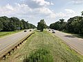
Palisades Interstate Parkway southbound in Alpine, New Jersey
_from_the_pedestrian_overpass_just_south_of_Exit_3_in_Alpine,_Bergen_County,_New_Jersey.jpg)
_at_the_exit_for_U.S._Route_9W_(Fletcher_Avenue,_Fort_Lee,_Interstate_95,_Interstate_80,_New_Jersey_Route_4,_U.S._Route_46)_in_Fort_Lee,_Bergen_County,_New_Jersey.jpg)
