Mount Putnik facts for kids
Quick facts for kids Mount Putnik |
|
|---|---|

Mount Putnik
|
|
| Highest point | |
| Elevation | 2,940 m (9,650 ft) |
| Prominence | 181 m (594 ft) |
| Listing | Mountains of Alberta |
| Geography | |
| Parent range | Kananaskis Range Canadian Rockies |
| Topo map | NTS 82J/11 |
| Climbing | |
| Easiest route | scramble |
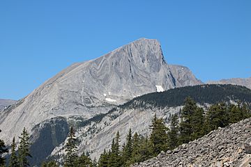
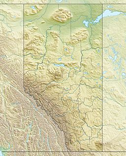
Mount Putnik is a mountain found in Peter Lougheed Provincial Park in Alberta, Canada. It stands north of Three Isle Creek and west of the Kananaskis River. This mountain is named after Radomir Putnik (1847-1917), a famous military leader from Serbia.
About Mount Putnik
Mount Putnik reaches an elevation of 2,940 meters (9,646 feet). The easiest way to reach its top is by scrambling, which means climbing over rocks and steep ground using your hands and feet. It is part of the Kananaskis Range within the larger Canadian Rockies.
Why is it Called Mount Putnik?
The mountain was named to honor Field Marshal Radomir Putnik, who was a key military leader in Serbia. In June 2012, a special plaque was placed on the mountain. This plaque remembers the brave people of Serbia and their leader, Radomir Putnik. They made a huge sacrifice during World War I (1914-1918). This effort was part of what Canada and its allies did in Europe to protect human rights and freedoms.
Mountain Weather and Climbing
Mount Putnik is in a subarctic climate zone. This means it has very cold, snowy winters. Temperatures can drop below −20 °C (–4 °F). With wind chill, it can feel even colder, sometimes below −30 °C (–22 °F). Summers are usually mild. The best time to climb Mount Putnik is from June through September. Water from the mountain flows into streams that lead to the Kananaskis River.
 | Selma Burke |
 | Pauline Powell Burns |
 | Frederick J. Brown |
 | Robert Blackburn |


