Mount Romulus facts for kids
Quick facts for kids Mount Romulus |
|
|---|---|

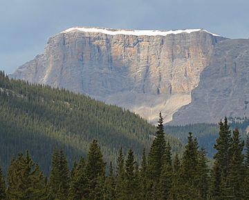
Mount Romulus, southeast face
|
|
| Highest point | |
| Elevation | 2,832 m (9,291 ft) |
| Prominence | 394 m (1,293 ft) |
| Parent peak | Fisher Peak (3053 m) |
| Listing | Mountains of Alberta |
| Geography | |
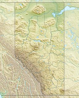
| Location | Elbow-Sheep Wildland Provincial Park Alberta, Canada |
| Parent range | Fisher Range Canadian Rockies |
| Topo map | NTS 82J/15 |
| Geology | |
| Age of rock | Cambrian |
| Climbing | |
| Easiest route | Scramble |
Mount Romulus is a tall mountain in the Canadian Rockies of Alberta, Canada. It stands 2,832-metre (9,291-foot) high. You can find it in the Little Elbow River Valley, which is part of Kananaskis Country.
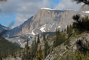
If the weather is good, you can see Mount Romulus from highways southwest of Calgary. It's easy to spot because of a special band of snow. This snow band forms above its wide cliffs on the southeast side.
The mountain gets its name from Romulus. In ancient mythology, Romulus and his twin brother Remus were believed to be the founders of Ancient Rome. There's even another mountain nearby called Mount Remus, which is 2.0 km (1.2 mi) to the east-northeast and is 2,688-metre (8,819-foot) tall. The name Mount Romulus was officially recognized in 1940. The closest higher mountain to Mount Romulus is Fisher Peak, about 4.0 km (2.5 mi) away to the northwest.
How Mount Romulus Was Formed
Mount Romulus is made of sedimentary rock. This type of rock forms from layers of sand, mud, and tiny bits of plants and animals that settle over time. These layers were laid down a very long time ago, during periods known as the Precambrian and Jurassic eras.
Imagine these rocks forming at the bottom of ancient, shallow seas. Later, huge forces from inside the Earth pushed these rock layers. This pushing caused the rocks to fold and break, moving them eastwards. This big event is called the Laramide orogeny. It helped create the amazing mountains we see in the Rockies today.
Weather and Climate Around the Mountain
Mount Romulus is in a subarctic climate zone. This means it has very cold and snowy winters. The summers are usually mild.
Temperatures can drop really low, sometimes below −20 °C. With the wind, it can feel even colder, below −30 °C! If you want to visit or climb the mountain, the best time is from June through September. The weather is usually much better then.
All the rain and melting snow from the mountain flows into the Little Elbow River. This river then joins the Elbow River.
 | Valerie Thomas |
 | Frederick McKinley Jones |
 | George Edward Alcorn Jr. |
 | Thomas Mensah |


