Mount Rosa (Colorado) facts for kids
Quick facts for kids Mount Rosa |
|
|---|---|

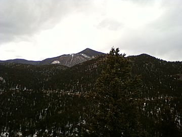
Mount Rosa viewed from Sugarloaf Mountain to the southeast.
|
|
| Highest point | |
| Elevation | 11,504 ft (3,506 m) |
| Prominence | 499 ft (152 m) |
| Isolation | 2.75 mi (4.43 km) |
| Geography | |
| Location | Teller County, Colorado, U.S. |
| Parent range | Front Range, Pikes Peak Massif |
| Topo map | USGS 7.5' topographic map Manitou Springs, Colorado |
| Climbing | |
| Easiest route | hike |
Mount Rosa is a mountain peak in the Rocky Mountains of North America. It is located in Colorado, United States. This mountain is part of the Front Range and the Pikes Peak Massif.
Mount Rosa stands at 11,504-foot (3,506 m) (about 3,506 meters) tall. It is found in Pike National Forest. The peak is about 12.8 miles (20.6 km) southwest of downtown Colorado Springs. It is located in Teller County.
About Mount Rosa
Mount Rosa is a very noticeable part of the skyline for Colorado Springs. It rises 5,475 ft (1,669 m) (about 1,669 meters) above the city. This makes it one of the taller mountains you can see from the city.
The mountain is part of the Front Range, which is a section of the larger Rocky Mountains. It is also part of the Pikes Peak Massif, a group of mountains around the famous Pikes Peak.
Exploring Mount Rosa
Many people enjoy hiking to the top of Mount Rosa. There are several trails in the area that lead to its summit. Hiking is a great way to experience the natural beauty of the mountain.
Hiking Trails
One popular way to reach the summit is by using the Frosty Park Route. Here's how you can find it:
- Start on Cheyenne Mountain Blvd. in the Broadmoor area. Head west.
- Next, take Old Stage Road and then Gold Camp Road. You will drive about 11.1 miles on these roads.
- Look for Forest Road 379.
Forest Road 379 is a rough road. You will need a tough vehicle with 4-wheel drive and high clearance to drive on it. Sometimes, there's a stream crossing with a lot of water. Drive about 1.5 miles on FR 379 until you reach a large open area. This area is on the western side of Mount Rosa. You can park your vehicle here.
From the parking area, you will start your hike on an unnamed trail. This trail goes east. It will lead you to Trail 672. Follow Trail 672 up the western side of Mount Rosa. This trail will take you to the windy north ridge of the mountain.
Once on the ridge, follow the trail that goes up and south. This trail leads directly to the summit of Mount Rosa. If you keep going past the summit, you would head down the eastern side of the mountain into Buffalo Canyon. Follow the summit trail for about half a mile to reach the very top of Mount Rosa.
 | Sharif Bey |
 | Hale Woodruff |
 | Richmond Barthé |
 | Purvis Young |


