Mount Watatic facts for kids
Quick facts for kids Mount Watatic |
|
|---|---|

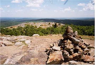
Summit of Mount Watatic.
|
|
| Highest point | |
| Elevation | 1,831 ft (558 m) |
| Prominence | 502 ft (153 m) |
| Geography | |
| Location | Ashburnham and Ashby, Massachusetts, United States |
| Parent range | The Wapack Range |
| Geology | |
| Age of rock | 400 million years |
| Mountain type | monadnock; metamorphic rock |
Mount Watatic is a mountain in the United States, located near the border of Massachusetts and New Hampshire. It stands about 1,832 feet (558 meters) tall. This mountain is a type of landform called a monadnock, which means it's a hill or mountain that rises sharply from flat land around it. Mount Watatic is at the southern end of the Wapack Range of mountains.
You can find Mount Watatic in the towns of Ashburnham and Ashby in Massachusetts. Part of it also reaches into New Ipswich, New Hampshire. Two well-known hiking paths, the 22-mile Wapack Trail and the 92-mile Midstate Trail, both cross over this mountain. There's also a shorter 1.1-mile Yellow Arrow trail. You can park on Massachusetts Route 119 for a quick hike to the top.
The name "Watatic" likely comes from a Native American phrase, Wetu-tick, which means "wigwam brook." This name probably first referred to a nearby stream and then to the mountain and a pond.
Mount Watatic: A Massachusetts Mountain
The water that flows off the east and south sides of Mount Watatic eventually reaches the Souhegan River. This river then flows into the Merrimack River and finally into the Atlantic Ocean. Water from the west and north sides of the mountain drains into the Millers River. This river flows into the Connecticut River, which then empties into Long Island Sound. So, water from Mount Watatic ends up in two different large bodies of water!
A Mountain with History
Mount Watatic was once home to a ski area. It operated from 1965 until 1984. There was an attempt to open the ski area again in 1988, but it didn't work out. The top of the mountain used to have a fire tower. This tower was open to visitors, but it was taken down in 1996.
Protecting Mount Watatic
In 2000, the summit of Mount Watatic was sold to a company called Industrial Communications and Electronics. Their plan was to build a 150-foot cellular telephone tower and a road to the top. However, in 2002, before the tower could be built, several groups worked together to buy the mountain. The Ashby Land Trust, the Town of Ashby, the Ashburnham Conservation Trust, the Town of Ashburnham, the Massachusetts Department of Fish and Wildlife, and the Massachusetts Department of Conservation and Recreation all helped. They bought the mountain for $2,500,000.
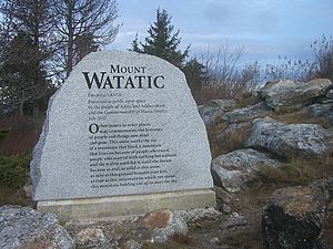
Sadly, by this time, a road had already been blasted into the mountain where the old ski trails were. This made some of the still-maintained ski trails unusable. However, this purchase led to the permanent protection of about 281 acres (1.14 km²) of the mountain, including its summit. This land is now set aside as conservation land. In July 2010, the State Commission of Massachusetts recognized Mount Watatic as one of the "1000 Great Places in Massachusetts."
- Southern New Hampshire Trail Guide (1999). Boston: The Appalachian Mountain Club.
- Flanders, John (1991) Wapack Trail Guide. West Peterborough, New Hampshire: Friends of the Wapack.
 | William M. Jackson |
 | Juan E. Gilbert |
 | Neil deGrasse Tyson |


