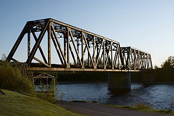
Métabetchouane River facts for kids
Quick facts for kids Metabetchouan River |
|
|---|---|
 |
|
| Other name(s) | Rivière Métabetchouane |
| Country | Canada |
| Province | Quebec |
| Region | Capitale-Nationale, Saguenay–Lac-Saint-Jean |
| Physical characteristics | |
| Main source | Mâles and Bouteille Lakes Lac-Croche, Capitale-Nationale 701 units? 47°26′09″N 71°41′07″W / 47.43583°N 71.68528°W |
| River mouth | Lac Saint-Jean Chambord / Desbiens, Saguenay–Lac-Saint-Jean 99 m (325 ft) 48°25′15″N 71°57′55″W / 48.42083°N 71.96528°W |
| Length | 169.4 km (105.3 mi) |
| Depth |
|
| Basin features | |
| Basin size | 2,245 km2 (867 sq mi) |
| Tributaries |
|
The Metabetchouan River (which is called Métabetchouane in French) is a river in Quebec, Canada. It flows into Lac Saint-Jean, a large lake in the middle of the province. The river passes through different areas, including the Capitale-Nationale and Saguenay–Lac-Saint-Jean regions.
The river starts from Mâles and Bouteille Lakes in the Laurentides Wildlife Reserve. It flows for about 169.4 km (105.3 mi) before reaching Lac Saint-Jean near the towns of Chambord and Desbiens. Near Desbiens, you can find a cool cave called Le trou de la Fée.
The Metabetchouan River is important for many reasons. It has been used to create hydroelectric power, which is electricity made from moving water. Today, it's also a popular spot for fun activities like rafting, canoeing, and fishing. It's especially known for its fresh-water salmon, which are called Ouananiche in the Saguenay-Lac-Saint-Jean area.
River's Journey
The Metabetchouan River starts in the Laurentides Wildlife Reserve. As it flows, it forms natural borders. For example, it marks the western edge of the Laurentides Wildlife Reserve for some distance. It also separates some towns and protected areas.
The river valley can be reached by different roads. Forest roads help people get to the middle part of the river. Closer to Lac Saint-Jean, main roads like Route 169 run along its lower section.
During winter, the river's surface usually freezes from late November to early April. It's generally safe to walk or travel on the ice from mid-December to late March.
Geography and Features
The Metabetchouan River has an average water flow of 47 m3/s (1,700 cu ft/s). It begins high up in the Laurentides Wildlife Reserve at Lac des Mâles, which is about 701 m (2,300 ft) above sea level. The river drops about 600 m (2,000 ft) from its source to its mouth.
Along its path, the river has several beautiful waterfalls. Two well-known ones are the "chute à l'Épouvante" (Fall to the Horror) and the Martine Fall.
The main areas that share water with the Metabetchouan River are:
- To the north: Lac Saint-Jean.
- To the east: Rivers like the Métabetchouane East River and Pikauba River.
- To the south: The Batiscan River and Jacques-Cartier River.
- To the west: Lakes like Lac des Commissaires and rivers like the Ouiatchouan River.
The river's journey is long and winding. It flows through many lakes, including Lac de la Bouteille, Lac aux Rognons, Petit lac Métascouac, Hugh Lake, Saint-Henri Lake, and Métabetchouane Lake. It also meets other rivers along the way, like the Métabetchouane East River and Rivière aux Canots.
Near its end, the Metabetchouane River forms a small lake where it meets Lac Saint-Jean. This spot is between the villages of Chambord and Desbiens. From Lac Saint-Jean, the water then flows into the Saguenay River and eventually reaches the Saint Lawrence estuary.
River's Name
The name "Metabetchouan" comes from the Innu language, which is spoken by Indigenous people in the area. The name combines two words: matabi and djiwan. Together, they mean "river that empties into a lake." This name perfectly describes how the river flows into Lac Saint-Jean.
History of the River
For thousands of years, the mouth of the Metabetchouan River was likely a seasonal camp for the Innu people. The river itself was an important travel route between Lac Saint-Jean and the Quebec City area.
In the 1960s, archaeologists found amazing things during digs along the riverbanks. They discovered a site that Indigenous peoples had used for about 5,000 years!
The first European to visit the area was Jean de Quen in 1647. However, he didn't mention the river in his report. The river was first written about in 1676 as Metabeki8an. That same year, a French trading post was built at the river's mouth. Jesuits also set up the Saint-Charles Mission there.
Later, in the mid-1800s, a merchant named William Price started cutting down trees along the river. The river was then used for a long time to float logs downstream, a process called log driving.
 | John T. Biggers |
 | Thomas Blackshear |
 | Mark Bradford |
 | Beverly Buchanan |


