
Nagakute facts for kids
Quick facts for kids
Nagakute
長久手市
|
|||
|---|---|---|---|

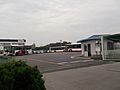
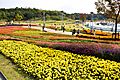
Site of Expo 2005
|
|||
|
|||

Location of Nagakute in Aichi Prefecture
|
|||

Nagakute
Location in Japan
|
|||
| Country | Japan | ||
| Region | Chūbu (Tōkai) | ||
| Prefecture | Aichi | ||
| Area | |||
| • Total | 21.55 km2 (8.32 sq mi) | ||
| Population | |||
| • Total | 61,503 | ||
| • Density | 2,854.0/km2 (7,391.7/sq mi) | ||
| Time zone | UTC+9 (Japan Standard Time) | ||
| - Tree | Maple | ||
| - Flower | Satsuki azalea | ||
| Phone number | 0561-63-1111 | ||
| Address | 60-1 Yazako, Shironouchi, Nagakute-shi, Aichi, Japan 480-1196 | ||


Nagakute (長久手市, Nagakute-shi) is a city located in Aichi Prefecture, Japan. As of October 1, 2019, about 61,503 people lived there in 24,352 households. The city covers an area of 21.55 square kilometers. Nagakute is also part of the World Health Organization’s Alliance for Healthy Cities (AFHC). This means it works to make the city a healthy place for everyone.
Contents
Geography and Climate

Nagakute is in the Owari Hills of central Aichi Prefecture. It sits between 43 and 184 meters above sea level. The big city of Nagoya is right next to it on the west side. Thirteen rivers flow through Nagakute, adding to its natural beauty.
Nagakute's Weather Patterns
The city has a climate with hot, humid summers and mild winters. This type of climate is called Cfa in the Köppen climate classification system. The average temperature in Nagakute is 15.5 degrees Celsius. The city gets about 1641 millimeters of rain each year. September is usually the wettest month. August is the hottest month, with temperatures around 27.9 degrees Celsius. January is the coldest, with temperatures around 4.0 degrees Celsius.
Population Growth
Nagakute's population has grown a lot over the last 50 years. In 2020, the average age of people living in Nagakute was 40.2 years old. This makes it the city with the youngest average age in Japan!
| Historical population | ||
|---|---|---|
| Year | Pop. | ±% |
| 1940 | 5,138 | — |
| 1950 | 6,638 | +29.2% |
| 1960 | 6,639 | +0.0% |
| 1970 | 11,317 | +70.5% |
| 1980 | 18,610 | +64.4% |
| 1990 | 33,714 | +81.2% |
| 2000 | 43,306 | +28.5% |
| 2010 | 52,399 | +21.0% |
| 2020 | 60,162 | +14.8% |
Nearby Cities and Towns
Nagakute shares its borders with several other places in Aichi Prefecture:
- Nagoya (specifically Moriyama-ku and Meitō-ku)
- Toyota
- Seto
- Nisshin
- Owariasahi
History of Nagakute
Ancient Battles and Domains
During the Sengoku period (a time of civil war in Japan), a famous battle took place near Nagakute. This was the Battle of Komaki and Nagakute. Later, during the Edo period, the area that is now Nagakute was part of the lands controlled by the Owari Domain.
Becoming a Village, Town, and City
Nagakute started as a village on May 10, 1906. This happened when three smaller hamlets, Nagakute, Kamigō, and Yazako, joined together. On April 1, 1971, Nagakute became a town. Finally, on January 4, 2012, Nagakute officially became a city.
Modern Developments and Expo 2005
A big event for Nagakute was Expo 2005. This world's fair helped the local economy a lot. It also led to the building of the Linimo, which is a special type of train called a linear motor train. The Linimo connects Nagakute with the big city of Nagoya.
International and National Connections
Nagakute has special relationships with other places around the world and in Japan. These are called "sister cities" or "friendship cities."
Sister Cities Around the World
Friendship Cities in Japan
 Nagiso, Nagano Prefecture (since October 21, 2006)
 Takarazuka, Hyōgo Prefecture (since October 27, 2012)
Economy and Industry
Nagakute's economy is strongly linked to the automobile industry. This is because of its location.
Major Companies in Nagakute
- Toyota Central R&D Labs., Inc. is located here. This company does research and development for Toyota.
- Nitto Kogyo, a company that makes electrical systems, also has its base in Nagakute.
- The main office for Aichi Rapid Transit Co., Ltd. is in Nagakute. This company operates the Linimo Maglev train.
Education in Nagakute
Nagakute is home to several universities and schools.
Universities in Nagakute

- Aichi Prefectural University
- Aichi Prefectural University of Fine Arts and Music
- Aichi Medical University
- Aichi Shukutoku University
Local Schools
The city government runs six public elementary schools and three public junior high schools. There is also one public high school run by Aichi Prefecture. Nagakute also has one private high school.
Getting Around Nagakute
Nagakute has good transportation options, including a unique train line and bus services.
Train Travel: The Linimo


The Linimo is a special type of train that uses magnets to float above the tracks. It's also known as the Tōbu Kyūryō Line. It has several stations within Nagakute:
- Hanamizuki-dōri
- Irigaike-kōen
- Nagakute Kosenjō
- Geidai-dōri
- Kōen-nishi
- Aichikyūhaku-kinen-kōen
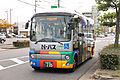
Bus Services
- The Meitetsu Bus company operates buses that serve Nagakute and nearby areas. Their main depot for Nagoya is located within the city.
- Nagakute also has its own community bus system called the N-Bus. The city owns these buses, and Meitetsu Bus operates them.
-
Meitetsu Bus Nagoya Depot
-
N-Bus


Roads and Expressways
The Nagoya Seto Expressway starts in Nagakute. This road connects to the Tōmei Expressway. While the Tōmei Expressway passes through Nagakute, it doesn't have an exit directly in the city. However, the Nagoya Interchange, which connects to both the Tōmei and Mei-Nikan Expressways, is very close by.
Fun Places to Visit
Nagakute has many interesting places to explore, from museums to historical sites and a popular theme park.
- Toyota Automobile Museum: A great place to see many different cars from history.
- Meito Art Museum
- Expo 2005 Site: The area where the big world's fair was held.
- Site of the Battle of Komaki and Nagakute: A historical spot where an important battle took place.
- Ghibli Park: A theme park based on the famous Studio Ghibli animated films.
Notable People from Nagakute
Some well-known individuals who come from Nagakute include:
- Shinta Fukushima, a professional soccer player
- Mine Kawakami, a talented pianist
Images for kids
-
Site of Expo 2005
-

Toyota Automobile Museum
-
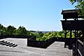
Iroganeyama Historical park
-
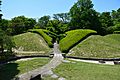
Nagakute Historic Battleground Park


See also
 In Spanish: Nagakute (Aichi) para niños
