National Hurricane Center facts for kids
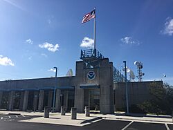 Front view of the National Hurricane Center headquarters |
|
| Agency overview | |
|---|---|
| Formed | 1965 |
| Jurisdiction | United States government |
| Headquarters | University Park, Miami-Dade County, Florida, United States 25°45′16″N 80°23′01″W / 25.75444°N 80.38361°W |
| Agency executive |
|
| Parent agency | NOAA |
The National Hurricane Center (NHC) is a special part of the United States government. It belongs to NOAA (National Oceanic and Atmospheric Administration) and the National Weather Service. The NHC's main job is to watch and predict tropical weather systems. These are storms like tropical storms and hurricanes.
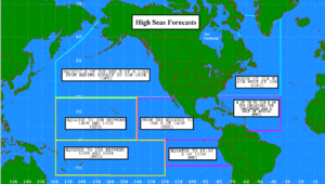
They cover a huge area, from the Prime Meridian (an imaginary line on Earth) all the way to the 140th meridian west. This includes the northern Atlantic Ocean and the northeast Pacific Ocean. The NHC is located in University Park, Florida, near Miami. It shares a campus with Florida International University.
The NHC has different teams that work together. One team, the Tropical Analysis and Forecast Branch (TAFB), creates forecasts for ships at sea. Another team, the Technology and Science Branch (TSB), helps with new technology. There's also a special unit called CARCAH. This unit helps send planes to fly into tropical cyclones. These "Hurricane Hunters" gather important information.
During hurricane season, the Hurricane Specialist Unit (HSU) issues weather outlooks. If a tropical storm or hurricane is expected, they send out warnings. These warnings go out to news channels and NOAA Weather Radio. This helps people prepare and stay safe.
The NHC is a US agency, but it's also important worldwide. The World Meteorological Organization chose it as a special center. This means the NHC is a main hub for tropical cyclone forecasts. It also collects observations for the North Atlantic and eastern Pacific oceans. If the NHC ever has problems, other centers can help. The Central Pacific Hurricane Center can back up forecasts for the Pacific. The Weather Prediction Center can help with the Atlantic.
Contents
History of the National Hurricane Center
How Hurricane Warnings Started
The first hurricane warning service began in the 1870s in Cuba. A person named Father Benito Viñes started it. After he passed away, the United States Signal Corps and United States Weather Bureau took over. They first worked from Jamaica in 1898, then Cuba in 1899. By 1902, they moved to Washington, D.C.
In 1935, regional offices took over hurricane warning duties. This is when the idea of the Atlantic hurricane season began. This season is a specific time of year when tropical cyclones are most likely. These regional offices started sending out hurricane updates every six hours.
The Jacksonville hurricane warning office moved to Miami, Florida, in 1943. By 1947, tropical cyclones in the Atlantic started getting names. They used the Joint Army/Navy Phonetic Alphabet. In 1953, the US Weather Bureau began naming storms with human names. This happened when storms became strong enough to be called tropical storms.
In the 1950s, the National Hurricane Research Project began. This project used airplanes to study tropical cyclones. They even did experiments on strong hurricanes. On July 1, 1956, a National Hurricane Information Center opened in Miami. This center collected all hurricane information from one US Weather Bureau office.
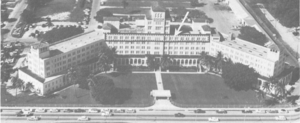
The Miami Hurricane Warning Office (HWO) moved buildings in 1958. At first, forecasts only looked one day ahead. This changed to two days in 1961, then three days in 1964. By 2001, forecasts looked five days into the future. The Miami HWO moved to the University of Miami campus in 1964. It was called the NHC in 1965.
The National Hurricane Center Today
| Director | Tenure | Ref. |
|---|---|---|
| Gordan Dunn | 1965–1967 | |
| Robert Simpson | 1968–1973 | |
| Neil Frank | 1973–1987 | |
| Bob Sheets | 1988–1995 | |
| Bob Burpee | 1995–1997 | |
| Jerry Jarrell | 1998–2000 | |
| Max Mayfield | 2000–2007 | |
| Bill Proenza | 2007 | |
| Edward Rappaport | 2007–2008 | |
| Bill Read | 2008–2012 | |
| Rick Knabb | 2012–2017 | |
| Edward Rappaport | 2017–2018 | |
| Kenneth Graham | 2018–2022 | |
| Jamie Rhome | 2022–2023 | |
| Mike Brennan | 2023–present |
In 1973, the National Meteorological Center started tracking tropical depressions that moved inland. The World Meteorological Organization took over naming Atlantic hurricanes in 1977. In 1978, the NHC moved its offices. Male names were added to the hurricane list starting in 1979.
In 1984, the NHC became separate from the Miami Weather Service Forecast Office. This meant the NHC director was in charge of the hurricane center. By 1988, the NHC also became responsible for tropical cyclones in the eastern Pacific. This happened when the Eastern Pacific Hurricane Center closed.
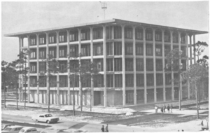
In 1992, Hurricane Andrew hit the NHC building. It damaged the weather radar and wind measuring tools. A new, stronger radar system was put in place in 1993. In 1995, the NHC moved to a new building. This building on the Florida International University campus can stand strong winds. Its name was changed to the Tropical Prediction Center in 1995.
Later, on October 1, 2010, the Tropical Prediction Center was renamed the NHC again. The group that forecasts hurricanes became the Hurricane Specialist Unit (HSU).
Hurricane forecasting uses different methods. One way is to look at past storm patterns. Another way uses powerful computers. These computers use math to predict how storms will move. The World Meteorological Organization still creates and updates the hurricane naming lists. Names of very deadly or famous storms are removed from the list. This means they won't be used again.
How the NHC is Organized
The NHC has about 66 staff members. This includes 12 managers. The NHC is one of nine national centers. These centers make up the National Centers for Environmental Prediction (NCEP).
Hurricane Specialist Unit (HSU)
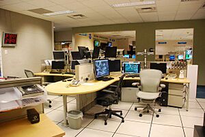
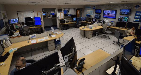
The Hurricane Specialist Unit (HSU) has meteorologists who predict tropical storms. They work in shifts from May to November. During this time, they watch weather patterns in the Atlantic and Eastern Pacific oceans. When a tropical storm forms, they issue updates every six hours. If a storm threatens land, they send out public warnings more often.
The specialists work with officials in countries that might be affected. They forecast where storms will go and recommend warnings. During hurricane season, the HSU also publishes a Tropical Weather Outlook. This report points out areas where tropical cyclones might form.
If storms happen outside the main hurricane season, the HSU issues special outlooks. Other centers can help if the HSU has communication problems. For example, the Central Pacific Hurricane Center can back up Pacific forecasts. The Weather Prediction Center can back up Atlantic forecasts.
The HSU also works with other centers every day. They identify systems for future weather maps. Outside of hurricane season, the specialists teach the public about hurricane safety.
Senior hurricane specialist Lixion Avila retired in April 2020. He had worked at the NHC since 1987. Senior hurricane specialist Stacy Stewart retired in January 2022. He had worked at the NHC since 1999.
Tropical Analysis and Forecast Branch (TAFB)
The Tropical Analysis and Forecast Branch (TAFB) is another part of the NHC. It was created in 1967. The TAFB is in charge of forecasts for the tropical parts of the Atlantic and Pacific oceans. Unlike the HSU, the TAFB works all year round.
The TAFB also uses satellites to estimate tropical cyclone positions. They use radar to track storms. They help with tropical cyclone forecasts and support the media. The Ocean Prediction Center can back up the TAFB if needed.
Technology and Science Branch (TSB)
The Technology & Science Branch (TSB) creates new tools for weather prediction. They work with other government groups and universities. The TSB created the ATCF system. This system helps combine different data and models. It also helps create and update storm records.
The TSB supports the NHC's computers and website. They also maintain many models that predict tropical cyclone behavior. The Storm Surge Unit is part of this branch. This unit develops software to forecast storm surge. Storm surge is the rise in sea level caused by a storm.
CARCAH Unit
The Chief, Aerial Reconnaissance Coordination, All Hurricanes (CARCAH) is a part of the 53d Weather Reconnaissance Squadron. This squadron is also known as the Hurricane Hunters. CARCAH's job is to coordinate all flights into tropical cyclones. These flights gather important information for the NHC. They cover the North Atlantic, Caribbean, Gulf of Mexico, and North Pacific.
During winter, CARCAH also helps with winter storm flights. These flights happen before big snowstorms. They also fly when there is a lot of uncertainty in weather predictions.
Hurricane Liaison Team (HLT)
The Hurricane Liaison Team (HLT) helps connect the NHC with emergency managers. These are people who help communities prepare for disasters. The HLT includes federal, state, and local emergency managers. It also includes meteorologists from the National Weather Service.
The team keeps open communication about storms. They hold video and phone calls with the NHC and other agencies. These include FEMA (Federal Emergency Management Agency) and state Emergency Operations Centers. During major hurricanes, the president of the United States might join these calls. Local mayors and state governors also join.
Research at the NHC
The NHC creates a tropical cyclone report for every tropical cyclone. These reports are available since 1958 for the Atlantic. They are available since 1988 for the Eastern Pacific. Each report summarizes the storm's history. It includes weather facts, damages, and how the storm moved.
The NHC also keeps archives of hurricane history. This includes annual reports on every tropical cyclone. They have old storm materials and season summaries. They also maintain HURDAT, which is the official tropical cyclone database.
Programs work to make hurricane forecasts more accurate. The Joint Hurricane Testbed (JHT) is one such program. It helps bring new research into forecasting operations. Since 2001, the JHT has funded many projects. These projects have helped the NHC improve its operations.
The Hurricane Forecast Improvement Program (HFIP) also works to improve forecasts. Its goal is to make weather prediction models much better. They aim for big improvements in tracking and predicting storm strength.
See also
 In Spanish: Centro Nacional de Huracanes para niños
- Bureau of Meteorology (Australia)
- Canadian Hurricane Centre
- Central Pacific Hurricane Center
- India Meteorological Department
- Japan Meteorological Agency
- Joint Typhoon Warning Center
- Fiji Meteorological Service
- Centre météorologique régional spécialisé cyclones de La Réunion (La Réunion) in French (French: Météo-France: Centre météorologique régional spécialisé cyclones de La Réunion)
- Meteorological Service of New Zealand Limited
- Tropical Cyclone Warning Centre (TCWC Jakarta) (Indonesia) (Indonesian: Badan Meteorologi, Klimatologi, dan Geofisika: Pusat Peringatan Dini Siklon Tropis)
 | Selma Burke |
 | Pauline Powell Burns |
 | Frederick J. Brown |
 | Robert Blackburn |


