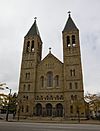
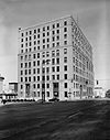
National Register of Historic Places listings in Akron, Ohio facts for kids
Welcome to Akron, Ohio! Did you know that this city is home to many amazing buildings and places that are super old and important? These special spots are listed on something called the National Register of Historic Places. It's like a hall of fame for buildings, districts, and other cool sites across the United States.
When a place is on this list, it means it's been recognized by the government for its history, architecture, or what it means to our culture. It helps protect these places so future generations can enjoy and learn from them.
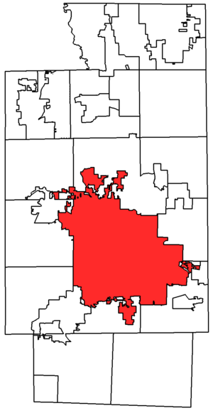
In all of Summit County, Ohio, there are 182 places on this list. Akron itself has 60 of these special spots! Two of them are even more important and are called National Historic Landmarks. This article will tell you all about the historic places right here in Akron.
Akron's Historic Treasures
Akron is full of history, and many of its buildings tell stories from the past. These places show us how people lived, worked, and built the city over many years. Let's explore some of these cool historic sites.
| Name on the Register | Image | Date listed | Location | Description | |
|---|---|---|---|---|---|
| 1 | Akron Jewish Center |
(#86001919) |
220 S. Balch St. 41°05′11″N 81°32′04″W / 41.086389°N 81.534444°W |
This building has been an important gathering place for the Jewish community in Akron for many years. | |
| 2 | Akron Post Office and Federal Building |
(#83002059) |
168 E. Market St. 41°05′00″N 81°30′49″W / 41.083333°N 81.513611°W |
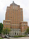
This grand building once served as the main post office and a federal office building for the city. | |
| 3 | Akron Public Library |
(#83002060) |
69 E. Market St. 41°05′06″N 81°30′52″W / 41.085°N 81.514444°W |
The main branch of the Akron Public Library has been a center for learning and reading for the community. | |
| 4 | Akron Rural Cemetery Buildings |
(#80003236) |
150 Glendale Ave. 41°05′05″N 81°31′32″W / 41.084722°N 81.525556°W |
These buildings are part of one of Akron's oldest cemeteries, which is a peaceful and historic place. | |
| 5 | Akron Soap Company |
(#14000811) |
237-243 Furnace St. 41°05′20″N 81°30′26″W / 41.0889°N 81.5072°W |
This building was once home to a company that made soap, showing Akron's industrial past. | |
| 6 | Akron Y.M.C.A. Building |
(#80003237) |
80 W. Center St. 41°04′49″N 81°31′24″W / 41.080278°N 81.523333°W |
The YMCA building provided a place for recreation, education, and community activities for many years. | |
| 7 | Akron-Fulton International Airport Administration Building |
(#01001361) |
1800 Triplett Boulevard 41°02′31″N 81°27′47″W / 41.041944°N 81.463056°W |
This building is part of Akron's airport history, showing how air travel developed in the area. | |
| 8 | Byron R. Barder House |
(#87001598) |
1041 W. Market St. 41°06′02″N 81°33′00″W / 41.100417°N 81.550000°W |
A historic home that shows the architectural styles popular in Akron long ago. | |
| 9 | Stacy G. Carkhuff House |
(#84003804) |
1225 W. Market St. 41°06′11″N 81°33′15″W / 41.103056°N 81.554167°W |
Another beautiful historic house, giving us a peek into Akron's past. | |
| 10 | Cascade Locks Historic District |
(#92001627) |
Roughly bounded by North, Howard, Innerbelt State Route 59, and the canal from Locks 10 to 16, including discontiguous parts north 41°05′35″N 81°31′16″W / 41.093056°N 81.521111°W |
This district includes parts of the old Ohio and Erie Canal, which was very important for trade and travel in Ohio's early days. | |
| 11 | Cole Avenue Housing Project Historic District |
(#07001090) |
744 Colette Dr. 41°03′05″N 81°30′07″W / 41.051467°N 81.501928°W |
This area represents an important part of Akron's social history, showing how housing was developed for communities. | |
| 12 | Eagles Temple |
(#82003656) |
131-137 E. Market St. 41°05′03″N 81°30′48″W / 41.084167°N 81.513333°W |
The Eagles Temple was a meeting place for a fraternal organization, important in Akron's community life. | |
| 13 | East Market Street Church of Christ |
(#88003440) |
864 E. Market St. 41°04′22″N 81°29′30″W / 41.072778°N 81.491667°W |
This church building has served its congregation and the community for many years. | |
| 14 | Firestone Tire and Rubber Company |
(#14000338) |
1200 Firestone Parkway 41°03′06″N 81°31′50″W / 41.051667°N 81.530556°W |
This building was part of the famous Firestone company, which was a huge part of Akron's history as the "Rubber Capital of the World." | |
| 15 | First Congregational Church |
(#04000061) |
292 E. Market St. 41°04′53″N 81°30′31″W / 41.081389°N 81.508611°W |
This church building has a long history and beautiful architecture. | |
| 16 | First National Bank Tower |
(#07000633) |
106 S. Main St. 41°04′56″N 81°31′08″W / 41.082222°N 81.518889°W |
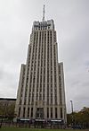
This tall building was once the First National Bank Tower and is now known as the FirstMerit Tower. | |
| 17 | Jacob M. Gayer House |
(#84003442) |
406 Sumner St. 41°04′19″N 81°30′53″W / 41.071944°N 81.514722°W |
Another historic home that shows the style of houses built in Akron's past. | |
| 18 | Glendale Cemetery |
(#01001063) |
150 Glendale Ave. 41°05′02″N 81°31′44″W / 41.083889°N 81.528889°W |
Glendale Cemetery is not just a burial ground; it's a beautiful park with historic monuments and landscaping. | |
| 19 | Goodyear Airdock |
(#73002259) |
Southern side of the Akron Airport 41°01′55″N 81°28′15″W / 41.031944°N 81.470833°W |
This massive building was used to build and house blimps and airships, showing Akron's role in aviation history. | |
| 20 | Goodyear Hall-Ohio Savings and Trust Company |
(#14000030) |
1201 E. Market St. 41°04′00″N 81°28′58″W / 41.066667°N 81.482778°W |
Goodyear Hall was a community center for Goodyear employees, offering many services and activities. | |
| 21 | Goodyear Tire and Rubber Company Headquarters |
(#13000683) |
1144 E. Market St. 41°03′56″N 81°28′58″W / 41.065556°N 81.482778°W |
This was the main office for the Goodyear Tire and Rubber Company, a very important business in Akron. | |
| 22 | The Gothic Building |
(#10000280) |
102 S. High St. and 52-58 E. Mill St. 41°04′55″N 81°31′01″W / 41.082083°N 81.516944°W |
The Gothic Building is known for its unique architectural style. | |
| 23 | Grace Reformed Church |
(#84003806) |
172 W. Bowery St. 41°04′48″N 81°31′28″W / 41.08°N 81.524444°W |
This church has been a spiritual home for many Akron residents over the years. | |
| 24 | Hall Park Allotment Historic District |
(#02001274) |
Roughly along Oakdale Ave., from Crestwood Ave. and Crosby St. 41°05′20″N 81°32′00″W / 41.088889°N 81.533333°W |
This district shows how neighborhoods were planned and built in Akron's past. | |
| 25 | Hower Mansion |
(#73001536) |
60 Fir Hill 41°04′46″N 81°30′28″W / 41.079556°N 81.507778°W |
The Hower Mansion is a grand historic home, giving us a glimpse into the lives of wealthy families in Akron. | |
| 26 | Andrew Jackson House |
(#75001537) |
277 E. Mill St. 41°04′48″N 81°30′34″W / 41.080000°N 81.509444°W |
This house is another example of Akron's historic residential architecture. | |
| 27 | Loew's Theatre |
(#73001537) |
182 S. Main St. 41°04′51″N 81°31′13″W / 41.080833°N 81.520278°W |
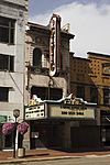
Now known as the Akron Civic Theatre, this beautiful building was once a famous movie palace. | |
| 28 | Main Exchange Historic District |
(#09000912) |
1 W. Exchange St., 323-337 S. Main St., 12 E. Exchange St., 380-348 S. Main St., and 328-326 S. Main St. 41°04′36″N 81°31′20″W / 41.076539°N 81.522111°W |
This district includes several historic buildings that were important for business and daily life in Akron. | |
| 29 | Main-Market Historic District |
(#03000719) |
15-47 N. Main St., 1-39 S. Main St., 39-168 E. Market St., 18-42 N. High St., and 70 Broadway St. 41°05′06″N 81°30′59″W / 41.085047°N 81.51635°W |
This area is a key part of downtown Akron, with many historic commercial buildings. | |
| 30 | Wells E. Merriman House |
(#83002061) |
641 W. Market St. 41°05′40″N 81°32′16″W / 41.094444°N 81.537778°W |
A historic residence that adds to the rich architectural heritage of Akron. | |
| 31 | Lewis Miller House |
(#76001531) |
142 King Dr. 41°05′04″N 81°31′23″W / 41.084444°N 81.523056°W |
This house belonged to Lewis Miller, a notable figure in Akron's history. | |
| 32 | O'Neil's Department Store |
(#90001776) |
226-250 S. Main St. 41°04′46″N 81°31′24″W / 41.079444°N 81.523333°W |
O'Neil's was a very popular department store, a place where many Akron families shopped for generations. | |
| 33 | Old Akron Post Office |
(#72001046) |
70 E. Market St. 41°05′04″N 81°30′55″W / 41.084444°N 81.515278°W |
This building served as an early post office for Akron, handling mail for the growing city. | |
| 34 | Col. Simon Perkins Mansion |
(#74001624) |
550 Copley Rd. 41°05′06″N 81°32′30″W / 41.085°N 81.541667°W |
This mansion was the home of Colonel Simon Perkins, an important founder of Akron. | |
| 35 | Portage Hotel |
(#80004611) |
10 N. Main St. 41°05′08″N 81°31′01″W / 41.085556°N 81.516944°W |
The Portage Hotel was once a grand hotel, hosting many visitors and events in Akron. | |
| 36 | Quaker Oats Cereal Factory |
(#78002195) |
120 E. Mill St. 41°04′50″N 81°30′56″W / 41.080556°N 81.515556°W |
This unique building was originally a Quaker Oats cereal factory, later repurposed into a hotel and shops. | |
| 37 | The Rhodes and Watters Apartment Buildings |
(#07001296) |
614, 608, 610, and 612 W. Market St., and 16 Rhodes Ave. 41°05′37″N 81°32′14″W / 41.093611°N 81.537222°W |
These apartment buildings show the style of multi-family homes built in Akron. | |
| 38 | Byron W. Robinson House |
(#91001415) |
715 E. Buchtel Ave. 41°04′37″N 81°29′43″W / 41.077083°N 81.495278°W |
Another historic house that adds to Akron's collection of important buildings. | |
| 39 | Charles Willard Seiberling House |
(#93000405) |
1075 W. Market St. 41°06′06″N 81°33′05″W / 41.101667°N 81.551389°W |
This house belonged to Charles Willard Seiberling, a member of a prominent Akron family. | |
| 40 | Selle Gear Company |
(#05001213) |
451 S. High St. 41°04′25″N 81°31′20″W / 41.073611°N 81.522222°W |
The Selle Gear Company building represents Akron's industrial past and its manufacturing heritage. | |
| 41 | Dr. Robert Smith House |
(#85003411) |
855 Ardmore Ave. 41°05′45″N 81°32′58″W / 41.095833°N 81.549306°W |
This house is a National Historic Landmark because it was the home of Dr. Bob, one of the founders of Alcoholics Anonymous. | |
| 42 | South Main Street Historic District |
(#08000622) |
156-222 S. Main St., 153-279 S. Main St. 41°04′46″N 81°31′12″W / 41.079381°N 81.520136°W |
This district along South Main Street features many historic buildings that were part of Akron's busy downtown. | |
| 43 | St. Bernard's Church |
(#89000174) |
240 S. Broadway St. 41°04′41″N 81°31′07″W / 41.078056°N 81.518611°W |
St. Bernard's Church is a beautiful and historic place of worship in Akron. | |
| 44 | St. Paul's Sunday School and Parish House |
(#76001532) |
E. Market and Forge Sts. 41°04′51″N 81°30′25″W / 41.080833°N 81.506944°W |
This building was an important part of St. Paul's church community. | |
| 45 | Stan Hywet Hall-Frank A. Seiberling House |
(#75002058) |
714 N. Portage Path 41°07′07″N 81°33′05″W / 41.118611°N 81.551389°W |
Stan Hywet Hall is a magnificent estate and a National Historic Landmark. It was the home of Frank A. Seiberling, who founded the Goodyear Tire and Rubber Company. | |
| 46 | Stan Hywet Poultry Keepers Cottage |
(#12001183) |
1103 Courtleigh Dr. 41°07′06″N 81°33′12″W / 41.118333°N 81.553333°W |
This small cottage is part of the larger Stan Hywet Hall estate. | |
| 47 | Summit County Courthouse and Annex |
(#74001625) |
209 S. High St. 41°04′46″N 81°31′02″W / 41.079544°N 81.517103°W |
The Summit County Courthouse is where important legal and government work happens for the county. | |
| 48 | Valley Railway Historic District |
(#85001123) |
Cuyahoga Valley between Rockside Rd. in the Cuyahoga Valley National Park and Howard St. at Little Cuyahoga Valley 41°13′38″N 81°34′13″W / 41.227222°N 81.570278°W |
This historic railway district runs through the beautiful Cuyahoga Valley National Park and connects Akron to other parts of the county. | |
| 49 | Viall Lodge |
(#94000238) |
1135 E. Market St. 41°04′05″N 81°29′04″W / 41.068056°N 81.484444°W |
Viall Lodge is another historic building that contributes to Akron's rich past. | |
| 50 | Werner Company Building |
(#76001533) |
109 N. Union 41°05′03″N 81°30′21″W / 41.084167°N 81.505833°W |
The Werner Company Building was part of Akron's industrial growth. | |
| 51 | Edward P. Werner House |
(#05001146) |
258 W. Market St. 41°05′20″N 81°31′34″W / 41.088889°N 81.526111°W |
This house is another example of the historic homes found in Akron. | |
| 52 | Wesley Temple AME Zion Church |
(#94000243) |
104 N. Prospect St. 41°05′10″N 81°30′38″W / 41.086111°N 81.510556°W |
Wesley Temple AME Zion Church has been an important spiritual and community center. | |
| 53 | Westmont Building |
(#84003807) |
22 Rhodes Ave. 41°05′35″N 81°32′15″W / 41.093194°N 81.537500°W |
The Westmont Building is a historic structure that adds to the character of Akron. | |
| 54 | Young Women's Christian Association |
(#82001491) |
146 S. High St. 41°04′52″N 81°31′03″W / 41.081111°N 81.5175°W |
The YWCA building has provided support and programs for women and girls in Akron for many years. |


