
National Register of Historic Places listings in Fulton County, Georgia facts for kids

Fulton County, Georgia, is home to many amazing places that are listed on the National Register of Historic Places (NRHP). This special list helps protect buildings, sites, and areas that are important to American history and culture. Think of it like a hall of fame for historic spots!
Many of these cool places are in Atlanta, the biggest city in Fulton County. Some other historic spots in Atlanta are found in DeKalb County, too.
Contents
What is the National Register of Historic Places?
The National Register of Historic Places is the official list of the nation's historic places worth saving. It's managed by the National Park Service. When a place is added to the NRHP, it means it's recognized as important for its history, architecture, archaeology, engineering, or culture. This recognition can help protect the place and sometimes even provide money for its care.
Historic places can be:
- Buildings: Like old homes, schools, or churches.
- Structures: Such as bridges, lighthouses, or monuments.
- Sites: Places where important events happened, like battlefields or ancient villages.
- Objects: Things like sculptures or even old trains.
- Historic Districts: These are areas with many historic buildings or sites that together tell a story.
Cool Historic Places in Fulton County
Fulton County has a wide variety of historic places. Let's explore some of them!
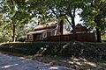
Historic Homes and Buildings
Many old homes and buildings in Fulton County are on the NRHP. They show us how people lived and worked long ago.
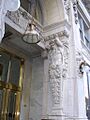
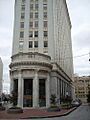
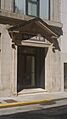
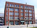
- Academy of Medicine: This beautiful building in Atlanta was listed in 1980. It's a great example of classic architecture.

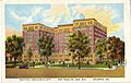
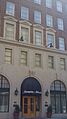
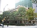
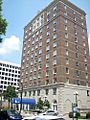
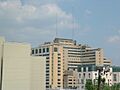
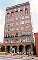
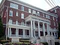
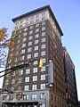
- Atlanta Biltmore Hotel and Biltmore Apartments: Listed in 1980, this grand building in Atlanta was once a fancy hotel and apartment complex. It shows the style of big city living from the past.

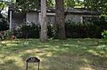
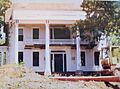
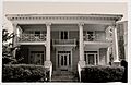
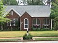
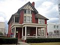
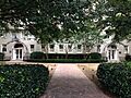
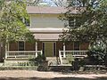
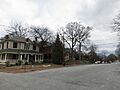
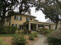
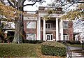
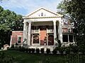
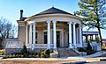
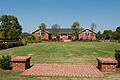
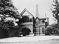
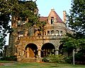
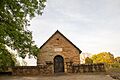
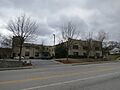
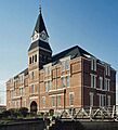
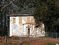
- Barrington Hall: Located in Roswell, this home was listed in 1971. It's a lovely example of a plantation house from the 1800s.
.jpg)
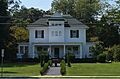
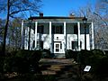
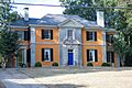
- Bulloch Hall: Also in Roswell and listed in 1971, this is another important historic home. It's known for being the childhood home of Martha Bulloch Roosevelt, the mother of President Theodore Roosevelt.

- Burns Cottage: This unique cottage in Atlanta, listed in 1983, is a replica of the birthplace of famous Scottish poet Robert Burns.

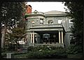
- Rufus M. Rose House: This Atlanta home, listed in 1977, is a rare example of a fancy 19th-century house that still stands on Peachtree Street. It was designed by architect Emil Charles Seiz in 1901.

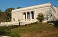
- Swan House: Located in Atlanta and listed in 1977, this is a very famous and beautiful mansion. It's part of the Atlanta History Center and shows what life was like for wealthy families in the early 20th century.

- Tullie Smith House: Also part of the Atlanta History Center and listed in 1970, this is a simpler, older farmhouse. It helps us understand how everyday families lived in Georgia before the Civil War.

Important Public Buildings
Fulton County also has many public buildings that are historically significant.
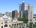
- Atlanta City Hall: The main government building for Atlanta, listed in 1983, is an important landmark in the city's downtown.

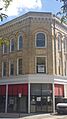
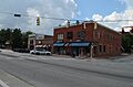
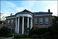
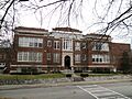
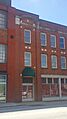
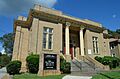
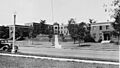
- Campbell County Courthouse: This courthouse in Fairburn, listed in 1976, was once the courthouse for the old Campbell County before it became part of Fulton County.
.jpg)
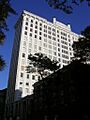
- Fulton County Courthouse: The main courthouse for Fulton County in Atlanta, listed in 1980, is where many important legal decisions have been made.

- Georgia State Capitol: This is the most important government building in Georgia, located in Atlanta and listed as a National Historic Landmark in 1971. It's where the state's laws are made.

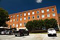
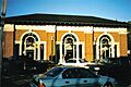
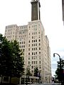
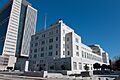
- U.S. Post Office and Courthouse: This building in Atlanta, listed as a National Historic Landmark in 1974, is famous because many important cases from the Civil Rights Movement were first heard here.

Churches and Religious Sites
Several churches in Fulton County are recognized for their historical importance.
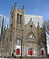
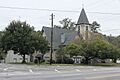
- Central Presbyterian Church: This Atlanta church, listed in 1986, is a beautiful example of church architecture.

- First Congregational Church: Listed in 1979, this Atlanta church has a rich history, especially within the African American community.

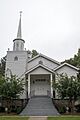
- North Avenue Presbyterian Church: Designed by Bruce & Morgan and built in 1900, this Atlanta church was listed in 1978.

- Shrine of the Immaculate Conception: This historic Catholic church in Atlanta, listed in 1976, is one of the oldest churches in the city.

- St. Mark United Methodist Church: Built between 1902 and 1903 by architect Willis Franklin Denny, this Atlanta church was listed in 1987.

Unique and Industrial Sites
Fulton County also has interesting industrial and unique historic places.
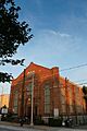
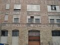
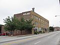
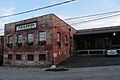
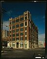
- Atlanta and West Point Railroad Freight Depot: This old train depot in Atlanta, listed in 1976, reminds us of the city's history as a major railroad hub.
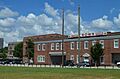
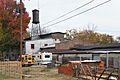
- Dixie Coca-Cola Bottling Company Plant: This Atlanta plant, listed as a National Historic Landmark in 1977, is where Coca-Cola was first bottled! It's a very important site for the history of this famous drink.

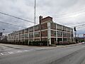
- Ford Motor Company Assembly Plant: This large plant in Atlanta, listed in 1984, shows the history of car manufacturing in the region.

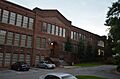
- King Plow Company: This industrial site in Atlanta, listed in 1996, was once a factory that made farming equipment. Today, it's been repurposed into an arts center.

- Sears, Roebuck and Co. Mail-Order Warehouse and Retail Store: Now known as Ponce City Market, this huge building in Atlanta was once a major distribution center for Sears. It was listed in 2016.

- The Texas (locomotive): This famous steam locomotive, listed in 1973, was involved in the Great Locomotive Chase during the Civil War. It's a fascinating piece of railroad history.

- Western and Atlantic Railroad Zero Milepost: This spot in Atlanta, listed in 1977, marks the very beginning of the Western and Atlantic Railroad, which was crucial to Atlanta's growth.

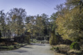
Historic Districts
Historic districts are areas where many buildings and sites together tell a story.
- Adair Park Historic District: This Atlanta district, listed in 2000, is a neighborhood with many historic homes.

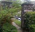
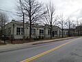
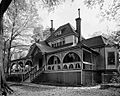
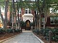
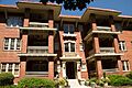
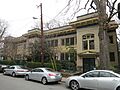
- Ansley Park Historic District: Listed in 1979, this is a beautiful, planned neighborhood in Atlanta with many large, historic homes.
.JPG)
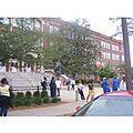
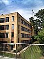
- Atlanta University Center District: Listed in 1976, this district includes several historically Black colleges and universities in Atlanta, which have played a huge role in education and civil rights.
- Cabbagetown District: This unique Atlanta neighborhood, listed in 1976, was originally built for mill workers and has a distinct character.
,_Boulevard,_Pearl_Street,_Memorial_Drive,_%26_Railroa,_Atlanta_(Fulton_County,_Georgia).jpg)
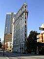
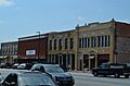
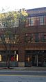
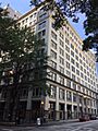
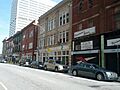
- Fairlie-Poplar Historic District: This downtown Atlanta district, listed in 1982, has many historic commercial buildings and skyscrapers.

- Grant Park Historic District: This Atlanta district, listed in 1979, surrounds the famous Grant Park and has many historic homes.

- Inman Park Historic District: Listed in 1973, Inman Park is one of Atlanta's first planned suburbs and is known for its beautiful Victorian homes.

- Martin Luther King, Jr., Historic District: This very important district in Atlanta, listed as a National Historic Landmark in 1974, includes the birth home, church, and tomb of Martin Luther King Jr.. It's a place of great significance for the Civil Rights Movement.

- Oakland Cemetery: This historic cemetery in Atlanta, listed in 1976, is the final resting place for many famous Georgians and features beautiful monuments.

- Roswell Historic District: This district in Roswell, listed in 1974, includes many of the town's oldest buildings and homes, showing its history as a mill town.

- Sweet Auburn Historic District: This Atlanta district, listed as a National Historic Landmark in 1976, was a thriving center of African American business and culture during the 20th century.
.jpg)
- Underground Atlanta Historic District: This area in Atlanta, listed in 1980, is a historic shopping and entertainment district built below the city streets.

- Virginia-Highland Historic District: This popular Atlanta neighborhood, listed in 2005, is known for its charming bungalows and tree-lined streets.

- West End Historic District: This Atlanta district, listed in 1999, is one of the city's oldest and most historic neighborhoods, known for its Victorian architecture.
.jpg)
Former Listings
Some places that were once on the National Register of Historic Places in Fulton County have been removed. This can happen if a building is torn down or if it loses its historic importance.
- Glenridge Hall: This historic home in Atlanta was removed from the list in 2015 because it was unfortunately demolished.
Images for kids
-
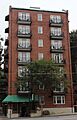
61 16th Street Apartment Building
-
63 Magnum Street Industrial Building
-
705 Piedmont Avenue Apartments
-
Charles R. Adams Park
-
Jack and Helen Adams Lustron House
-
Thomas P. Arnold House
-
Atkins Park District
-
Atlanta Buggy Company and Warehouse
-
Atlanta Spring and Bed Company
-
Atlanta Stockade
-
Atlanta Waterworks Hemphill Avenue Station
-
Atlanta Women's Club
-
Levi Ballard House (now demolished)
-
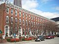
Baltimore Block
-
Bass Furniture Building
-
Briarcliff Hotel
-
Dr. Marion Luther Brittain, Sr., House
-
Brookhaven Historic District
-
Building at 161 Spring St.
-
Butler Street Colored Methodist Episcopal Church
-
Candler Building
-
Capital City Club
-
Capitol View Manor Historic District
-
Castleberry Hill Historic District
-
Church of the Sacred Heart of Jesus
-
Citizens and Southern Bank Building
-
Coca-Cola Building Annex
-
College Street School
-
Cox-Carlton Hotel
-
Crescent Apartments (Margaret Mitchell House)
-
William H. Crogman School
-
Cyclorama of the Battle of Atlanta
-
H. B. Davis Building-Hotel Roxy
-
East Point Industrial District
-
Empire Manufacturing Company Building
-
English-American Building
-
Fairburn Commercial Historic District
-
Fire Station No. 11
-
First Methodist Episcopal Church, South
-
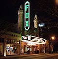
Fox Theatre
-
Fox Theatre Historic District
-
Freeman Ford Building
-
Garden Hills Historic District
-
Garrison Apartments
-
General Electric Company Repair Shop Warehouse
-
Georgia Institute of Technology Historic District
-
Jeremiah S. Gilbert House
-
Glenn Building
-
Grady Hospital
-
Grant Park North
-
W. D. Grant Building
-
Great Atlantic & Pacific Tea Company
-
Griffith School of Music
-
Habersham Memorial Hall
-
Joel Chandler Harris House
-
Healey Building
-
Herndon Home
-
Highland School
-
Home Park School
-
Hotel Row Historic District
-
Hurt Building
-
Imperial Hotel
-
Inman Park-Moreland Historic District
-
Island Ford Lodge
-
Victor H. Kriegshaber House
-
Crawford W. Long Memorial Hospital
-
Means Street Historic District
-
Medical Arts Building
-
Memorial to the Six Million
-
Midtown Historic District
-
Mozley Park Historic District
-
National NuGrape Company
-
New Hope African Methodist Episcopal Church and Cemetery
-
Newtown Elementary School
-
William P. Nicolson House
-
Odd Fellows Building and Auditorium
-
J. K. Orr Shoe Company
-
Palmer House and Phelan House Apartments
-
Peachtree Christian Church
-
Peachtree Highlands-Peachtree Park Historic District
-
Peachtree Southern Railway Station
-
Edward C. Peters House
-
Piedmont Park
-
Piedmont Park Apartments
-
Retail Credit Company Home Office Building
-
Reynoldstown Historic District
-
Rhodes Memorial Hall
-
Rhodes-Haverty Building
-
Rock Spring Presbyterian Church
-
Roscoe-Dunaway Gardens Historic District
-
Simeon and Jane Rucker Log House
-
St. Andrews Apartments
-
Sardis Methodist Church and Cemetery
-
Selig Company Building
-
Archibald Smith House
-
Southern Bell Telephone Company Building
-
Southern Belting Company Building
-
Southern Dairies
-
Southern Spring Bed Company
-
Stewart Avenue Methodist Episcopal Church South
-
Stone Hall, Atlanta University
-
Techwood Homes Historic District
-
Tyree Building
-
United States Post Office, Federal Annex
-

Utoy Cemetery
-
E. Van Winkle Gin and Machine Works
-
Booker T. Washington High School
-
Western Electric Company Building
-
Judge William Wilson House
-
Winecoff Hotel
-
Yonge Street School
-
Trio Steam Laundry
-
Troy Peerless Laundry Building
-
Thorton Building
-
Henry B. Tompkins House


.jpg)


_now_the_J._Mack_Robinson_College_of_Business_Administration_Building.jpeg)


.jpg)
.jpg)


_Atlanta_Georgia.JPG)


.jpg)


.jpg)


