Neighborhoods of Albany, New York facts for kids
Welcome to the neighborhoods of Albany, New York! Albany is the capital city of New York State, and like many cities, it's made up of many different neighborhoods. Each one has its own unique history, feel, and special places. Let's explore some of them!
Contents
- Arbor Hill: A Historic Spot
- Buckingham Lake: A Quiet Area
- Center Square: Full of Life
- Eagle Hill: A Diverse Community
- Manning Boulevard: Unique Carriage Paths
- Melrose: Historic Homes
- Normanskill: Named After a Creek
- North Albany: An Early Settlement
- Park South: A Renewed Area
- Pine Hills: Home to Students
- South End: A Diverse Region
- The Dunes: A Suburban Feel
- University Heights: A Learning Hub
- West Hill: A Busy Area
- Other Neighborhoods to Explore
Arbor Hill: A Historic Spot
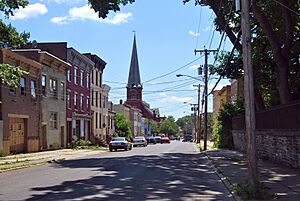
Arbor Hill is a very old neighborhood in northeastern Albany. It's located close to the Hudson River. This area stretches from Clinton Avenue north to the Livingston Avenue Railroad Bridge. It also goes from the Hudson River west to Henry Johnson Boulevard.
When Albany was first founded in 1686, Arbor Hill was outside the city limits. It was originally called Colonie. In 1804, it became its own village. Later, in 1815, it officially joined the city of Albany. That's when Patroon Street became Clinton Avenue.
The name "Arbor Hill" comes from the Ten Broeck Mansion. This mansion is a very important historical and cultural spot in the neighborhood. Arbor Hill is also home to Dudley Heights. This part of the neighborhood was where the Dudley Observatory was first built.
Buckingham Lake: A Quiet Area
The Buckingham Lake neighborhood is a peaceful area in Albany. It's bordered by Western Avenue to the north and Route 85 to the west. To the south, you'll find Krumkill Road and New Scotland Avenues. South Manning Boulevard forms its eastern border.
Center Square: Full of Life
Center Square is known for its beautiful buildings and lively atmosphere. It's a popular spot for entertainment, culture, and dining. This neighborhood is bordered by Lark Street on the west and Spring Street on the north. South Swan Street is to the east, and Jay Street is to the south.
Center Square is also very close to Washington Park. Many people compare Center Square and the nearby Hudson/Park neighborhood to New York City's Greenwich Village. This is because they both have a cool mix of homes, shops, restaurants, and unique stores.
Eagle Hill: A Diverse Community
Eagle Hill is a neighborhood in western Albany, close to the Town of Guilderland. It gets its name from the Eagle Hill Cemetery. This is a large neighborhood with many different kinds of people living there.
Eagle Hill has been described as a "tranquil, pretty place." It has narrow, tree-lined streets and a mix of different housing styles.
Manning Boulevard: Unique Carriage Paths
Manning Boulevard is a long road that runs through Albany. However, the Manning Boulevard neighborhood is a smaller area around the boulevard. It's located between Washington and Western Avenues.
What makes this neighborhood special are the carriage paths. These paths run on both sides of Manning Boulevard. They were built a long time ago, in the late 1800s.
Melrose: Historic Homes
Melrose is a neighborhood in western Albany. It has mostly one-family homes and includes Rosemont Park. It's generally located between Washington Avenue to the north and Western Avenue to the south. Brevator Street is to the west, and Manning Boulevard is to the east.
Melrose Avenue itself is built on the path of New York State's first passenger railroad. This railroad once ran from Albany to Schenectady. The historic Jesse Buel House is also located in Melrose. People describe Melrose as a "cute family neighborhood with some history."
Normanskill: Named After a Creek
The Normanskill neighborhood is named after the Normans Kill. This is a creek that forms part of Albany's southern border. This neighborhood includes areas that were once called Hurstville and Karlsfeld. These areas joined Albany in 1967.
North Albany: An Early Settlement
North Albany was settled in the mid-1600s. It was first home to the Patroon of Rensselaerswyck and his tenants. Later, it became a small community in the town of Watervliet.
North Albany is located between the Town of Colonie, New York and Village of Menands, New York to the north. To the south is the Livingston Avenue railroad bridge. The Hudson River is to the east, and Van Rensselaer Boulevard is to the west.
Park South: A Renewed Area
Park South is a small neighborhood located between University Heights and the southern edge of Washington Park. In the early 2000s, this area underwent a big change. Many older homes were updated or replaced. New office buildings, shops, and apartments were also added.
Pine Hills: Home to Students
The Pine Hills neighborhood is a large area in Albany. It's generally bordered by Washington Avenue to the north and South Lake Avenue to the east. Woodlawn Avenue and Cortland Street are to the south, and South Manning Boulevard is to the west. The neighborhood got its name in 1891.
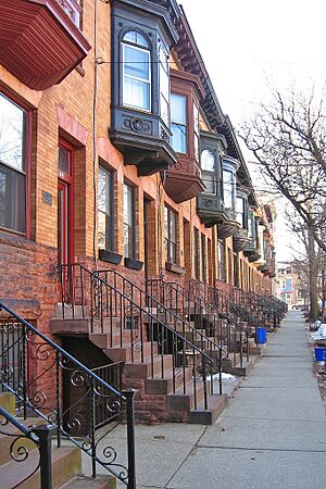
Pine Hills has many multi-unit homes, duplexes, and semi-detached houses. It's home to several schools, including Albany High School, the LaSalle School, the College of St. Rose, and the Alumni Quad of the University at Albany. Many college students live in the eastern part of Pine Hills.
South End: A Diverse Region
The South End is a large and varied part of Albany. It's made up of several smaller neighborhoods, each with its own character.
Delaware Avenue: A City Entrance
Delaware Avenue is a main road that leads into Albany from the south. It's especially used by people coming from the Bethlehem and Delmar areas. The Delaware Avenue neighborhood is located southwest of the Empire State Plaza.
Only a small part of Delaware Avenue is considered the "Delaware Neighborhood." In recent years, money was used to improve this area. New streets, lighting, and trees were added to make it safer and more welcoming.
Mansion District: Grand Homes
The Mansion neighborhood is named after the Governor's Mansion, which is a very important building there. This neighborhood shows off many different architectural styles from the 1800s.
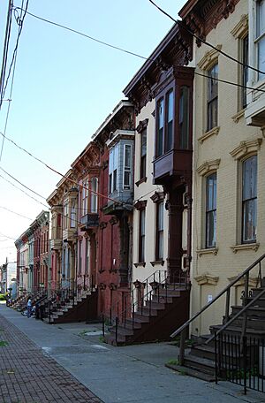
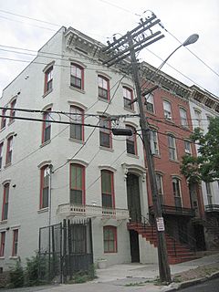
Many buildings here are in the Italianate style, which is very popular. You can also see buildings that mix Greek Revival and Italianate styles. There are even some unique examples of Gothic Revival decorations on rowhouses.
The Dunes: A Suburban Feel
The Dunes is a neighborhood located in a long, narrow part of western Albany. This area is known as the Albany Pine Bush. It's west of Crossgates Mall. The City of Albany website says that this neighborhood "has a distinctly suburban feel," meaning it's more like a suburb than a busy city center.
Rapp Road Community: A Special History
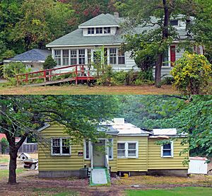
The Rapp Road Community Historic District is a special residential area. It's listed on the National Register of Historic Places. This district is a rare example of a "chain migration" community. This means that many people from the same area moved here together.
This community was formed during the Great Migration. This was a time when millions of African-Americans moved from the rural Southern United States to cities in the Northeast, Midwest, and West. This happened between 1916 and 1970.
The Rapp Road Community Historic District is located along Rapp Road. It's just north of the border between the City of Albany and the Town of Guilderland.
University Heights: A Learning Hub
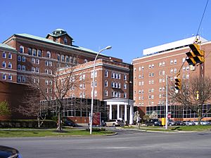
University Heights is a neighborhood filled with places of learning and healing. It's home to the Albany College of Pharmacy, Albany Law School, Sage College of Albany, and Albany Medical College. The medical college is part of the large Albany Medical Center.
West Hill: A Busy Area
West Hill stretches from Central Avenue north to Tivoli Hollow. It goes from Henry Johnson Boulevard west to Manning Boulevard. This neighborhood is dominated by Central Avenue. Central Avenue is like Albany's "Main Street" and is a very important road into the city. Clinton and Livingston Avenues are also key roads here.
Other Neighborhoods to Explore
Albany has even more neighborhoods, each with its own story! Here are a few more:
- Beverwyck
- Helderberg
- Hudson/Park
- New Scotland/Woodlawn
- Pastures
- Sheridan Hollow
- Washington Square
- Whitehall
 | Sharif Bey |
 | Hale Woodruff |
 | Richmond Barthé |
 | Purvis Young |


