Nemei River facts for kids
Quick facts for kids Nemei River |
|
|---|---|

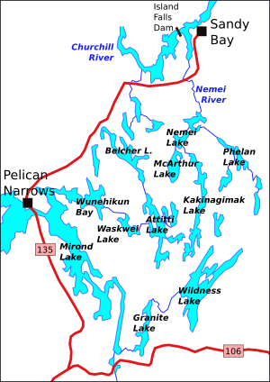
Attitti and surrounding lakes. Nemei River in northeast of the sketch map
|
|
|
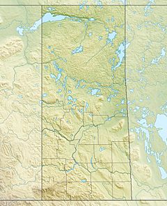
Location in Saskatchewan
|
|
| Country | Canada |
| Province | Saskatchewan |
| Physical characteristics | |
| Main source | Nemei Lake 55°18′39″N 102°21′07″W / 55.310709°N 102.351868°W |
| River mouth | Churchill River south of Sandy Bay, Saskatchewan 55°28′33″N 102°19′39″W / 55.475699°N 102.327538°W |
| Basin features | |
| River system | Churchill River |
The Nemei River is a river in Saskatchewan, Canada. It is a smaller river that flows into the much larger Churchill River. The Nemei River starts in Nemei Lake and travels north until it joins the Churchill River near a place called Sandy Bay. This river flows through an area known as the Canadian Shield, which is very old and mostly flat land. The weather here is quite cold, known as a sub-arctic climate.
Contents
Where is the Nemei River Located?
The Nemei River flows into the Churchill River after the Reindeer River joins it. The name "Nemei" comes from an Indigenous language and means "sturgeon," which is a type of large fish.
The Nemei River meets the Churchill River downstream from the Island Falls power dam. This dam was built a long time ago, in 1929, to create electricity. The mouth of the Nemei River, where it joins the Churchill, is about 308 meters (1,010 feet) above sea level.
Lakes that Feed the Nemei River
Several lakes help feed the Nemei River with water. Phelan Lake drains its water northwest into Nemei Lake, and then this water continues into the Nemei River. You can reach Phelan Lake by following a water route from the south, which includes Wildnest, Kakinagimak, and Nemei Lakes.
Other lakes also send their water north into the Nemei River. These include Robbestad Lake, McArthur Lake, and the northern part of Kakinagimak Lake. All this water eventually flows into the Churchill River.
What is the Environment Like Around the Nemei River?
The Nemei River is located in a subarctic climate zone. This means it gets very cold in winter and has short, cool summers. The average temperature for the whole year is about -3°C (27°F). July is usually the warmest month, with an average temperature of 16°C (61°F). January is the coldest, averaging -22°C (-8°F).
The land around the river is typical of the Canadian Shield. This area has a low, rolling landscape, meaning it's mostly flat with gentle hills. Most of the time, the land doesn't change much in height, usually less than 30 meters (100 feet). However, some hills and ridges to the east can rise more than 100 meters (350 feet) above the lakes. The land around the Nemei River is mostly covered by forests.
Helping Fish Cross the Highway
Saskatchewan Highway 135 crosses over the Nemei River. When the highway was built, the river was directed through large pipes called culverts under the road. At first, these culverts were placed too high. This meant the water flowed out above the river level on the other side, creating a small waterfall that fish couldn't swim up. This blocked the fish from moving upstream to different parts of the river.
To fix this problem, new, larger culverts, about 3 meters (10 feet) wide, were installed. These new culverts were placed at the same level as the river. This allowed fish to swim through easily and continue their journey upstream, helping to protect the river's fish population.
 | Sharif Bey |
 | Hale Woodruff |
 | Richmond Barthé |
 | Purvis Young |


