Nevada State Route 582 facts for kids
Quick facts for kids
State Route 582 |
||||
|---|---|---|---|---|
| Boulder Highway Fremont Street |
||||
|
SR 582 highlighted in red
|
||||
| Route information | ||||
| Maintained by NDOT | ||||
| Length | 15.392 mi (24.771 km) | |||
| Existed | c. 1991–present | |||
| Major junctions | ||||
| South end | ||||
| North end | ||||
| Highway system | ||||
Nevada highways
|
||||
State Route 582 (SR 582) is an important highway in the Las Vegas Valley in Nevada. It is about 15 miles (25 kilometers) long. This highway used to be part of bigger U.S. routes like U.S. Route 93 and U.S. Route 95. These routes were later moved to a newer, faster freeway.
SR 582 is mostly known as Boulder Highway. It connects Downtown Las Vegas with the city of Henderson. It also helps people get to Boulder City, which is southeast of Henderson.
Contents
What is State Route 582 like?
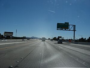
State Route 582 officially starts in Henderson. This is near where the I-11/US 93/US 95 freeway meets Wagonwheel Drive. From there, SR 582 quickly becomes a busy road with many businesses. It heads northwest through Henderson.
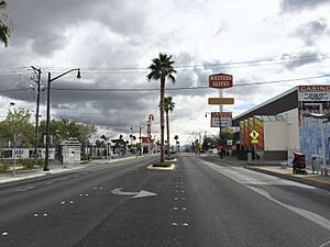
A part of SR 582 is sometimes called the "Boulder Strip". This name is similar to the famous Las Vegas Strip. This section of Boulder Highway has nice landscaping in the middle. You can also find several local casinos here, like Boulder Station and Sam's Town Hotel and Gambling Hall.
As you go north, SR 582 changes its name. It goes from Boulder Highway to Fremont Street. This happens when the road crosses into the city of Las Vegas at Sahara Avenue. Just before Charleston Boulevard (which is SR 159), Fremont Street changes again. It goes from a divided highway to a multi-lane road.
SR 582 ends at a big intersection called "Five-Points". This is where it meets Charleston Boulevard (SR 159) and Eastern Avenue. Fremont Street continues past this point. It curves more to the west as it goes into Downtown Las Vegas.
History of the Highway
Boulder Highway was built in 1931. For a while, it was known as SR 5. Later, it carried major U.S. routes like US 93, US 95, and US 466. These routes went from near Boulder City, through Henderson, and into downtown Las Vegas. The US 466 name was removed in 1971.
In the late 1980s, the Nevada Department of Transportation (NDOT) started building a new freeway. This freeway would extend US 95 southeast from downtown to Henderson. As parts of this new freeway opened, the US 93 and US 95 names were moved. They left Fremont Street and Boulder Highway. This made Boulder Highway a state route instead of a U.S. route. By 1995, the new freeway was finished. US 93 and US 95 were completely off SR 582.
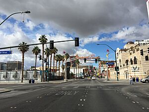
In Downtown Las Vegas, Fremont Street used to go further west. It ended at Main Street. But in September 1994, the part of Fremont Street west of Las Vegas Boulevard was closed to cars. This was done to build the Fremont Street Experience. This is a popular outdoor walking area with a light show. After this, the Nevada DOT stopped taking care of this part of SR 582.
In 2007, the city of Las Vegas finished the Fremont East district. This project rebuilt Fremont Street between Las Vegas Boulevard and Eighth Street. The goal was to remind people of "old Las Vegas" and make the nightlife more active. Because of this project, the northern end of SR 582 moved south to Eighth Street.
By early 2019, the Nevada DOT stopped maintaining the part of SR 582 between Charleston Boulevard and Eighth Street. They started giving ownership of this road section to the City of Las Vegas.
Major Roads Connected to SR 582
The entire route is in Clark County.
| Location | Mile | Roads intersected | Notes | |
|---|---|---|---|---|
| Henderson | 0.0 | 0.0 | This is where SR 582 officially begins. It's an interchange with I-11, US 93, and US 95. | |
| 4.2 | 6.8 | This road used to be called SR 146. | ||
| 6.7 | 10.8 | Sunset Road | This road used to be part of SR 562. | |
| Whitney | 8.5 | 13.7 | Russell Road | This road leads to Sam Boyd Stadium. |
| 9.9 | 15.9 | |||
| 11.0 | 17.7 | |||
| 11.2 | 18.0 | |||
| Las Vegas–Sunrise Manor line | 13.2 | 21.2 | This is another interchange with I-11, US 93, and US 95. | |
| 14.1 | 22.7 | Sahara Avenue | This road used to be part of SR 589. | |
| 15.4 | 24.8 | This is where SR 582 ends. Fremont Street continues past this point. | ||
| 1.000 mi = 1.609 km; 1.000 km = 0.621 mi | ||||
See also
 In Spanish: Ruta Estatal de Nevada 582 para niños
 | Frances Mary Albrier |
 | Whitney Young |
 | Muhammad Ali |


