Newfield, New Jersey facts for kids
Quick facts for kids
Newfield, New Jersey
|
|
|---|---|
|
Borough
|
|
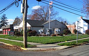
Newfield municipal building
|
|
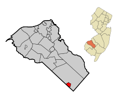
Map of Newfield highlighted within Gloucester County. Inset: Location of Gloucester County in New Jersey.
|
|
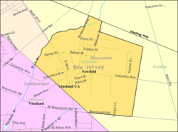
Census Bureau map of Newfield, New Jersey
|
|
| Country | |
| State | |
| County | |
| Incorporated | March 8, 1924 |
| Government | |
| • Type | Borough |
| • Body | Borough Council |
| Area | |
| • Total | 1.74 sq mi (4.51 km2) |
| • Land | 1.74 sq mi (4.50 km2) |
| • Water | 0.00 sq mi (0.01 km2) 0.17% |
| Area rank | 427th of 565 in state 19th of 24 in county |
| Elevation | 118 ft (36 m) |
| Population
(2020)
|
|
| • Total | 1,774 |
| • Estimate
(2023)
|
1,798 |
| • Rank | 496th of 565 in state 24th of 24 in county |
| • Density | 1,020.6/sq mi (394.1/km2) |
| • Density rank | 383rd of 565 in state 14th of 24 in county |
| Time zone | UTC−05:00 (Eastern (EST)) |
| • Summer (DST) | UTC−04:00 (Eastern (EDT)) |
| ZIP Code |
08344
|
| Area code(s) | 856 |
| FIPS code | 3401551390 |
| GNIS feature ID | 0885319 |
| Website | |
Newfield is a small town, called a borough, located in Gloucester County, New Jersey. In 2020, about 1,774 people lived there. This was an increase from 1,553 people in 2010.
Newfield became an official borough on March 8, 1924. Before this, it was part of Franklin Township. A group of 240 residents traveled to Trenton to ask for their own town. The name "Newfield" comes from it being a "new field" development.
Contents
Geography of Newfield
Newfield covers about 1.74 square miles (4.51 square kilometers). Most of this area is land, with a very small amount of water.
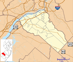
Newfield shares its borders with two other towns. It borders Franklin Township in Gloucester County. It also borders Vineland in Cumberland County.
Population Changes Over Time
| Historical population | |||
|---|---|---|---|
| Census | Pop. | %± | |
| 1930 | 880 | — | |
| 1940 | 889 | 1.0% | |
| 1950 | 1,010 | 13.6% | |
| 1960 | 1,299 | 28.6% | |
| 1970 | 1,487 | 14.5% | |
| 1980 | 1,563 | 5.1% | |
| 1990 | 1,592 | 1.9% | |
| 2000 | 1,616 | 1.5% | |
| 2010 | 1,553 | −3.9% | |
| 2020 | 1,774 | 14.2% | |
| 2023 (est.) | 1,798 | 15.8% | |
| Population sources: 1930–2000 1930 1940–2000 2000 2010 2020 |
|||
In 2010, there were 1,553 people living in Newfield. Most people (about 94.7%) were White. About 2.2% were Black or African American. A small number of people were Native American or Asian. About 6.6% of the population identified as Hispanic or Latino.
The average family size was about three people. The median age in Newfield was 41.5 years old. This means half the people were older and half were younger than 41.5.
Local Economy
Newfield is home to Sweet Amalia Market and Kitchen. This restaurant was named one of the 50 best in the United States by The New York Times in 2024.
Education in Newfield
Newfield does not have its own school buildings for all grades. Instead, it works with other school districts.
Elementary School Students
Students from kindergarten through sixth grade attend schools in the Franklin Township Public Schools. Newfield students make up about 100 of the 1,400 students in this district.
The schools in this district include:
- Mary F. Janvier Elementary School (grades K–2)
- Main Road School (grades 3–4)
- Caroline L. Reutter School (grades 5–6)
Middle and High School Students
For seventh through twelfth grades, students go to the Delsea Regional School District. This district also serves students from Elk Township and Franklin Township. Newfield students started attending Delsea Regional schools in 2010.
The schools in this district are:
- Delsea Regional Middle School (grades 7 and 8)
- Delsea Regional High School (grades 9–12)
Private Schools
Edgarton Christian Academy is a private Christian school for students in grades K–8. It opened in 2012. In 2019, when another local private school closed, many of its students moved to Edgarton. Edgarton Christian Academy is building a new, larger school building in Buena.
Notre Dame Regional School was a Catholic school that had a campus in Newfield. It closed in 2012. Many of its students then joined the new Edgarton Christian Academy.
Transportation Options
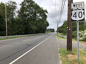
Newfield has about 12 miles of roads. Most of these roads are maintained by the borough itself.
Major Roads
U.S. Route 40 is the main highway that goes through Newfield.
Public Transit
NJ Transit offers bus service on route 408. This bus connects Newfield to Millville and Philadelphia.
Famous People from Newfield
People who have lived in or are connected to Newfield include:
- Job Bicknell Ellis (1829–1905), a scientist who studied fungi (a type of mushroom or mold).
- Herbert Fortier (1867–1949), an actor from the time of silent movies.
- Bessie Blount Griffin (1914–2009), a physical therapist and inventor.
See also
 In Spanish: Newfield (Nueva Jersey) para niños
 | Ernest Everett Just |
 | Mary Jackson |
 | Emmett Chappelle |
 | Marie Maynard Daly |


