
Millville, New Jersey facts for kids
Quick facts for kids
Millville, New Jersey
|
||
|---|---|---|
|
City
|
||

High Street in downtown Millville in 2006
|
||
|
||
| Nickname(s):
"The Holly City of America"
|
||

Map of Millville highlighted within Cumberland County. Right: Location of Cumberland County in New Jersey.
|
||

Census Bureau map of Millville, New Jersey
|
||

Millville, New Jersey
Location in Cumberland County, New Jersey

Millville, New Jersey
Location in New Jersey

Millville, New Jersey
Location in the United States
|
||
| Country | ||
| State | ||
| County | Cumberland | |
| Founded | c. 1720 | |
| Incorporated | February 24, 1801 (as Township) | |
| Reincorporated | March 1, 1866 (as City) | |
| Government | ||
| • Type | Walsh Act | |
| • Body | Board of Commissioners | |
| Area | ||
| • Total | 44.50 sq mi (115.25 km2) | |
| • Land | 42.00 sq mi (108.78 km2) | |
| • Water | 2.50 sq mi (6.47 km2) 5.62% | |
| Area rank | 43rd of 565 in state 4th of 14 in county |
|
| Elevation | 43 ft (13 m) | |
| Population
(2020)
|
||
| • Total | 27,491 | |
| • Estimate
(2023)
|
27,358 | |
| • Rank | 91st of 565 in state 2nd of 14 in county |
|
| • Density | 654.6/sq mi (252.7/km2) | |
| • Density rank | 424th of 565 in state 3rd of 14 in county |
|
| Time zone | UTC−05:00 (Eastern (EST)) | |
| • Summer (DST) | UTC−04:00 (Eastern (EDT)) | |
| ZIP Code |
08332
|
|
| Area code(s) | 856 | |
| FIPS code | 3401146680 | |
| GNIS feature ID | 0885304 | |

Millville is a city located in Cumberland County, in the state of New Jersey, United States. In 2020, about 27,491 people lived there. The city's name comes from the idea of creating a "mill town" in the area.
Millville first became a township on February 24, 1801. Later, it was reincorporated as a city on March 1, 1866. It is part of the South Jersey region and is also considered part of the larger Delaware Valley or Philadelphia metropolitan area.
Contents
History of Millville
Millville has a long and interesting history, especially with its connection to mills and glassmaking.
Early Beginnings and Mills
Around 1720, people believe there was a sawmill in the area. It was known as "Shingle Landing" back then. There was also a public road, a place for boats to land, and a bridge.
In 1790, Joseph Smith and Henry Drinker bought a large piece of land. They started the Union Estates Company. They built lumber mills along the Maurice River and created a dam to power these mills. Joseph Buck, a veteran from the American Revolutionary War, helped plan what would become Millville in 1795.
Glassmaking and Manufacturing Growth
In 1806, an Irish immigrant named James Lee opened the first glass factory in the area. He used the local sand and wood to make glass.
In the early 1850s, the Smith and Wood Iron Foundry and New Jersey Mills were built. By 1860, a bleachery and dye house were added to New Jersey Mills, which then became Millville Manufacturing. David Wood built a dam, creating the largest man-made lake in the state. This lake powered the entire manufacturing operation. By 1870, the mill had 600 employees, and that number doubled in 40 years.
Changes and New Developments
In 1862, Charles K. Landis planned the city of Vineland nearby. In 1864, Vineland separated from Millville Township.
In 1936, Millville became home to Roosevelt Park. This was the country's first housing development specifically for older people. It was built on land the town had taken back for unpaid taxes. This "Roosevelt Colony" became the first senior citizens retirement colony in the United States when it opened on October 23, 1936.
Millville's Role in World War II
Millville Airport was named "America's First Defense Airport" on August 2, 1941. Construction for military facilities began less than a year later. In January 1943, the Millville Army Air Field opened. It was a gunnery school for fighter pilots. Pilots trained there using Curtiss P-40 Warhawk and later Republic P-47 Thunderbolt aircraft. Thousands of soldiers and civilians worked there, and about 1,500 pilots received advanced training.
After World War II, the airport was returned to Millville. Many of the airport buildings were turned into apartments for veterans returning from the war. These apartments were removed in the early 1970s. The airport then became an important center for industry and aviation in Southern New Jersey.
Revitalization and Arts
Until the late 1990s, downtown Millville was quiet. Buildings like the Levoy Theatre and Wheaton Glass Factory were empty. However, major redevelopment has happened in recent years. The Riverfront and Downtown areas have become a place for artists. Many studios, shops, and restaurants are now there. Old buildings have been restored, and more development is planned.
Millville has an arts district called the Glasstown Arts District. A public art center with galleries and studios is a main attraction. It is open six days a week. The district has seven full-time galleries and ten part-time ones. These are often open on weekends and the third Friday of each month. Wheaton Arts and the Creative Glass Center of America have a large collection of old American glass. They also show modern glass art in a restored 19th-century glass factory. The Levoy Theatre, which opened in 1908 and closed in 1974, reopened in September 2012.
Millville is also famous for a special way of making paperweights. This technique started there. In the early 1900s, glassworkers made "crimp flowers," mostly roses, in their free time. These paperweights are often called "Millville roses."
Geography and Climate
Millville covers about 44.50 square miles (115.25 km2). Most of this is land, with a smaller part being water.
Neighboring Areas and Roads
Millville borders several other towns in Cumberland County. These include Commercial Township, Deerfield Township, Downe Township, Fairfield Township, Lawrence Township, Maurice River Township, and Vineland.
Major roads that go through Millville include Route 47, Route 49, and Route 55.
Weather Patterns
Millville has a humid subtropical climate. This means it has hot, humid summers and mild winters.
| Climate data for Millville Executive Airport, New Jersey (1991–2020 normals, extremes 1947–present) | |||||||||||||
|---|---|---|---|---|---|---|---|---|---|---|---|---|---|
| Month | Jan | Feb | Mar | Apr | May | Jun | Jul | Aug | Sep | Oct | Nov | Dec | Year |
| Record high °F (°C) | 74 (23) |
76 (24) |
86 (30) |
93 (34) |
96 (36) |
100 (38) |
103 (39) |
101 (38) |
97 (36) |
97 (36) |
84 (29) |
77 (25) |
103 (39) |
| Mean daily maximum °F (°C) | 42.2 (5.7) |
44.6 (7.0) |
52.3 (11.3) |
63.7 (17.6) |
72.9 (22.7) |
81.6 (27.6) |
86.1 (30.1) |
84.3 (29.1) |
78.0 (25.6) |
66.9 (19.4) |
56.1 (13.4) |
46.7 (8.2) |
64.6 (18.1) |
| Daily mean °F (°C) | 33.0 (0.6) |
34.6 (1.4) |
41.8 (5.4) |
52.1 (11.2) |
61.7 (16.5) |
70.9 (21.6) |
76.2 (24.6) |
74.3 (23.5) |
67.6 (19.8) |
55.9 (13.3) |
45.5 (7.5) |
37.3 (2.9) |
54.2 (12.3) |
| Mean daily minimum °F (°C) | 23.8 (−4.6) |
24.6 (−4.1) |
31.4 (−0.3) |
40.6 (4.8) |
50.4 (10.2) |
60.2 (15.7) |
66.2 (19.0) |
64.4 (18.0) |
57.2 (14.0) |
45.0 (7.2) |
34.9 (1.6) |
27.9 (−2.3) |
43.9 (6.6) |
| Record low °F (°C) | −10 (−23) |
−6 (−21) |
−7 (−22) |
17 (−8) |
29 (−2) |
40 (4) |
44 (7) |
44 (7) |
35 (2) |
21 (−6) |
12 (−11) |
2 (−17) |
−10 (−23) |
| Average precipitation inches (mm) | 3.13 (80) |
2.63 (67) |
4.09 (104) |
3.53 (90) |
3.12 (79) |
3.91 (99) |
4.26 (108) |
4.61 (117) |
3.15 (80) |
3.82 (97) |
3.17 (81) |
3.95 (100) |
43.37 (1,102) |
| Average precipitation days (≥ 0.01 in) | 8.9 | 9.3 | 10.5 | 11.1 | 10.6 | 10.0 | 9.8 | 8.9 | 8.4 | 8.6 | 8.3 | 10.3 | 114.7 |
| Source: NOAA | |||||||||||||
Population Data
Millville's population has changed over the years. Here's a look at how many people have lived in the city.
| Historical population | |||
|---|---|---|---|
| Census | Pop. | %± | |
| 1810 | 1,032 | — | |
| 1820 | 1,010 | −2.1% | |
| 1830 | 1,559 | 54.4% | |
| 1840 | 1,771 | 13.6% | |
| 1850 | 2,332 | 31.7% | |
| 1860 | 3,932 | 68.6% | |
| 1870 | 6,101 | * | 55.2% |
| 1880 | 7,660 | 25.6% | |
| 1890 | 10,002 | 30.6% | |
| 1900 | 10,583 | 5.8% | |
| 1910 | 12,451 | 17.7% | |
| 1920 | 14,691 | 18.0% | |
| 1930 | 14,705 | 0.1% | |
| 1940 | 14,806 | 0.7% | |
| 1950 | 16,041 | 8.3% | |
| 1960 | 19,096 | 19.0% | |
| 1970 | 21,366 | 11.9% | |
| 1980 | 24,815 | 16.1% | |
| 1990 | 25,992 | 4.7% | |
| 2000 | 26,847 | 3.3% | |
| 2010 | 28,400 | 5.8% | |
| 2020 | 27,491 | −3.2% | |
| 2023 (est.) | 27,358 | −3.7% | |
| Population sources: 1810–2010 1810–1920 1840 1850–1890 1850–1870 1850 1870 1880–1890 1890–1910 1870–1930 1900–1990 2000 2010 2020 * = Lost territory in previous decade. |
|||
2010 Census Information
In 2010, the 2010 United States census counted 28,400 people in Millville. There were 10,648 households. About 69% of the people were White, and nearly 20% were Black or African American. About 15% of the population identified as Hispanic or Latino. The average age was 36.6 years old.
2000 Census Information
The 2000 United States census showed 26,847 people living in Millville. About 76% were White, and 15% were African American. About 11% of the population was Hispanic or Latino. The median income for a household was $40,378.
Millville also has a Ukrainian community. It is home to Sts. Peter and Paul Ukrainian Orthodox Church and St. Nicholas Ukrainian Catholic Church.
Economy and Business
Millville is part of a special Urban Enterprise Zone (UEZ) with Vineland. This program helps encourage jobs and investments. Shoppers in this zone can pay a lower sales tax rate. Millville joined this program in 1983. Its status as a UEZ is set to expire in December 2023.
Arts and Culture Scene
The Levoy Theatre is a historic place in Millville. It first opened in 1908. After being closed for 34 years, it reopened in September 2012. The reopening featured an orchestra playing music for silent films.
City Government
Millville first became a township in 1801 and then a city in 1866.
How Millville is Governed
Since 1913, Millville has used the Walsh Act form of government. This means the city is run by a group of five commissioners. These commissioners are elected by the people for four-year terms. After each election, the commissioners choose one of their members to be the mayor. They also choose another to be the vice mayor. Each commissioner is in charge of a different city department.
In November 2014, Michael Santiago became the first Hispanic mayor of Millville. In January 2022, Lisa Orndorf made history as the first woman to serve as Millville's mayor. In March 2024, Mayor Lisa Orndorf resigned. Commissioner Benjamin Romanik was then appointed mayor. In April 2024, Marissa Ranello was appointed to fill a vacant commissioner seat.
As of 2024, the Millville City Commission includes:
- Mayor Benjamin J. Romanik (Commissioner of Public Affairs)
- Charles Kirk Hewitt (Commissioner of Public Safety)
- Joseph Sooy (Commissioner of Revenue and Finance)
- Marissa Ranello (Commissioner of Parks and Public Property)
- Stephen E. Watson Jr. (Commissioner of Public Works)
Political Participation
As of March 2011, Millville had 17,500 registered voters. Most voters were not affiliated with a political party. Among those who were, Democrats outnumbered Republicans.
In the 2012 presidential election, Barack Obama (a Democrat) received 60.6% of the votes in Millville. In the 2013 gubernatorial election, Republican Chris Christie received 57.4% of the votes.
| Year | Republican | Democratic | Third party | |||
|---|---|---|---|---|---|---|
| No. | % | No. | % | No. | % | |
| 2024 | 5,706 | 50.60% | 5,455 | 48.37% | 116 | 1.03% |
| 2020 | 5,819 | 46.57% | 6,506 | 52.06% | 171 | 1.37% |
| 2016 | 5,025 | 47.13% | 5,253 | 49.27% | 384 | 3.60% |
| 2012 | 4,182 | 38.08% | 6,653 | 60.59% | 146 | 1.33% |
| 2008 | 4,515 | 39.85% | 6,523 | 57.57% | 292 | 2.58% |
| 2004 | 4,677 | 46.81% | 5,082 | 50.86% | 233 | 2.33% |
Representation in Government
Millville is part of the 2nd Congressional District for national elections. For state elections, it is in New Jersey's 1st state legislative district.
New Jersey's Second Congressional District is represented by Frank LoBiondo (R, Ventnor City). New Jersey is represented in the United States Senate by Cory Booker (D, Newark, term ends 2021) and Bob Menendez (D, Paramus, 2019). For the 2016–2017 session (Senate, General Assembly), the 1st Legislative District of the New Jersey Legislature is represented in the State Senate by Jeff Van Drew (D, Dennis Township) and in the General Assembly by Bob Andrzejczak (D, Middle Township) and R. Bruce Land (D, Vineland). Cumberland County is governed by a seven-member Board of Chosen Freeholders, who are elected at-large in partisan elections to serve staggered three-year terms in office, with two or three seats coming up for election each year. At an annual reorganization meeting held each January, the freeholders select one member to serve as Freeholder Director and another as Deputy Director. As of 2014[update], Cumberland County's Freeholders (with committee liaison assignments, political party, residence and term-end dates listed in parentheses) are Freeholder Director Joseph Derella (Administration / Public Safety; D, Millville, term ends December 31, 2015), Freeholder Deputy Director Douglas M. Long (NA; D, Upper Deerfield Township, 2015), Darlene Barber (Education; D, 2016, Upper Deerfield Township), Carol Musso (Community Services; D, Deerfield Township, 2014), James Sauro (Agriculture; R, Vineland, 2014), Thomas Sheppard (Health; R, Lawrence Township, 2016) and Tony Surace (Public Works; D, Millville, 2014). The county's constitutional officers are County Clerk Gloria Noto (Vineland, 2014), Sheriff Robert A. Austino (Vineland, 2014) and Surrogate Douglas M. Rainear (Bridgeton, 2018).
Education System
Millville has its own public school system. The Millville Public Schools serve students from pre-kindergarten through twelfth grade.
Schools in Millville
As of the 2021–22 school year, the district had nine schools and about 5,107 students. The student-to-teacher ratio was about 11.8 students per teacher.
The schools in the district include:
- Child Family Center (PreK)
- R. M. Bacon Elementary School (K-5)
- Holly Heights Elementary School (K-5)
- Mount Pleasant Elementary School (K-5)
- Rieck Avenue Elementary School (K-5)
- Silver Run Elementary School (K-5)
- Lakeside Middle School (6-8)
- Millville Senior High School (9-12)
- Thunderbolt Academy, which offers an alternative setting for students needing extra support.
Some nearby townships, like Commercial Township, Lawrence Township, and Maurice River Township, send their high school students to Millville Senior High School.
Millville Senior High School has been undergoing a large expansion project. This project will add a lot of new space and renovate existing parts of the building. The goal is for all high school students to attend school in one building.
In 2017, R.D. Wood Elementary School closed to help the district save money.
Other Educational Options
Students can also attend Cumberland County Technical Education Center in Millville. This center offers technical training programs to students from across the county for free.
St. Mary Magdalen School was a Catholic school that served students in grades K-8. It opened in 1882 but closed in June 2012 due to financial problems and fewer students. Nearby Catholic schools include Bishop Schad School in Vineland and St. Mary Regional School in East Vineland.
Higher Education
Rowan College of South Jersey Cumberland Campus is partly located in Millville.
Public Library
The Millville Public Library serves as the city's public library.
Transportation and Travel
Millville has a network of roads. The city maintains about 107.90 miles of roads.
_at_Exit_27_(New_Jersey_State_Route_47,_Millville,_Vineland)_in_Millville,_Cumberland_County,_New_Jersey.jpg)
Public Transport Options
Millville Municipal Airport is used for general aviation.
NJ Transit offers several bus routes in the Millville area. These include routes to Philadelphia and Atlantic City.
Attractions and Things to Do
- New Jersey Motorsports Park
- Southwind Vineyard & Winery
- Laurel Lake Community Center, Beaches and Piersites
- Wheaton Arts and Cultural Center
- Glasstown Brewing Company
Parks and Recreation
The Cumberland Cape Atlantic YMCA is located in nearby Vineland. This YMCA serves Atlantic and Cape May counties as well.
Millville used to have its own YMCA campus, which closed in 1990. In 1997, the Millville Housing Authority bought the campus. They turned parts of it into apartments and built a new exercise center. The Holly City Development Corp. Family Center (HCDC) now uses the first floor of the new building.
Notable People from Millville
Many interesting people have lived in Millville. Here are a few:
- A. R. Ammons (1926–2001), a famous author and poet.
- George K. Brandriff (1890–1936), a painter.
- Fred Pierce Corson (1896−1985), a Bishop of The Methodist Church.
- Grace Mary Flickinger (1935–2024), a biology professor.
- Merritt Gant (born 1971), a guitarist for the metal band Overkill.
- Stephen O. Garrison (1853–1900), a Methodist minister who founded The Training School in Vineland, New Jersey.
- L. Fred Gieg (1890–1977), a football and basketball player and coach.
- Leon Henderson (1895–1986), a government administrator during World War II.
- Dwayne Hendricks (born 1986), a professional football player.
- James R. Hurley (born 1932), a politician.
- Buddy Kennedy (born 1998), a Major League Baseball player.
- R. Bruce Land (born 1950), a politician.
- William A. McKeighan (1842–1895), a politician from Nebraska.
- Walter Mulford (1877–1955), a forester and professor.
- Chase Petty (born circa 2002–2003), a Minor League Baseball player.
- Steve Romanik (1924–2009), a football player for the Chicago Bears and Chicago Cardinals.
- Edward H. Salmon (born 1942), a politician who was mayor of Millville.
- Hannah Whitall Smith (1832–1911), an author and speaker.
- Logan Pearsall Smith (1865–1946), an essayist and critic.
- Edward C. Stokes (1860–1942), who served as Governor of New Jersey.
- Barry H. Streeter (born circa 1949), a former college football coach.
- Mike Trout (born 1991), a famous Major League Baseball player for the Los Angeles Angels, nicknamed "The Millville Meteor."
- Daniel D.W. (born 1979), an author and VFX designer.
- Anne Waldman (born 1945), a poet.
- Frank H. Wheaton Sr. (1881–1983), known for his work with Glassware.
Images for kids
-

The Maurice River in Millville in 2006
-
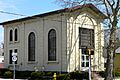
Millville's First Bank Building


See also
 In Spanish: Millville (Nueva Jersey) para niños
