Newtonia, Missouri facts for kids
Quick facts for kids
Newtonia, Missouri
|
|
|---|---|

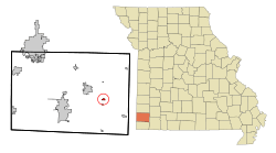
Location of Newtonia, Missouri
|
|
| Country | United States |
| State | Missouri |
| County | Newton |
| Area | |
| • Total | 0.33 sq mi (0.85 km2) |
| • Land | 0.33 sq mi (0.85 km2) |
| • Water | 0.00 sq mi (0.00 km2) |
| Elevation | 1,191 ft (363 m) |
| Population
(2020)
|
|
| • Total | 204 |
| • Density | 625.77/sq mi (241.24/km2) |
| Time zone | UTC-6 (Central (CST)) |
| • Summer (DST) | UTC-5 (CDT) |
| ZIP code |
64853
|
| Area code(s) | 417 |
| FIPS code | 29-52292 |
| GNIS feature ID | 2396814 |
Newtonia is a small village in Newton County, Missouri, United States. In 2020, about 204 people lived there. It is part of the larger Joplin area. Newtonia is famous for being the location of two important battles during the American Civil War.
The village has some old houses built before the Civil War. One of these is the Mathew H. Ritchey House. There is also a cemetery where soldiers who died in the Civil War are buried. Newtonia is mostly a farming community and is very close to Stark City, Missouri.
Contents
History of Newtonia
Newtonia was first planned out in 1857. It got its name from Newton County, where it is located. A post office opened in Newtonia in 1858 and stayed open until 1973.
Important Historic Sites
Several places in Newtonia are very important historically. They are listed on the National Register of Historic Places. This list includes places that are special because of their history or architecture.
- The First Battle of Newtonia Historic District
- The Mathew H. Ritchey House
- The Second Battle of Newtonia Site
In 2008, a tornado hit the village. It caused damage to many homes, including the historic Mathew H. Ritchey House.
Geography of Newtonia
Newtonia is located in southwest Missouri. It sits on Missouri Route 86. The village is about nine miles east of Neosho.
Stark City is just one mile south of Newtonia on Route 86. Granby is about 4.5 miles to the northwest. You can reach Granby by taking U.S. Route 60.
The United States Census Bureau says that Newtonia covers a total area of about 0.33 square miles. All of this area is land.
Population and People
| Historical population | |||
|---|---|---|---|
| Census | Pop. | %± | |
| 1870 | 463 | — | |
| 1880 | 436 | −5.8% | |
| 1900 | 355 | — | |
| 1910 | 203 | −42.8% | |
| 1920 | 200 | −1.5% | |
| 1930 | 203 | 1.5% | |
| 1940 | 195 | −3.9% | |
| 1950 | 190 | −2.6% | |
| 1960 | 153 | −19.5% | |
| 1970 | 208 | 35.9% | |
| 1980 | 224 | 7.7% | |
| 1990 | 204 | −8.9% | |
| 2000 | 231 | 13.2% | |
| 2010 | 199 | −13.9% | |
| 2020 | 204 | 2.5% | |
| U.S. Decennial Census | |||
What the 2010 Census Showed
In 2010, the census counted 199 people living in Newtonia. There were 74 households, which means 74 groups of people living together. Out of these, 55 were families.
Most people in the village were White (95.0%). A small number were Asian (2.5%), Native American (0.5%), or African American (0.5%). About 1.5% of the people were of Hispanic or Latino background.
About 29.7% of the households had children under 18 living with them. Most households (59.5%) were married couples. About 23% of all households had only one person living there. Also, 16.3% of households had someone aged 65 or older living alone.
The average age of people in the village was 41.3 years old. About 26.6% of residents were under 18. About 19.1% were 65 years or older. The population was almost evenly split between males (50.8%) and females (49.2%).
See also
 In Spanish: Newtonia (Misuri) para niños
 | Madam C. J. Walker |
 | Janet Emerson Bashen |
 | Annie Turnbo Malone |
 | Maggie L. Walker |

