Nicasio Creek facts for kids
Quick facts for kids Nicasio Creek |
|
|---|---|

Nicasio Creek
|
|
| Country | United States |
| State | California |
| Region | Marin County |
| District | West Marin |
| Physical characteristics | |
| Main source | Big Rock Ridge 4 mi (6 km) southwest of Novato 1,030 ft (310 m) 38°3′42″N 122°37′37″W / 38.06167°N 122.62694°W |
| River mouth | Lagunitas Creek 2 mi (3 km) east of Point Reyes Station 39 ft (12 m) 38°4′12″N 122°46′12″W / 38.07000°N 122.77000°W |
Nicasio Creek is a stream about 11.9-mile-long (19.2 km) in Marin County, California, United States. It is the main stream that flows into Lagunitas Creek. Lagunitas Creek then flows into Tomales Bay and finally into the Pacific Ocean. The Nicasio Reservoir, a large lake created by Seeger Dam in 1961, is also found on this stream.
Contents
History of Nicasio Creek
Nicasio Creek and the nearby Rancho Nicasio are likely named after a Coast Miwok person. This person was given the name "Nicasio" by Spanish missionaries long ago. Old maps from the 1830s and 1840s show names like Arroyo de Nicasio (Nicasio Creek) and Casa de los Indios de Nicasio (house of the Nicasio Indians).
Land and the Miwok People
In the mid-1830s, General Mariano Vallejo was an important leader in California. He promised a large area of land, about 80,000 acres (324 km2), to the Marin County Coast Miwok Indians. This was because their original lands had been taken over by the Mission San Rafael Arcángel.
In 1835, Mexican Governor José Figueroa officially granted the land. However, the land was later given to others instead of the Miwok people. By 1843, the lands were granted to Pablo de la Guerra and John B. R. Cooper. In 1855, the Miwok's claim to the land was not accepted.
Halleck Creek's Name
Later, in 1850, Pablo de la Guerra sold his land to Henry Wager Halleck. Halleck was a lawyer and later became a general during the American Civil War. He was even promoted by President Lincoln to be the general-in-chief of the United States armies. Halleck enjoyed hunting and fishing at Rancho Nicasio. He built a house near the creek, which is now called Halleck Creek.
Where Nicasio Creek Flows
The Nicasio Creek watershed is an area of 36 square miles (93 km2) in Marin County, California, where all the rain and water drain into Nicasio Creek. This creek is the most important stream that feeds into Lagunitas Creek. Lagunitas Creek then flows into the Pacific Ocean at Tomales Bay.
The Creek's Journey
Nicasio Creek starts on Big Rock Ridge, which is west of Novato. It first flows south. As it gets closer to Lucas Valley Road, it turns and follows the road west. It passes south of Skywalker Ranch and goes through the town of Nicasio.
North of Nicasio, the creek flows into Nicasio Reservoir. Another stream, Halleck Creek, also joins the reservoir from the east. The water then flows out of the reservoir to the west, through a gap in Bolinas Ridge.
Seeger Dam
Seeger Dam is located about 1 mile (1.6 km) upstream from where Nicasio Creek meets Lagunitas Creek. The Marin Municipal Water District (MMWD) built this dam in 1960. Its purpose is to store water for cities in southern Marin County. From the dam, Nicasio Creek flows west, next to Point Reyes-Petaluma Road, until it joins Lagunitas Creek.
Wildlife in Nicasio Creek
Before Seeger Dam was built, Nicasio Creek was a very important place for fish. Half of the steelhead trout (Oncorhynchus mykiss) and coho salmon (Oncorchus kisutch) in the Lagunitas Creek area used to lay their eggs here.
Impact of the Dam on Fish
The dam created a barrier that fish could not pass. It also covered up areas where fish used to lay eggs. This reduced the number of salmon and steelhead fish entering the Lagunitas Creek watershed by half.
To help the fish, the Marin Municipal Water District tried to catch coho salmon below the dam. They would then move them to the area above the dam. However, by 1991, very few coho salmon were returning to lay eggs. Also, because the dam blocks the flow of sand and small stones, there isn't enough suitable gravel for fish to lay eggs in the mile below the dam. Today, most fish spawning in the Lagunitas Creek area happens in San Geronimo Creek, which is a stream not controlled by a dam.
Other Animals
A river otter (Lontra canadensis) was seen at the southwest corner of Nicasio Reservoir in January 2008. This shows that otters also live in the area around the creek.
Bridges Over Nicasio Creek
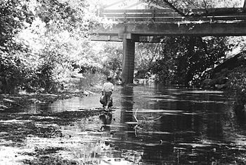
There are at least two bridges that cross Nicasio Creek. Point Reyes-Petaluma Road crosses the creek in two different spots:
- One bridge is 3.47 miles (5.58 km) east of State Route 1. It is a 133-foot (41 m) concrete bridge built in 1960.
- Another bridge is 3.2 miles (5.1 km) east of State Route 1. This one is a 102-foot (31 m) concrete bridge built in 1937.
 | Isaac Myers |
 | D. Hamilton Jackson |
 | A. Philip Randolph |

