Nimbin, New South Wales facts for kids
Quick facts for kids NimbinNew South Wales |
|
|---|---|
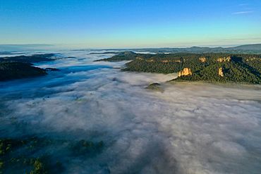
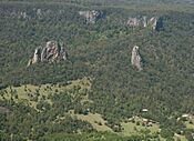
The Nimbin Valley and Nimbin Rocks in the Northern Rivers of NSW (aerial shot)
|
|
| Population | 1,607 (2021) |
| Postcode(s) | 2480 |
| Elevation | 65 m (213 ft) |
| Location |
|
| LGA(s) | City of Lismore |
| State electorate(s) | Lismore |
| Federal Division(s) | Page |
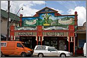
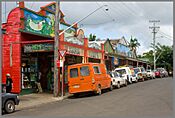
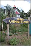
Nimbin is a unique town located in the Northern Rivers area of New South Wales, Australia. It is about 30 kilometers (19 miles) north of Lismore. The town is well-known for its focus on protecting the environment. People in Nimbin often use ideas like permaculture (designing sustainable human settlements) and aim for sustainability and self-sufficiency. This means they try to live in ways that don't harm the planet and can support themselves. Nimbin has become an important part of Australian culture. Many of the ideas about alternative living that started here are now common in Australia.
Contents
Nimbin's History
Nimbin and the areas around it are part of the "Rainbow Region." This place is very important to the Indigenous Bundjalung people. The name Nimbin comes from the local Whiyabul (Widgibal) clan. Their Dreamtime stories tell of the Nimbinjee spirit people who protect this land. Since 1973, Nimbin has also become a special place for people in Australia who choose alternative ways of living.
In the 1840s, loggers came to the area for its forests of Red Cedar trees. By the end of that century, most of the trees were cut down. After the cedar forests were gone, Nimbin was divided up in 1903. The land was then used for dairy farming and growing bananas. In the 1960s, the dairy industry faced problems, and Nimbin's economy struggled.
Things changed in 1973 when the Aquarius Festival was held in the village. This was a large gathering of university students and people interested in alternative lifestyles. It was the first event in Australia that asked for permission to use the land from the Traditional Owners. This was a big step towards reconciliation between different groups of people. After the festival, many participants stayed in Nimbin. They formed communities where they lived together, seeking an "alternative lifestyle." Nimbin even made legal history for being the first place in Australia to allow groups to own land together. Since the Aquarius Festival, many writers, artists, musicians, environmentalists, and permaculture fans have moved to the region. Tourists and young families also come here to escape city life.
In 1979, the Nimbin community worked together to protect the local rainforest in an event called the "Battle for Terania Creek." Because of their efforts, the New South Wales government created a new rule. This rule stopped rainforest logging across the entire state. It was the first government law in the world to protect rainforests.
In 1961, before the dairy industry declined, Nimbin had a population of 6,020 people. By 2011, Nimbin's population was 468. However, many people live in the rural areas around Nimbin. This means Nimbin serves about ten thousand people who live within 15 kilometers (9 miles) of the town.
Places to Stay and Things to See
Nimbin offers many different places for visitors to stay. You can find campgrounds, hostels for backpackers, bush cabins, and hotels.
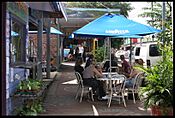
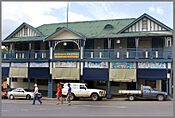
The town has important services like a police station, a hospital, and a medical center. There are also lawyers, a real estate agency, and a service station. You can find restaurants, cafes, and a pub with its own restaurant. Nimbin also has sports clubs and a bowling club. The Nimbin Neighbourhood and Information Centre (NNIC) is run by local volunteers. It helps visitors with guides and offers computers for internet use. It also has a small Centrelink office, legal advice, and a nurse. The center even publishes the local newspaper. Fun things to do include visiting the town hall, going to markets, listening to bands, and enjoying walks in the mountains. You might also see street performers and stalls.
Nearby Attractions
- Nimbin Rocks are jagged rock formations. They are like natural landmarks for the village. They were formed from old volcanic vents.
- Mount Warning is about 50 kilometers (31 miles) away. The Bundjalung people call it Wollumbin, which means 'cloud catcher.' Captain James Cook named it Mount Warning because it helped sailors spot dangerous reefs. The top of Mount Warning is the first part of mainland Australia to see the sunrise each day. It is the center of an ancient volcano that was once much taller. You can climb to the summit of Mount Warning on a 9-kilometer (5.6-mile) walk. It takes about five hours to go there and back.
- Nightcap National Park is one of the few places left where you can see parts of the original Big Scrub rainforest.
- There are also local creeks, water holes, and rivers where you can go swimming.
Local Media
The Nimbin Good Times is a free newspaper that comes out every month. It is also given out in Lismore, Byron Bay, and parts of Brisbane and Sydney.
Nimbin Zone Magazine is a magazine published every two months. It features creative and artistic people from Nimbin and nearby areas.
The community radio station 2NIMFM offers a different kind of media voice. It plays many types of music and has programs in Japanese, German, and the Bundjalung language.
Churches in Nimbin
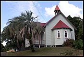
Nimbin has several churches that are part of the community's history.
- St Mark's Anglican Church has gates dedicated to Ernest Andrew McClelland, who passed away in 1954.
- St Patrick's Catholic Church used to be a church but is now private property.
- St Stephen's Presbyterian Church was built in 1922.
- The Uniting Church building was designed by Eustace William Henry Stanger. He was a carpenter who helped build many timber buildings in Nimbin.
Getting Around
Nimbin is 35 kilometers (22 miles) from Lismore Airport. This airport has flights to Sydney several times a day.
Northern River Buslines offers many bus services each weekday. Route 650 goes to Lismore.
Gosel's Bus Service runs two buses each weekday on route 630 to Murwillumbah. From there, you can connect to Tweed Heads.
There is also a school bus service available to the public on school days that goes to Kyogle.
Gallery
Sister Cities
Nimbin has special connections with other towns around the world, known as sister cities:
 Woodstock, United States
 Tākaka, New Zealand
 North Cave, England
 Freetown Christiania, Denmark
 | Emma Amos |
 | Edward Mitchell Bannister |
 | Larry D. Alexander |
 | Ernie Barnes |


