
Nord-Ouest Department facts for kids
Quick facts for kids Nord-Ouest |
|
| (Kréyòl: Nòdwès) | |
| Department | |
| Country | |
|---|---|
| Capital | Port-de-Paix |
| - elevation | 0 m (0 ft) |
| - coordinates | 19°57′N 72°50′W / 19.950°N 72.833°W |
| Area | 2,176 km² (840 sq mi) |
| Population | 531,198 (2003) |
| Density | 244.1 /km² (632 /sq mi) |
| Subdivisions | 3 Arrondissements 10 Communes |
| Timezone | EST (UTC-5) |
| - summer (DST) | DST (UTC-4) |
| Area code | +509 |
| ISO 3166-2 | HT-NO |
Nord-Ouest (which means North-West in English) is one of the ten main areas, or departments, in Haiti. It is located in the northwestern part of the country. The main city and capital of Nord-Ouest is Port-de-Paix.
After the Haitian Revolution, Haiti was first divided into three big departments: Nord, Ouest, and Sud. The Nord-Ouest department used to be part of the larger Nord Department.
Contents
Geography of Nord-Ouest
The Nord-Ouest department covers an area of 2,176 square kilometers. This area includes the famous Tortuga Island. The department is located on Haiti's northern, or northwestern, Peninsula. Most of this region is quite dry, except for Tortuga Island and the area around Port-de-Paix.
Borders and Nearby Areas
The department is surrounded by water and other parts of Haiti.
- To the north, it borders the Atlantic Ocean.
- To the east, it is next to the Nord Department.
- To the south, it touches the Artibonite Department and the Gulf of Gonâve.
- To the west, you'll find the Windward Passage. This passage is a narrow stretch of ocean that separates the island of Hispaniola (where Haiti is) from Cuba. On clear nights, you might even be able to see the Guantánamo Province in Cuba!
Mountains and Lowlands
Most of the Nord-Ouest department is covered by mountains. This area is known as the Massif du Nord-Ouest, which means "Northwestern mountain range." The western part of this mountain range is flatter. It is called the Plateau de Bombardopolis, or "Bombardopolis Plateau".
Low-lying areas are mostly found near the coast. Some important lowlands include:
- The Jean Rabel Valley
- The Valley of the Trois-Rivières (in the northern part)
- The Plain of L'Arbre (in the southern part)
Rivers in the Region
The Trois-Rivières is one of the most important rivers in Haiti, and it flows through this department. Other smaller rivers in the area are the Jean Rabel and du Mole rivers.
History of Nord-Ouest
The northern coast of the Nord-Ouest department was the first place European explorers landed on the island of Hispaniola. This happened during Christopher Columbus's first trip to the Americas in 1492.
On December 5, 1492, Columbus saw the Cape Saint-Nicolas. The very next day, he sailed into the Bay of Môle-Saint-Nicolas. This is where the town of Môle-Saint-Nicolas is located today.
A few days later, on December 7, he visited other bays like Port-à-l'Écu and Moustique. He named Moustique Bay "Puerto de la Concepción" and stayed there until December 13. Then, on December 15, he sailed to the bay of Port-de-Paix. He named this beautiful spot "Valle del Paraíso" or "Valparaiso", which means "Paradise Valley" in Spanish.
Population and People
According to a census taken in 2003, the Nord-Ouest department had a population of 531,198 people. This included 256,238 men and 274,960 women. About 118,798 people (or 22.36%) lived in cities and towns. In that year, there were about 244 people living in each square kilometer of the department.
How Nord-Ouest is Organized
The department is divided into three main areas called arrondissements (which are like districts). These arrondissements are then split into 10 smaller areas called communes (which are like municipalities or towns).
Here are the arrondissements and their communes:
- Môle-Saint-Nicolas
- Baie de Henne
- Bombardopolis
- Jean-Rabel
- Môle-Saint-Nicolas
- Port-de-Paix
- Bassin Bleu
- Chansolme
- La Tortue (Tortuga Island)
- Port-de-Paix
- Saint-Louis-du-Nord
- Anse-à-Foleur
- Saint-Louis-du-Nord
Economy and Jobs
The main way people earn a living in the Nord-Ouest department is through agriculture. There are many very small farms where people grow different crops. In the mountain areas, coffee is an important crop.
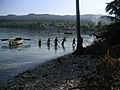
Fishing is also a very important activity for people living along the coast.
Images for kids
-
Môle-Saint-Nicolas

See also
 In Spanish: Departamento Noroeste para niños
