Norfolk Bay (Tasmania) facts for kids
Quick facts for kids Norfolk Bay |
|
|---|---|
| Location | Southeast Tasmania |
| Coordinates | 42°58′12″S 147°46′48″E / 42.97000°S 147.78000°E |
| Primary inflows | Frederick Henry Bay |
| Primary outflows | Frederick Henry Bay |
| Basin countries | Australia |
| Frozen | never |
| Islands | Smooth Island, King George Island, Fulham Island and Dart Island |
| Settlements | Hobart |
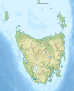
The Norfolk Bay is a large area of water located in the southeast part of Tasmania, Australia. It connects to Frederick Henry Bay in the northwest. The bay also links to Blackman Bay through a waterway known as the Denison Canal.
Contents
Discovering Norfolk Bay
The first time European explorers officially recorded seeing Norfolk Bay was in 1792. This discovery was made by Willaumetz, an officer with the D'Entrecasteaux expedition. However, his team could only explore as far as Primrose Point.
Later, in 1798, Matthew Flinders visited the bay. He named it "Norfolk" after the small ship he was sailing with George Bass. In 1802, another explorer named Baudin also explored the bay. He didn't know Flinders had already named it, so he called it "Port Buache." Today, only the name Norfolk Bay is used.
In the past, this bay was known for having many large sharks. Authorities would regularly feed these sharks. This was done to stop people from trying to escape from the nearby prison settlement by swimming across the bay to the mainland.
Exploring the Geography
Norfolk Bay is home to several islands. These include Smooth Island, King George Island, Fulham Island, and Dart Island. There are also smaller rock islands like the Mackerel Islets, Tinpot Island, and Mason rock.
Many other bays and sounds are located next to Norfolk Bay. These include Frederick Henry Bay, Dunalley Bay, King George Sound, Connellys Bay, and Lime Bay.
The bay is surrounded by several towns and communities. These include Connellys Marsh, Dunalley, Murdunna, Eaglehawk Neck, Taranna, Koonya, Premaydena, and Saltwater River.
Boating in Norfolk Bay
Boaters often find Norfolk Bay to be quite shallow, usually about 6 to 7 meters deep. However, it does have some deeper spots. Even though it's shallow, strong winds, especially from the southwest, can make the water choppy. The good news is that there isn't much ocean swell, which helps keep conditions safer.
During the summer, strong easterly winds can blow across the bay. Sailors are always advised to watch out for sudden changes in wind direction, especially for southwesterly winds.
Fishing in Norfolk Bay
If you like fishing, the most common fish you'll find in Norfolk Bay is the sand flathead. A study by the University of Tasmania found that the best places to catch flathead are southeast of a line between Premaydena and Boxalls Bay. The area near Koonya is particularly good for finding many flathead.
 | Janet Taylor Pickett |
 | Synthia Saint James |
 | Howardena Pindell |
 | Faith Ringgold |


