North Fortuna Mountain facts for kids
Quick facts for kids North Fortuna Mountain |
|
|---|---|

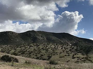
North Fortuna Mountain viewed from California State Route 52.
|
|
| Highest point | |
| Elevation | 1,291 ft (393 m) |
| Prominence | 411 ft (125 m) |
| Geography | |
| Location | San Diego County, California. |
| Topo map | USGS La Mesa |
| Climbing | |
| Easiest route | Trail |
North Fortuna Mountain is a mountain that stands about 1,291-foot (393 m) (or 393 meters) tall. You can find it in Mission Trails Regional Park in San Diego, California. This mountain is the most northern of five main peaks in the park. It's easy to spot North Fortuna Mountain if you are driving on nearby Interstate 15 or State Route 52.
Hiking Adventures

There are many ways to reach the top of North Fortuna Mountain. A popular path starts near the Old Mission Dam. This trail goes up a low area, called a saddle, between North Fortuna and its smaller neighbor, South Fortuna. From there, the path turns north and leads you right to the summit of North Fortuna.
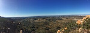
When you reach the top, you get amazing 360-degree views! You can see all around San Diego, Santee, and even the MCAS Miramar base. You can also spot other famous places like Cowles Mountain to the south. Farther east, you might see Cuyamaca Peak and the Cuyamaca Mountains. It's a great reward for your hike!
 | Precious Adams |
 | Lauren Anderson |
 | Janet Collins |

