North Norwich, New York facts for kids
Quick facts for kids
North Norwich, New York
|
|
|---|---|
 |
|
| Country | United States |
| State | New York |
| County | Chenango |
| Government | |
| • Type | Town Council |
| Area | |
| • Total | 28.24 sq mi (73.15 km2) |
| • Land | 28.14 sq mi (72.89 km2) |
| • Water | 0.10 sq mi (0.27 km2) |
| Elevation | 1,512 ft (461 m) |
| Population
(2010)
|
|
| • Total | 1,783 |
| • Estimate
(2016)
|
1,733 |
| • Density | 61.58/sq mi (23.78/km2) |
| Time zone | UTC-5 (Eastern (EST)) |
| • Summer (DST) | UTC-4 (EDT) |
| ZIP code |
13814
|
| Area code(s) | 607 |
| FIPS code | 36-017-53297 |
| GNIS feature ID | 0979291 |
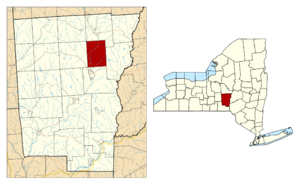
North Norwich is a small town in Chenango County, New York, United States. In 2010, about 1,783 people lived there. The town is located just north of the city of Norwich in the eastern part of the county.
Contents
History of North Norwich
The first people started to settle in this area around 1794. The town of North Norwich was officially created in 1849. It was formed from the northern part of the larger town of Norwich.

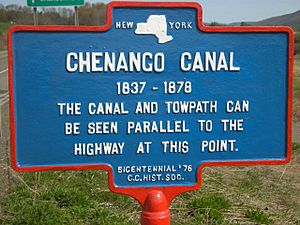
A long time ago, the Chenango Canal used to pass through North Norwich. Canals were important for transporting goods and people.
Geography of the Town
North Norwich covers an area of about 73.2 square kilometers (about 28.24 square miles). Most of this area is land. Only a very small part, about 0.3 square kilometers, is water.
New York State Route 12 is a main highway that goes through the town. It runs from north to south. Another shorter road, New York State Route 320, is located near the southern border of the town.
The Chenango River flows southward through North Norwich. This river is a branch of the larger Susquehanna River.
Population Facts
| Historical population | |||
|---|---|---|---|
| Census | Pop. | %± | |
| 1850 | 1,172 | — | |
| 1860 | 1,171 | −0.1% | |
| 1870 | 1,075 | −8.2% | |
| 1880 | 964 | −10.3% | |
| 1890 | 858 | −11.0% | |
| 1900 | 801 | −6.6% | |
| 1910 | 691 | −13.7% | |
| 1920 | 619 | −10.4% | |
| 1930 | 689 | 11.3% | |
| 1940 | 770 | 11.8% | |
| 1950 | 875 | 13.6% | |
| 1960 | 1,096 | 25.3% | |
| 1970 | 1,579 | 44.1% | |
| 1980 | 1,687 | 6.8% | |
| 1990 | 1,998 | 18.4% | |
| 2000 | 1,966 | −1.6% | |
| 2010 | 1,783 | −9.3% | |
| 2016 (est.) | 1,733 | −2.8% | |
| U.S. Decennial Census | |||
According to the census in 2000, there were 1,966 people living in North Norwich. These people lived in 727 households. A household is a group of people living in the same home.
About 35.5% of the households had children under 18 years old living with them. Most households, 58.6%, were married couples living together.
The population was spread out by age. About 28.1% of the people were under 18. About 11.3% were 65 years old or older. The average age in the town was 36 years.
Communities and Locations
Here are some of the smaller communities and important places in North Norwich:
- Burwell Corners – This place is near the eastern border of the town.
- Lt. Warren Eaton Airport (OIC) – This airport is close to the southern town line. It serves the city of Norwich and the areas around it.
- Galena – This is a small hamlet located southwest of the main North Norwich village.
- Kings Settlement – Another hamlet found in the southeastern part of the town.
- North Norwich – This is the main hamlet of North Norwich. It is located right on NY-12.
- Plasterville – A hamlet south of the North Norwich village.
- Sherburne Four Corners – This hamlet is in the northwestern corner of the town.
- Steam Sawmill Hill – A noticeable hill located near the northern border of the town.
See also
 In Spanish: North Norwich (Nueva York) para niños
 | Precious Adams |
 | Lauren Anderson |
 | Janet Collins |


