Nugent's Pass facts for kids
Quick facts for kids Nugents Pass |
|
|---|---|
| Elevation | 4,593 ft (1,400 m) |
| Location | |
| Coordinates | 32°11′00″N 110°06′02″W / 32.1834091°N 110.1006262°W |
| Topo map | USGS Steele Hills |
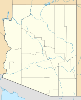
Nugents Pass is a natural opening or low point between hills in Cochise County, Arizona. It sits at about 4,593 feet (1,400 meters) above sea level. This pass is named after John Nugent. He was a journalist who traveled with a group of Forty-Niners during the Gold Rush. Nugent shared his travel notes with Lt. John G. Parke. Parke was exploring for a good railroad path from the Pima Villages to the Rio Grande.
A Path Through History
Nugents Pass was an important route for early travelers heading west. It was part of the Southern Emigrant Trail. People called it the Tucson Cutoff or "Puerto del Dado" Trail. Later, this trail became known as the Apache Pass Trail.
Spanish and Mexican soldiers used this path for a long time. Early American explorers and fur trappers also traveled through it. The pass became well-known to American settlers in 1849. This was after a group of Forty-Niners, led by John Coffee Hays, used the route.
The Tucson Cutoff Trail
The Tucson Cutoff was a specific path that went through Nugents Pass. It started on the east side of the Animas Valley. From there, it went west through Stein's Pass. It then reached a wet, marshy area on the San Simon River.
The trail continued through Puerto del Dado to Dos Cabezas Spring. Travelers then crossed the Sulphur Springs Valley and the Willcox Playa. Next, they reached Croton Springs. After that, they went through Nugents Pass.
The path then followed Tres Alamos Wash down to the San Pedro River. This crossing was near Tres Alamos. Finally, the trail went southwest from Tres Alamos. It ended at a waterhole on Cooke's Wagon Road. This spot was west of modern Mescal. Here, the Tucson Cutoff reconnected with Cooke's main route to Tucson.
Later Stagecoach Routes
In the late 1850s, new stagecoach routes appeared. The San Antonio–San Diego Mail Line and the Butterfield Overland Mail were two of them. These stagecoach lines changed their path. They left the Nugents Pass route at Dos Cabezas Spring.
Instead, they took a shorter way south of Willcox Playa. This new route went through Dragoon Pass. It led to a middle crossing of the San Pedro River. This area is now near modern Benson and south of Pomerene.
Even with these new stagecoach routes, Nugents Pass remained useful. It was still used as a wagon route for many years. People continued to travel through it between the San Pedro River and the Sulphur Springs Valley.
 | Jackie Robinson |
 | Jack Johnson |
 | Althea Gibson |
 | Arthur Ashe |
 | Muhammad Ali |


