Ojuelos de Jalisco facts for kids
Quick facts for kids
Ojuelos de Jalisco
|
||
|---|---|---|
|
Municipality and Town
|
||
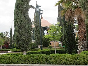
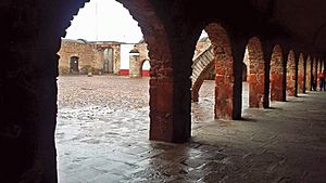
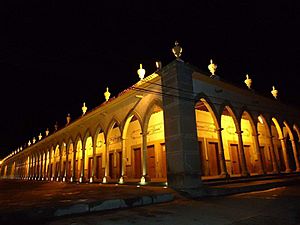
Plaza de Armas
|
||
|
||
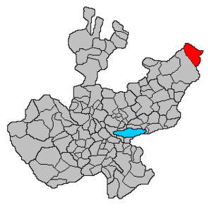
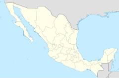
Location of the municipality in Jalisco
|
||
| Country | ||
| State | Jalisco | |
| Garrison built | 1569 | |
| Area | ||
| • Total | 1,156.71 km2 (446.61 sq mi) | |
| Population
(2010)
|
||
| • Total | 30,097 | |
| Time zone | UTC-6 (Central Standard Time) | |
| • Summer (DST) | UTC-5 (Central Daylight Time) | |
| Postcode |
47540
|
|
| Area code(s) | 496 | |
Ojuelos de Jalisco is a town and municipality in the state of Jalisco, Mexico. In 2010, the municipality had a population of over 30,000 people. The town itself had about 11,881 residents.
Ojuelos is located where three major Mexican highways meet: 51, 70, and 80. It's in the north-central part of Mexico. This area is special because Ojuelos borders three different states: Guanajuato, Zacatecas, and Aguascalientes. It's also close to San Luis Potosi. This means Ojuelos has more borders with other states than almost any other municipality in Mexico! It also shares a border with the Lagos de Moreno municipality in Jalisco.
Contents
History of Ojuelos
Founding and the Fort
Ojuelos was founded in 1569 by a Spanish explorer named Pedro Carrillo Davila. He built it as a strong military fort. Its purpose was to protect travelers from attacks by Chichimecas warriors. The Chichimecas were native groups who lived in the area.
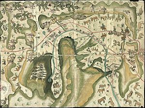
This fort in Ojuelos was one of seven forts built along an important trade route. This route went from Mexico City to Zacatecas. It later became known as the Camino Real de Tierra Adentro. The fort in Ojuelos was the first one built. It is also the only one that still stands today!
The decision to build these forts came from the Viceroy Martín Enriquez de Almanza. A Viceroy was like a governor who ruled a colony for the king of Spain. He ordered the forts after many attacks by the Chichimecas, led by their leader, Maxorro.
A Historic Landmark
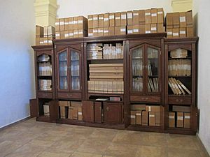
Ojuelos is very important in the history of Colonial Mexico. Its fort is the only one from 1569 that still has its original structure. Today, this historic fort houses the local government offices and a library.
Becoming a Municipality
In 1874, Ojuelos officially became a Municipality. This happened after a long disagreement about its borders with the state of Zacatecas. Ignacio L. Vallarta, who was the Governor of Jalisco, made this decision.
World Heritage Site
In 2010, UNESCO declared Ojuelos a World Heritage Site. This means it's a place of special cultural or historical importance to the world. It's part of the Camino Real de Tierra Adentro.
The Camino Real de Tierra Adentro was a very old and important road. It was also called the "Silver Route." This UNESCO site includes parts of this 1,400-kilometer road. The full route was 2,600 kilometers long. It stretched from Mexico City all the way to Texas and New Mexico in the United States.
This road was used for about 300 years, from the mid-1500s to the 1800s. It was mainly used to transport silver from mines in Zacatecas, Guanajuato, and San Luis Potosí. Mercury, which came from Europe, was also transported on this route.
Even though it was built for mining, the road also helped connect Spanish and Native American cultures. In Ojuelos, two specific places are part of the UNESCO site:
- The historic downtown of Ojuelos, which includes "El Fuerte" (the fort) and "El Parian."
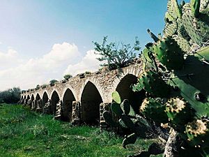
- The Bridge of Ojuelos, also known as "El Puente de Ojuelos."
Culture and Traditions
Ojuelos is known for its traditional crafts and foods. People here make beautiful wool serapes (blankets or shawls). They also create pottery and colonial-style furniture. For treats, you can find delicious eggnog (called rompope) and sweet paste made from prickly pear fruit.
Landmarks to Visit
Architecture and Buildings
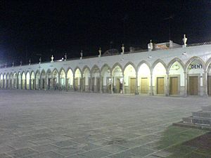
- El Parián: This is a beautiful plaza in Ojuelos. It has 102 Gothic arches all around it. A priest named Luis G. Maciel designed El Parián in the late 1800s.
- El Fuerte (Municipal Palace): This is the historic fort built in the 16th century. Today, it serves as the city hall.
- Hacienda de Ojuelos: This is a traditional hacienda house. Today, it's used as a training and meeting center for the local church.
- The Bridge of Ojuelos: This historic bridge was built in the 16th century as part of the Camino Real de Tierra Adentro.
Churches
- Temple of San José: A significant church in the town.
Parks and Natural Areas
- Cerro del Toro and the Mayal: These are hills, meaning "Hill of the Bull and the Mayal."
- Cerro de Buenavista: This hill means "Hill of Good View."
See also
 In Spanish: Ojuelos de Jalisco para niños
 | Victor J. Glover |
 | Yvonne Cagle |
 | Jeanette Epps |
 | Bernard A. Harris Jr. |


