Old Monroe, Missouri facts for kids
Quick facts for kids
Old Monroe, Missouri
|
|
|---|---|

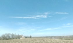
Old Monroe in 2024
|
|

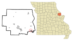
Location of Old Monroe, Missouri
|
|
| Country | United States |
| State | Missouri |
| County | Lincoln |
| Area | |
| • Total | 0.37 sq mi (0.95 km2) |
| • Land | 0.36 sq mi (0.94 km2) |
| • Water | 0.01 sq mi (0.02 km2) |
| Elevation | 443 ft (135 m) |
| Population
(2020)
|
|
| • Total | 249 |
| • Density | 687.85/sq mi (265.62/km2) |
| Time zone | UTC-6 (Central (CST)) |
| • Summer (DST) | UTC-5 (CDT) |
| ZIP code |
63369
|
| Area code(s) | 636 |
| FIPS code | 29-54416 |
| GNIS feature ID | 2396052 |
Old Monroe is a small city located in Lincoln County, Missouri, in the United States. In 2020, about 249 people lived there.
Contents
History of Old Monroe
Old Monroe has an interesting past, including being the site of an old fort and a battle.
Early Beginnings
The area where Old Monroe now stands was once home to Fort Howard. The city itself was first planned out in 1819. It was named after James Monroe, who was the President of the United States at that time.
The word "Old" was added to the city's name later. This was done to avoid confusion with another city called Monroe City, especially for mail delivery.
The Battle of the Sink Hole
A significant event in the area's history was the Battle of the Sink Hole. This battle happened on May 24, 1815. It took place after the official end of the War of 1812.
- Who fought? Missouri Rangers fought against Sauk Indians. The Sauk were led by a famous leader named Black Hawk.
- Why did it happen? The Sauk people might not have known, or perhaps they didn't care, that their British allies had signed a peace agreement called the Treaty of Ghent with the U.S.
- Where was it? The battle happened in a low area near the Cuivre River, close to where Old Monroe is today.
After this battle, in 1816, Black Hawk agreed again to the Treaty of St. Louis. This happened after new talks with the United States government.
Changing Names and Roles
Old Monroe was first called "Monroe." From 1819 to 1823, it was the main town, or "county seat," for Lincoln County. This meant it was the center for government activities.
Around 1857, the name changed to "Old Monroe." This happened when another county, Monroe County, and its main town, Monroe City, were created. To prevent mix-ups, the postal service started calling the older town "Old Monroe."
Geography and Location
Old Monroe is located at 38°55′55″N 90°44′53″W / 38.93194°N 90.74806°W. This is its exact spot on a map.
The city covers a total area of about 0.26 square miles (0.67 square kilometers). Most of this area is land, about 0.25 square miles (0.65 square kilometers). A very small part, about 0.01 square miles (0.026 square kilometers), is water.
Population Information
| Historical population | |||
|---|---|---|---|
| Census | Pop. | %± | |
| 1910 | 251 | — | |
| 1920 | 317 | 26.3% | |
| 1930 | 271 | −14.5% | |
| 1940 | 272 | 0.4% | |
| 1950 | 268 | −1.5% | |
| 1960 | 290 | 8.2% | |
| 1970 | 330 | 13.8% | |
| 1980 | 272 | −17.6% | |
| 1990 | 242 | −11.0% | |
| 2000 | 250 | 3.3% | |
| 2010 | 265 | 6.0% | |
| 2020 | 249 | −6.0% | |
| U.S. Decennial Census | |||
What the 2010 Census Showed
In 2010, the census counted 265 people living in Old Monroe. There were 102 households, which are groups of people living together.
- Most residents, about 97%, were White.
- A small number of people were African American, Native American, or from other racial backgrounds.
- About 1.9% of the population identified as Hispanic or Latino.
Many households had children under 18 living there. The average household had about 2.6 people. The average age of people in the city was 31.8 years old.
Education
Students in Old Monroe attend schools within the Winfield R-IV School District.
See also
 In Spanish: Old Monroe (Misuri) para niños
 | Tommie Smith |
 | Simone Manuel |
 | Shani Davis |
 | Simone Biles |
 | Alice Coachman |

