Orangeville, Pennsylvania facts for kids
Quick facts for kids
Orangeville, Pennsylvania
|
||
|---|---|---|
|
Borough
|
||
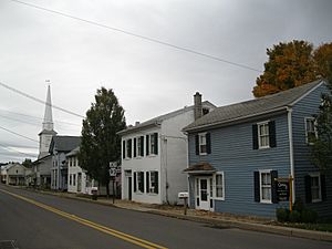
Looking south on PA 487 in Orangeville in October 2012
|
||
|
||
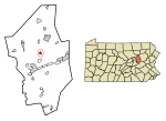
Location of Orangeville in Columbia County, Pennsylvania.
|
||
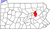
Map showing Columbia County in Pennsylvania
|
||
| Country | United States | |
| State | Pennsylvania | |
| County | Columbia | |
| Settled | 1822 | |
| Incorporated | 1900 | |
| Government | ||
| • Type | Borough Council | |
| Area | ||
| • Total | 0.45 sq mi (1.17 km2) | |
| • Land | 0.45 sq mi (1.15 km2) | |
| • Water | 0.01 sq mi (0.02 km2) | |
| Elevation | 580 ft (180 m) | |
| Population
(2020)
|
||
| • Total | 479 | |
| • Density | 1,076.40/sq mi (415.48/km2) | |
| Time zone | UTC-5 (Eastern (EST)) | |
| • Summer (DST) | UTC-4 (EDT) | |
| ZIP Code |
17859
|
|
| Area code(s) | 570 | |
| FIPS code | 42-56912 | |
Orangeville is a small town, called a borough, located in Columbia County, Pennsylvania, in the United States. It is part of a larger area known as Northeastern Pennsylvania. In 2020, about 478 people lived there. Orangeville is also part of the Bloomsburg-Berwick micropolitan area, which is a group of nearby towns.
Contents
History of Orangeville
How Orangeville Started
Orangeville began to take shape in 1822. A man named Clemuel G. Ricketts from Ohio planned to create a community near Knob Mountain. However, some people were already living in the area before his plan.
Soon after the town was designed, new buildings started to appear. These included houses and a tannery, which is a place where animal hides are made into leather. Once about five or six houses were built, a post office was also opened in the town.
Choosing the Town's Name
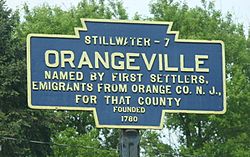
Several names were thought of for the new community. Some ideas were Knobtown, Rickettsville, and The Trap. But in the end, the name Orangeville was chosen. It was named after Orange County, New York, and Orange, New Jersey.
In 1853, a business that made plows (tools for farming) and grain-threshers (machines for separating grain) was built in Orangeville. The town officially became a borough in the year 1900.
Geography and Location
Where Orangeville Is Found
Orangeville is located north of the center of Columbia County. It is completely surrounded by Orange Township, which is a separate local government area.
The U.S. Census Bureau says that Orangeville covers about 1.2 square kilometers (0.45 square miles). A very small part of this area, about 0.02 square kilometers (0.01 square miles), is water.
Nearby Areas and Natural Features
Orangeville is about 7 miles (11 km) north of Bloomsburg. You can get there by taking Pennsylvania Route 487. Benton is another town, about 10 miles (16 km) north, also along PA 487. If you travel east from Orangeville on Pennsylvania Route 93, you will reach Berwick in about 10 miles (16 km).
A stream called Fishing Creek flows along the northwestern edge of Orangeville. This creek is a branch of the large Susquehanna River. Also, the lower part of Knob Mountain is located in the northeastern part of Orangeville.
Population of Orangeville
How Many People Live Here
Orangeville has seen its population change over the years. Here's a look at how many people have lived in the borough:
| Historical population | |||
|---|---|---|---|
| Census | Pop. | %± | |
| 1880 | 403 | — | |
| 1900 | 439 | — | |
| 1910 | 399 | −9.1% | |
| 1920 | 417 | 4.5% | |
| 1930 | 415 | −0.5% | |
| 1940 | 434 | 4.6% | |
| 1950 | 424 | −2.3% | |
| 1960 | 444 | 4.7% | |
| 1970 | 431 | −2.9% | |
| 1980 | 507 | 17.6% | |
| 1990 | 504 | −0.6% | |
| 2000 | 500 | −0.8% | |
| 2010 | 508 | 1.6% | |
| 2020 | 478 | −5.9% | |
| 2021 (est.) | 478 | −5.9% | |
| Sources: | |||
In 2000, there were 500 people living in Orangeville. The population density was about 1,164 people per square mile (449 people per square kilometer).
Age Groups in the Borough
The people living in Orangeville include different age groups. In 2000:
- About 20.2% of the population was under 18 years old.
- About 31.2% of the population was 65 years old or older.
The average age of people in Orangeville was 47 years.
Education in Orangeville
Local School District
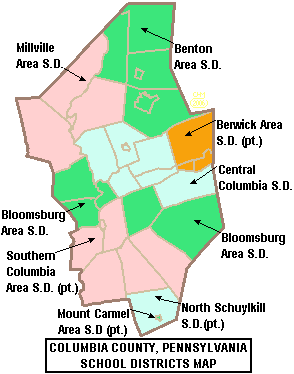
The students in Orangeville attend schools in the Central Columbia School District. This school district serves about 2,100 students. It has three main school buildings and one office building.
Students are divided into different schools based on their grade level:
- The Elementary School teaches students from kindergarten to 4th grade.
- The Middle School teaches students from 5th to 8th grade.
- The High School teaches students from 9th to 12th grade.
School Performance and Improvements
In 2003, data showed that about 71.1% of students passed the state-required tests. The school district spends about $6,999 on each student.
In 2007, the Pittsburgh Business Times looked at how well schools performed. They ranked the Central Columbia School District 146th out of 499 school districts in Pennsylvania. This ranking was based on student test scores over three years.
The Middle School had a big renovation project from 2006 to 2007. This project added new parts to the school. These additions help the school handle more students as class sizes grow.
See also
 In Spanish: Orangeville (Pensilvania) para niños
 | William M. Jackson |
 | Juan E. Gilbert |
 | Neil deGrasse Tyson |


