Oxford, Pennsylvania facts for kids
Quick facts for kids
Oxford, Pennsylvania
|
|
|---|---|
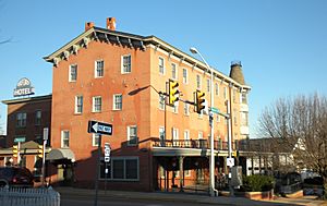
Oxford Hotel
|
|
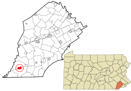
Location in Chester County and the U.S. state of Pennsylvania.
|
|
| Country | United States |
| State | Pennsylvania |
| County | Chester |
| Incorporated | 1833 |
| Area | |
| • Total | 1.97 sq mi (5.09 km2) |
| • Land | 1.96 sq mi (5.08 km2) |
| • Water | 0.00 sq mi (0.01 km2) |
| Elevation | 535 ft (163 m) |
| Population
(2020)
|
|
| • Total | 5,736 |
| • Density | 2,922.06/sq mi (1,128.24/km2) |
| Time zone | UTC-5 (EST) |
| • Summer (DST) | UTC-4 (EDT) |
| ZIP Code |
19363
|
| Area codes | 610 and 484 |
| FIPS code | 42-57480 |
Oxford is a small town, also known as a borough, in Chester County, Pennsylvania, United States. It's the closest town to Lincoln University. In 2020, about 5,733 people lived there.
Contents
Oxford's Early Days and Growth
Oxford was known by different names, like Oxford Crossing and Oxford Village, in the 1700s.
The town got its own post office in 1805. Then, in 1833, Oxford officially became a borough. Its first leader, called a burgess (which is like a mayor today), was Thomas Alexander. He owned a general store, which is believed to be the oldest building in Oxford.
The Dickey Family and Lincoln University
In the 1800s, the northern part of Oxford belonged to the Dickey family. This family included important people like a minister, a banker, and local business owners. Reverend John Miller Dickey and his wife, Sarah Emlen Cresson, started Ashmun Institute in 1854. This school later became Lincoln University, a famous historically Black college.
Railroads and a Busy Community
The Dickey family also helped change the path of the new Philadelphia and Baltimore Central Railroad (P&BC) so it would go through Oxford. Train tracks were built in the 1850s. By 1860, the railroad reached Oxford, connecting it to big cities like Philadelphia and Baltimore.
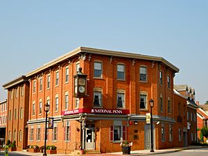
During the Civil War, Oxford was a very busy place. The main business area on Third Street was rebuilt, including the Oxford Hotel (1858) and Oxford Hall (1862). Oxford became known for its candy and manufacturing businesses.
A second railroad, the Peach Bottom Railway, was built in the 1870s. It carried farm products and people between Oxford and Peach Bottom. However, this railroad didn't make much money and closed in 1918.
Changes in Transportation
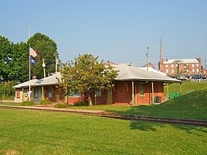
The Pennsylvania Railroad took over the P&BC line before World War I. Passenger train service on this line stopped in 1935. Later in the 1900s, major roads changed, and Oxford was no longer on the main routes. A bypass for U.S. Route 1 was built in the late 1960s. Even bigger, the opening of Interstate 95 in 1963 moved most of the traffic between Philadelphia and Baltimore away from Oxford. Today, the old train station is used as the borough hall.
In 2008, the Oxford Historic District and the Oxford Hotel were added to the National Register of Historic Places. This means they are important historical places.
Where is Oxford Located?
Oxford covers an area of about 1.97 square miles (5.09 square kilometers). Almost all of this area is land. There are about 2,581 people living in each square mile.
Who Lives in Oxford?
| Historical population | |||
|---|---|---|---|
| Census | Pop. | %± | |
| 1850 | 186 | — | |
| 1860 | 482 | 159.1% | |
| 1870 | 1,151 | 138.8% | |
| 1880 | 1,502 | 30.5% | |
| 1890 | 1,711 | 13.9% | |
| 1900 | 2,032 | 18.8% | |
| 1910 | 2,390 | 17.6% | |
| 1920 | 2,093 | −12.4% | |
| 1930 | 2,606 | 24.5% | |
| 1940 | 2,723 | 4.5% | |
| 1950 | 3,091 | 13.5% | |
| 1960 | 3,376 | 9.2% | |
| 1970 | 3,658 | 8.4% | |
| 1980 | 3,633 | −0.7% | |
| 1990 | 3,769 | 3.7% | |
| 2000 | 4,315 | 14.5% | |
| 2010 | 5,077 | 17.7% | |
| 2020 | 5,733 | 12.9% | |
| 2021 (est.) | 5,737 | 13.0% | |
| Sources: | |||
In 2010, about 60% of the people in Oxford were non-Hispanic White. About 9% were Black or African American, and about 29% were of Hispanic or Latino background. Many people in Oxford were born outside the United States.
In 2000, there were 4,315 people living in Oxford. About 30.5% of households had children under 18. The average household had about 2.65 people. The median age was 35.5 years old. This means half the people were younger and half were older than 35.5.
Cool Places to See in Oxford
- Oxford Town Clock: This clock is on the BB&T bank building. It was fixed up in May 2001.
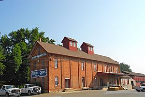
- Union Fire Company No. 1: The fire station, located near Market Street, was once the Dickey Building. It was renovated and is still used by the fire company today.
- Oxford Presbyterian Church: This church is one of the oldest buildings in town. It was damaged by fire in 1989 after lightning struck its tall steeple. It has been rebuilt and is still an active church.
- Parking Garage: Oxford has built a new four-story parking garage in the middle of town. The borough office will also move to the first floor of this garage. This new addition aims to bring more people to the town.
Learning and Schools in Oxford
Oxford has its own public school system called the Oxford Area School District. There are six schools:
- Jordan Bank Elementary (Kindergarten)
- Elk Ridge Elementary (Grades 1-2)
- Nottingham Elementary (Grades 3-4)
- Hopewell Elementary (Grades 5-6)
- Penn's Grove Middle School (Grades 7-8)
- Oxford Area High School (Grades 9-12)
Penn's Grove Middle School used to be the high school. A new high school building was finished in November 2005. Sacred Heart School, a private school, was built in Oxford in 2002.
Oxford high school sports teams are part of the American Division in the Ches-Mont League. They play sports like football, basketball, baseball, soccer, and more.
Oxford is very close to Lincoln University. This important college was founded in 1854. Famous people like writer Langston Hughes and Supreme Court Justice Thurgood Marshall studied there.
Getting Around Oxford
As of 2020, Oxford had about 18.32 miles of public roads. The state of Pennsylvania maintains some roads, and the borough maintains others.
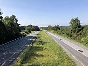
U.S. Route 1 is the main highway near Oxford. It goes around the northwestern part of the town. Pennsylvania Route 472 runs through the center of town, mostly along Lancaster Avenue and Market Street. Pennsylvania Route 10 starts in the center of town and goes north on Third Street.
Famous People from Oxford
- William T. Fulton (1835–1912): A lawyer and a member of the Pennsylvania House of Representatives.
- John H. Ware III (1908–1997): He was the burgess (mayor) of Oxford and later a U.S. House Representative for Pennsylvania.
See also
 In Spanish: Oxford (Pensilvania) para niños
 | Shirley Ann Jackson |
 | Garett Morgan |
 | J. Ernest Wilkins Jr. |
 | Elijah McCoy |


