Paraíso, Tabasco facts for kids
Quick facts for kids
Paraíso, Tabasco
|
|
|---|---|
|
Town & Municipality
|
|
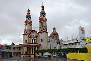
San Marcos Church in Paraíso
|
|
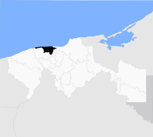
Location of the municipality within Tabasco
|
|
| Country | |
| State | Tabasco |
| Founded | 1840s |
| Area | |
| • Municipality | 577.55 km2 (222.99 sq mi) |
| Elevation
(of seat)
|
10 m (30 ft) |
| Population
(2010) Municipality
|
|
| • Municipality | 86,632 |
| Time zone | UTC-6 (Central (US Central)) |
| • Summer (DST) | UTC-5 (Central) |
| Postal code (of seat) |
86600
|
| Website | paraiso.gob.mx |
Paraíso is a town and municipality in the northern part of the Mexican state of Tabasco. It is about 75 kilometers north of Villahermosa, the state capital, right on the Gulf of Mexico. This area is known for fishing and farming.
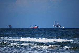
Today, Paraíso is also important for oil production. It has a port called Dos Bocas, which mainly handles oil. People also visit Paraíso for its beautiful beaches and natural spots. The area is part of the state's "Cacao Route" tourism program.
Contents
Exploring the Town of Paraíso
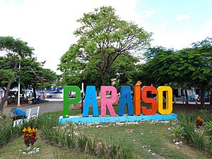
The town of Paraíso is located on the coast of Tabasco. It is about 75 kilometers north of Villahermosa. Even though tourism is important here, the town center still feels local. It is not filled with many big hotels. Most houses are simple, made of brick or adobe. Some larger homes have lovely gardens.
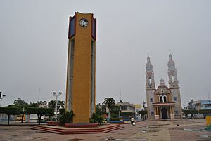
The town center has a big main plaza. The San Marcos Church is on the north side. This church and the La Asunción Church are very important. They are named after the town's two patron saints: Mark the Evangelist and Our Lady of the Assumption. The Parque Central Guillermo Sevilla Fiqueroa has a modern design. It features a tall clock tower, gardens, trees, and an open-air theater. There is also a cafeteria and a reflecting pool.
Paraíso celebrates Carnival starting on January 20 with an event called “La Pintorrea.” On the Sunday before Ash Wednesday, there is a fun "flour war." On Ash Wednesday, people ask for donations. After a church service, the day ends by burning a figure called “Juan Carnaval.”
History of Paraíso
The name "Paraíso" means "Paradise." Many people think it means "Heaven's Pass." But the name actually comes from a type of leafy tree in the mahogany family. The municipality does not have a special symbol or coat-of-arms.
The town of Paraíso was likely started between 1848 and 1852. It began as a camp for local people from the Mecoacán area. Later, people from Jalpa de Méndez and Comalcalco moved in. Some local writers say it was founded in 1823. They say a church for Mark the Evangelist and the Virgin of the Assumption was built then.
From the 1800s, much of the land was used to grow cocoa and fruit trees. During this time, Paraíso was a strong supporter of the Liberal side in the Reform War. It even had its own group of fighters called “Los Cangrejos y Pejelagartos” (Crabs and Pejalagarto fish). However, the town became smaller later in the century. By 1872, there were only four permanent houses.
During the Mexican Revolution, General Ignacio Gutierrez Gomez took the town in 1911. Generals Carlos Greene Ramirez and Ramon Sosa Torres took it again in 1914. After the war, the town grew a lot. In 1945, the governor of Tabasco, Noé de la Flor Casanova, declared it a city.
Geography and Natural Features
Paraíso is part of the Tabasco floodplain, which is very flat. It is only about two meters above sea level. The land gently slopes towards the Gulf of Mexico. Near the ocean, the soil is sandy with some clay. Further inland, clay soil is more common.
Because it is low and wet, Paraíso has lots of water. There are many lagoons, lakes, estuaries, and wetlands. Important water bodies include the Mecoacán, La Machona, and Tupilco lagoons. The El Eslabón lagoon gets water from the Gonzalez River as it flows into the Gulf. Other rivers and streams include the Seco and El Corcho.
The water flow in the municipality is divided into east and west. Both parts are connected by the Río Seco River and the Jobo Canal. The eastern side has the large Mecoacán lagoon. This lagoon opens into the Gulf of Mexico at Dos Bocas. Smaller lagoons like El Eslabón are linked to it.
The Mecoacán Lagoon is shallow, about 1.5 meters deep. It covers an area of 5,160 hectares. It is the second most important lagoon system in Tabasco. It has many oyster beds and used to have large mangrove forests. The Cuxcuxapa River and other small streams bring fresh water to the lagoon.
Climate and Weather
Paraíso has a hot and wet climate. It rains all year, especially in summer and fall. The average yearly rainfall is about 1,751.4 millimeters. Flooding is a common issue. For example, there was a big flood in October 2011.
The coolest months are November, December, and January. Temperatures average around 22°C. May is the hottest month, with average temperatures around 30°C. Temperatures can range from 12°C to 44°C. The windiest months are October, November, and December, with winds up to 30 km/h.
Paraíso has a tropical monsoon climate. This means it has a long wet season and high temperatures all year. The wet season lasts from May to February. Only March and April are truly dry, with less than 60 millimeters of rain. Even in the dry season, there is some rain. April is the driest month, with 44 millimeters. October is the wettest, with 345 millimeters.
Daily high temperatures are highest in May (34.4°C) and lowest in January (27.4°C). Night temperatures usually stay in the low 20s. They drop a bit lower from December to February.
| Climate data for Paraíso, Tabasco | |||||||||||||
|---|---|---|---|---|---|---|---|---|---|---|---|---|---|
| Month | Jan | Feb | Mar | Apr | May | Jun | Jul | Aug | Sep | Oct | Nov | Dec | Year |
| Mean daily maximum °C (°F) | 27.4 (81.3) |
29.2 (84.6) |
31.3 (88.3) |
33.7 (92.7) |
34.4 (93.9) |
34.1 (93.4) |
33.6 (92.5) |
33.9 (93.0) |
32.7 (90.9) |
31.1 (88.0) |
29.5 (85.1) |
28.0 (82.4) |
31.6 (88.8) |
| Daily mean °C (°F) | 22.8 (73.0) |
24.1 (75.4) |
25.8 (78.4) |
27.8 (82.0) |
28.5 (83.3) |
28.6 (83.5) |
28.3 (82.9) |
28.4 (83.1) |
27.6 (81.7) |
26.4 (79.5) |
24.9 (76.8) |
23.4 (74.1) |
26.4 (79.5) |
| Mean daily minimum °C (°F) | 18.3 (64.9) |
19.0 (66.2) |
20.3 (68.5) |
21.9 (71.4) |
22.6 (72.7) |
23.1 (73.6) |
23.0 (73.4) |
22.9 (73.2) |
22.6 (72.7) |
21.8 (71.2) |
20.3 (68.5) |
18.9 (66.0) |
21.2 (70.2) |
| Average rainfall mm (inches) | 155 (6.1) |
84 (3.3) |
53 (2.1) |
44 (1.7) |
72 (2.8) |
154 (6.1) |
128 (5.0) |
136 (5.4) |
309 (12.2) |
345 (13.6) |
182 (7.2) |
158 (6.2) |
1,820 (71.7) |
| Source: Climate-Data.org | |||||||||||||
Local Plants and Animals
The coastal areas of Paraíso have sandy soils, leading to beaches. Soils near the ocean can be salty. Most of the municipality has perennial rainforests. These forests have trees that are fifteen to thirty meters tall. However, most of these areas have been disturbed by human activity. Near the ocean, you can find beaches and mangrove trees. Sometimes, you might see a nopal cactus.
Wildlife in Paraíso mainly includes birds and reptiles. You might spot storks, kingfishers, seagulls, and buzzards. There are also marine and freshwater turtles, and various small lizards.
Economy and Jobs
Paraíso has 57,755 hectares of land. About 17% is used for farming, 16% for raising animals, and 12% for forests. The rest is for homes, cities, wetlands, or water bodies. Every April, the municipality holds a fair for agriculture, industry, and crafts.
About 33% of the working people in Paraíso are in farming and fishing. The most important crop is coconut. Paraíso is the top coconut producer in Tabasco. It grows over 60% of the state's coconuts. Other important crops are cacao and bananas. Corn and beans are usually grown in small plots for families to eat. Raising livestock like cattle or pigs is not a major part of the economy. Some tropical hardwood trees, like mahogany, are used to make furniture.
Fishing happens in both the ocean and fresh waters. People catch sea bass, shrimp, and shellfish. Paraíso is a big producer of oysters and, more recently, edible jellyfish. However, fishing has faced problems. Oil spills and red tide have caused fishing areas to close. In the 2000s, wild oyster harvests dropped by almost 50% in Tabasco's lagoons. Traditionally, men harvest oysters and women process them. But this way of life is changing. Too much harvesting is the main reason for the drop in oyster numbers. Experts suggest that oyster farming could help, but local fishermen are sometimes hesitant to change.
Almost 28% of the working population is in mining, oil, construction, and manufacturing. Oil drilling happens in two main areas: Puerto Ceiba Mesozoico and Puerto Ceiba Terciario. These areas produce over two thousand barrels of oil and 1.2 million cubic feet of natural gas daily. Most manufacturing is small-scale. It includes making corn flour, chocolate, ice, clothes, cinder blocks, and tortillas. Making fiberglass is also an important job source. Local crafts include figures made from dried coconuts and seashells, as well as hammocks.
Oil spills on land and in the ocean have caused problems for fishing and tourism. When spills happen, the air can smell strongly of oil. Beaches in Tabasco have been affected by spills from other areas, like Campeche. Local fishermen worry about their jobs because of oil spills, even big ones like the Deepwater Horizon oil spill far away. Paraíso beaches have sometimes been closed due to harmful chemicals, which hurts tourism. In 2005, PEMEX cleaned up twelve tons of oil and other pollution from 77 kilometers of Tabasco beaches, including those in Paraíso. Government groups check the beaches and waters to make sure they are safe for tourists.
Almost 35% of people work in commerce, tourism, and services. The municipality has four traditional markets and a weekly market. There are also supermarkets and other stores. Tourism is still growing, but it focuses on beaches, fishing, and natural sites. Paraíso's natural beauty has even been used for Mexican TV shows. Hotels range from small inns to one four-star hotel. The municipality is just north of the Comalcalco ancient ruins, and it is part of the Cacao Route.
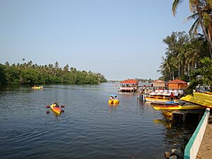
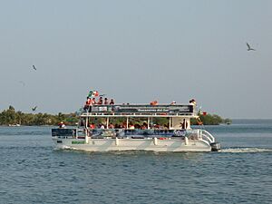
The most popular tourist area is Puerto Ceiba. People like its plants, docks, and an inn with a restaurant. Seafood dishes, especially oysters, are popular. Tourists can also take boat tours on the Mecoacán Lagoon. The Parador Turístico Puerto Ceiba is a viewpoint for the Mecoacán Lagoon. It offers boat tours on the Gonzalez River to the Gulf, and on the Mecoacán and Bellote Lagoons. Aqua Terra Paradise rents kayaks and paddle boats. It also offers banana boat rides, motorboat rides, and diving lessons. You can also go recreational fishing, snorkeling, and night diving.
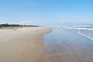
The El Paraíso Tourist Center is a fun place by the beach. It has a pool, hotel, restaurant, bungalows, and changing rooms. The beach here is wide, with fine gray sand and warm, calm blue waters. The water is shallow for up to 100 meters out.
Barra de Tupilco is a long beach with gray sand and blue-green water. Many people visit this area during the Holy Week holidays. The Tupilco lighthouse is one of the oldest in the state. Playa Bruja beach is three kilometers from Chiltepec. It is 200 meters long and 40 meters wide. It has fine gray sand and calm waves on clear green waters. You can find palapas (thatched shelters), hammocks, a restaurant, and changing rooms among palm trees and sea birds. Playa Varadero has equipment for volleyball and soccer. It hosts music events during the Holy Week vacation. Other beaches in the area include Playa Sol, Pico de Oro, and Arroyo Verde.
The "República de Paraíso" tourism road is a modern four-lane boulevard. It connects the town with Puerto Ceiba and El Bellote to the east. The road has many restaurants, mostly serving seafood. Many of them have a view of the Mecoacán Lagoon.
Isla Rebeca is an island surrounded by mangroves and beaches with fine gray sand and calm waters. In the early 2000s, there was a plan to build an ecotourism resort on Isla Rebeca. But the project was stopped, and many buildings were left unfinished. The island is a nature reserve. It is home to animals like raccoons, iguanas, and many kinds of water birds. The island is about 200 hectares in size.
Other fun places to visit include a center for raising freshwater turtles, which is the only one in Latin America. There is also a crocodile sanctuary at the Tupilco Lagoon.
Dos Bocas Port
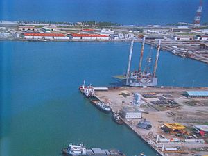
The Dos Bocas port (Puerto dos Bocas in Spanish) was built in 1979 and started working in 1982. It was made bigger starting in 1982 with new piers. In 2005, a new terminal began operating, and an industrial area was set up. The port mainly ships oil. It also handles other industrial and commercial goods.
The Puerto de Dos Bocas handles up to 85% of Mexico's oil production. It also brings in equipment for oil exploration. The port imports products and machinery to help local farming. Many of these farm products are then exported. Exports from the port include bananas, mango, pineapple, Persian lemon, papaya, orange, coffee, sugar cane, cocoa, and peppers. Products from animal farming are also exported. Most exports come from Tabasco, Campeche, Chiapas, and southern Veracruz.
In 2008, Dos Bocas exported about 8 million tons of goods. This was much less than its peak in 2003, when over 30 million tons were exported. The port also welcomed about two thousand passengers in 2008. The port mainly ships to Brownsville, Houston, Galveston, New Orleans, Mobile, and Jacksonville. But goods also go to and from other ports in southeast Mexico, Central America, the Caribbean, Europe, North Africa, and the Middle East. The Dos Bocas port also offers guided tours for visitors.
On July 26, 2019, the Secretariat of Energy announced plans to build an oil refinery here. The refinery will be able to process 340,000 barrels of oil.
The Municipality of Paraíso
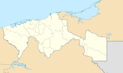
Paraíso is in the Grijalva Region of Tabasco, in the Chontalpa subregion. It is in the north of the state. It shares borders with the municipalities of Centla, Jalpa de Méndez, Comalcalco, and Cárdenas. The Gulf of Mexico is to its north.
Paraíso covers 577.55 square kilometers. It is the smallest municipality in the state. It includes one city (the main town), one town, three villages, and many smaller communities. The municipal government is led by a municipal president. The town of Paraíso has a population of 20,194 people. About 257 people in the municipality speak an indigenous language. These include Chontal, other Mayan languages, and Zapotec.
Local food is rich in seafood. Popular dishes include oysters, crabs, shrimp, snails, and squid. Oysters are very common, often served pickled or smoked. Other foods include iguana, freshwater turtle, and grilled pejelagarto fish. Sweets are made with coconut, pineapple, and soursop. The most traditional drink is pozol, made from corn and cacao.
The municipality has local newspapers like El Casabel and Horizontes Nacionales. It also has a magazine called La Edición. People get news from state, national, and satellite TV and radio.
Paraíso has 138 schools, from preschool to vocational training. This includes 59 preschools, 57 primary schools, and 16 middle schools. There are also high schools and special education centers. The number of people who cannot read or write in Paraíso dropped to 4.2% in 2008.
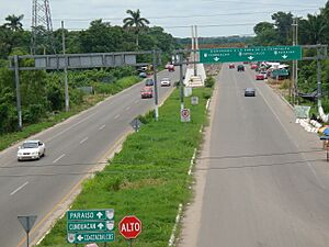
The municipality has 129.6 kilometers of main roads. Most of these are state highways. There are 18 bridges for vehicles. Key highways include Federal highway 180 and state highways connecting to Villahermosa and Comalcalco. Transportation is mainly focused at the Dos Bocas port. There is a highway that links the town of Paraíso with the port of Dos Bocas. A railway line between Dos Bocas port and Villa Chontalpa is being built. There is a bus terminal for travel between cities. Local transport includes vans, small buses, and taxis.
- Chiltepec* has about 3,700 people. It is 18 kilometers from the main town. Its main jobs are growing coconuts, fishing, and tourism. It is a fishing port at the mouth of the González River. It has the Playa Bruja and Playa Pirata beaches. The town has a simple dock and a boardwalk with benches and a lighthouse.
- Quintín Arauz* has about 3,500 people. It is 2.5 kilometers from the main town. People here grow coconut, cacao, and pepper. They also raise pigs and chickens.
- Puerto Ceiba* has about 2,500 people. It is six kilometers from the main town. Its main jobs are fishing and tourism.
- Libertad 1ª. Sección* has about 1,800 people. It is 5.5 kilometers from the main town. People here grow coconut, cacao, and pepper. They also raise pigs and chickens.
- Francisco I. Madero* has about 2,000 people. It is 7.5 kilometers from the main town. Its main jobs are growing coconut, cacao, and pepper. They also raise pigs and chickens.
- El Bellote* is a small community on the Mecoacán Lagoon. It focuses on fishing and tourism.
See also
 In Spanish: Paraíso (Tabasco) para niños
 | Kyle Baker |
 | Joseph Yoakum |
 | Laura Wheeler Waring |
 | Henry Ossawa Tanner |


