Hartland Township, Michigan facts for kids
Quick facts for kids
Hartland Township, Michigan
|
|
|---|---|

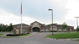
Hartland Township Hall
|
|

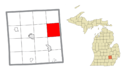
Location within Livingston County
|
|
| Country | United States |
| State | Michigan |
| County | Livingston |
| Established | 1836 |
| Area | |
| • Total | 37.3 sq mi (96.6 km2) |
| • Land | 35.9 sq mi (92.9 km2) |
| • Water | 1.4 sq mi (3.7 km2) |
| Elevation | 958 ft (292 m) |
| Population
(2020)
|
|
| • Total | 15,256 |
| • Density | 409.04/sq mi (157.93/km2) |
| Time zone | UTC-5 (Eastern (EST)) |
| • Summer (DST) | UTC-4 (EDT) |
| ZIP code(s) | |
| Area code(s) | 248, 517, and 810 |
| FIPS code | 26-37040 |
| GNIS feature ID | 1626446 |
Hartland Township is a community in Livingston County, Michigan. It's a special type of local government called a civil township. In 2020, about 15,256 people lived here. This was more than the 14,663 people counted in 2010.
Contents
Exploring Hartland's Communities
Hartland Township is home to a few different communities. Each one has its own unique feel.
Hallers Corners
- Hallers Corners is a small, unnamed community. It's located where Denton Hill and Holtforth roads meet. This spot is right on the border with Tyrone Township.
Hartland Village
- The community of Hartland is found near the center of the township. It's just north of where two major roads, U.S. 23 and M-59, cross paths.
Parshallville
- Parshallville is another small community. Part of it is located in the northwest corner of Hartland Township.
Geography of Hartland Township
Hartland Township is located in the eastern part of Livingston County. To its east, it shares a border with Oakland County.
Major Roads and Travel
U.S. Route 23 is a big four-lane highway that runs through the township. You can get on or off this highway at Exit 67 (which is for Highway M-59) and Exit 70 (for Clyde Road).
- U.S. 23 goes north about 28 miles (45 km) to Flint.
- It also goes south about 28 miles (45 km) to Ann Arbor.
- M-59 crosses the township just south of Hartland village. This road leads east about 24 miles (39 km) to Pontiac. It goes west about 10 miles (16 km) to Howell, which is the main town for Livingston County.
Land and Water
The township covers a total area of about 37.3 square miles (96.6 km²). Most of this area, about 35.9 square miles (92.9 km²), is land. The rest, about 1.4 square miles (3.7 km²), is water. This means about 3.86% of the township is covered by water.
The northern part of Hartland Township has water that flows into North Ore Creek. This creek then leads to the Shiawassee River, which eventually reaches Saginaw Bay. The southern part of the township drains into South Ore Creek. This creek flows into the Huron River, which then empties into Lake Erie.
People of Hartland Township
The census helps us understand the people who live in Hartland Township.
Population and Homes
In 2000, there were 10,996 people living in the township. These people lived in 3,696 households. Out of these, 3,108 were families. On average, about 2.96 people lived in each household. For families, the average size was 3.24 people.
Age Groups
The population in the township is spread out across different age groups:
- About 30.4% of the people were under 18 years old.
- About 6.1% were between 18 and 24 years old.
- About 31.3% were between 25 and 44 years old.
- About 25.0% were between 45 and 64 years old.
- About 7.3% were 65 years old or older.
The average age of people in Hartland Township was 36 years.
Income and Economy
In 2000, the average income for a household in the township was $75,908. For families, the average income was $79,524. The average income per person in the township was $28,971. A very small number of families (about 1.2%) and people (about 1.7%) lived below the poverty line. This included 1.9% of those under 18 and 5.7% of those 65 or older.
See also
 In Spanish: Municipio de Hartland (Míchigan) para niños


