
Saginaw Bay facts for kids
Quick facts for kids Saginaw Bay |
|
|---|---|

View from Bay City State Park
|
|

Saginaw Bay
Location in Michigan

Saginaw Bay
Location in the United States
|
|
| Location | Lake Huron Lower Peninsula of Michigan |
| Coordinates | 43°55′N 83°35′W / 43.917°N 83.583°W |
| Type | Bay |
| Basin countries | United States |
| Surface area | 1,143 square miles (2,960 km2) |
| Surface elevation | 581 feet (177 m) |
| Saginaw Bay Informational Designation | |
|---|---|

Saginaw Bay historic marker
|
|
| Designated | October 30, 1956 |
Saginaw Bay is a large bay found within Lake Huron. It is located on the eastern side of the state of Michigan in the United States. This bay creates the space between Michigan's "Thumb" region and the rest of the Lower Peninsula of Michigan.
Saginaw Bay covers an area of about 1,143 square miles (2,960 km2). It touches parts of five Michigan counties. These counties are Arenac, Bay, Huron, Iosco, and Tuscola.
Contents
Understanding the Saginaw Bay Watershed

A watershed is an area of land where all the water drains into a common point. The Saginaw Bay watershed is the largest one in Michigan. It collects water from about 15% of the state's total land area.
This watershed is home to the biggest connected system of freshwater coastal wetlands in the United States. These wetlands are very important for nature. The Saginaw Bay Watershed Initiative Network helps protect this area. They work to make sure the watershed develops in a way that is good for the environment. They also give money to new projects in the region. The area is currently listed as an "Area of Concern" by the Environmental Protection Agency. This means it needs special care to stay healthy.
Where Did the Name "Saginaw" Come From?
The name "Saginaw" might come from the Ojibwa words O-Sag-e-non or Sag-in-a-we. These words mean "to flow out." This could refer to the Saginaw River, which flows into Saginaw Bay and then into Lake Huron. The name "Saginaw" is not connected to the Saguenay region in Quebec, Canada. That name comes from a different language.
A Look at Saginaw Bay's History

For a long time, Native American groups lived in this area. The Ojibwe people were living around the Great Lakes before Europeans arrived.
In the early 1600s, French explorers were the first Europeans to visit the Great Lakes region. Father Jacques Marquette, a French Jesuit priest, visited the Saginaw Bay area in 1668. He had just started a mission in St. Ignace. Later, in 1686, Father Jean Enjalran tried to start a mission for Native Americans in the valley, but it did not succeed.
France gave control of this region to Great Britain after the Seven Years' War in 1763. Twenty years later, Great Britain gave it to the new United States of America. The area became part of the Michigan Territory in 1805. Later, Michigan became a state.
In the 1800s, Saginaw Bay was a busy place for shipping. Lumber and other goods were sent from here to markets in the eastern United States.
Towns and Islands Around the Bay
Around 1813, a man named Louis Campau set up a trading post for Native Americans along the Saginaw River. This led to the growth of Saginaw City, Michigan in 1816. Saginaw City later joined with East Saginaw City in 1890 to form the city of Saginaw, Michigan.
Bay City, Michigan is another important port city located at the southern end of the bay. There are two islands in the middle of the bay, Charity Island and Little Charity Island. These islands are known as great places for fishing.
Fishing in Saginaw Bay
Saginaw Bay is not as deep and is warmer than the main part of Lake Huron. Because of this, it has different kinds of fish. People fish in Saginaw Bay for fun and for business.
Walleye and yellow perch are popular fish for sport fishing. Commercial fishing mainly catches lake whitefish and yellow perch. The state of Michigan gives licenses for commercial fishing here.
In the past, most fishing in the bay was for business. But in the last half of the 1900s, fishing for fun became more popular. Around the mid-1900s, many fish populations in the Great Lakes, including Saginaw Bay, became very low. This happened because of several reasons:
- Habitat loss: Building dams and dirt filling up spawning areas.
- Pollution: Water getting dirty.
- Too many nutrients: Too much plant growth in the water, which uses up oxygen.
- Invasive species: New plants or animals that are not native to the area causing problems.
While a lot of commercial fishing happened, it was not thought to be the main reason for the fish decline. Fishing had been happening there since the late 1600s.
Fish populations started to get better after laws like the Clean Water Act were passed. These laws helped clean up the water. The walleye population began to recover in the early 1980s. This was when the Michigan Department of Natural Resources started putting young walleye into the bay.
The sport fishing for walleye quickly came back. However, commercial fishing for walleye, which stopped in 1970, stayed closed. From 1986 to 2002, sport fishers caught about 80,000 walleye each year. Most of these fish (up to 80%) came from the stocking program.
A big change happened in Lake Huron's food web in 2003. The invasive fish called alewife almost disappeared. Alewives used Saginaw Bay's shallow waters to lay eggs and raise their young. They were also a big threat to young walleye and yellow perch. Without the alewives, walleye and yellow perch had much more success having babies.
The Michigan Department of Natural Resources stopped stocking walleye in 2006. By 2009, the walleye population had fully recovered. Since then, people have caught between 150,000 and 350,000 walleye each year. In 2015, the state made it easier for people to catch walleye. They allowed more fish per day and a shorter minimum length.
Even though yellow perch also benefited from the lack of alewives, their adult numbers have gone down. This is because many young perch die in their first year. It is believed that walleye and other fish eat them.
Other important fish in Saginaw Bay include lake sturgeon and cisco (also called lake herring). Until the mid-1900s, there was a huge commercial fishery for cisco in Saginaw Bay. Their numbers dropped in the lake and have not recovered in the bay. In 2017, a program started to put young cisco into the bay. This project aims to bring back a breeding population. The U.S. Fish and Wildlife Service, the Michigan Department of Natural Resources, and other groups are working together on this.
Lake sturgeon also live in the bay and mainly lay their eggs in rivers. The Michigan Department of Natural Resources is also working to restock lake sturgeon. They are putting young sturgeon into the Saginaw River system.
Weather Monitoring in the Bay
The Saginaw Bay Light No. 1 is a special light that helps boats navigate. It is located about 11 nautical miles northeast of where the Saginaw River flows into the bay. This light house has weather equipment from NOAA. This equipment provides important weather information for the bay.
Gravelly Shoal Light, which is near Charity Island, also has a weather station.
Images for kids
-
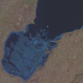
Taken with Resourcesat-2 on March 20, 2022.

See also
 In Spanish: Bahía de Saginaw para niños
