
Paskeville, South Australia facts for kids
Quick facts for kids PaskevilleSouth Australia |
|||||||||||||||
|---|---|---|---|---|---|---|---|---|---|---|---|---|---|---|---|

Main street of Paskeville, with the Paskeville Hotel in the foreground in 2010. The Hotel was burned down in 2012
|
|||||||||||||||

Paskeville
Location in South Australia
|
|||||||||||||||
| Postcode(s) | 5552 | ||||||||||||||
| Elevation | 123 m (404 ft) | ||||||||||||||
| Location | 20 km (12 mi) E of Kadina | ||||||||||||||
| LGA(s) |
|
||||||||||||||
| State electorate(s) | Narungga | ||||||||||||||
| Federal Division(s) | Grey | ||||||||||||||
|
|||||||||||||||
Paskeville is a small town located on the Yorke Peninsula in South Australia. It's about 20 kilometers east of Kadina, along the Copper Coast Highway that leads towards Adelaide. In 2016, Paskeville had a population of 178 people. The town is managed by two local councils: the Copper Coast Council and the District Council of Barunga West.
Contents
The Story of Paskeville
Who Lived Here First?
Paskeville is on the traditional lands of the Narungga people. They are the original Indigenous inhabitants of this area. The first European explorers to visit the northern Yorke Peninsula were John Hill and Thomas Burr. In 1840, they camped near where Paskeville is today. They reported finding lots of good farming land.
How Paskeville Began
In 1851, a sheep farm was started in the area, which became known as Green's Plains. More farmers arrived later to grow crops. Paskeville itself didn't become a town until 1878. This was when a train station was built there for the new Port Wakefield to Kadina railway. The town was officially named Paskeville on March 4, 1880. It was named after General Edward Hanson Paske.
Life in the Early Town
The railway was very important for Paskeville. Farmers used the train to send their wheat, barley, and wool to ports like Wallaroo. Goods sheds were built in 1887, and later, silos were added for storing grain. The town grew, offering services like churches, a school, shops, and a hotel. Paskeville got gaslight in 1903 and a new post office in 1925. The town was busy for a while, but when the railway closed in the 1980s, and with better roads and more shopping choices elsewhere, Paskeville's growth slowed down.
Water for the Region
A large water reservoir was built near Paskeville in the 1890s. It received water from the Beetaloo Reservoir and could hold a huge amount of water. This water was then sent to towns like Wallaroo, Kadina, and Moonta, and further down the Yorke Peninsula. In the 1960s, Paskeville also started receiving water from the River Murray through a pipeline.
Paskeville's Landscape and Weather
What Does the Area Look Like?
The northern Yorke Peninsula used to be covered in scrub, with very few rivers or streams. Now, most of the scrub has been cleared for farming. You'll mostly see rolling fields where grains are grown. Paskeville is on a slightly raised area, which means you can get clear views of the surrounding countryside. The ground is mostly limestone with old sand dunes on top. While it used to be hard to grow crops here, modern farming methods and fertilisers have made it a very productive area for food.
What's the Climate Like?
The area has a dry Mediterranean climate. This means it has warm, dry summers and mild, wet winters. The temperatures are usually a few degrees warmer than in Adelaide.
Yorke Peninsula Field Days
What are the Field Days?
Every two years, Paskeville hosts the Yorke Peninsula Field Days. This is a big three-day event that focuses on agriculture and the future of farming. It's a bit like a huge outdoor exhibition! The event also has many different displays that are interesting for both farming families and people from cities. The Field Days started way back in 1895. Since 1975, they have been held at a special permanent site about 3 kilometers west of the town.
Images for kids
-
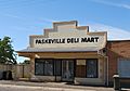
Former shop
-
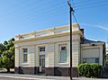
Former bank
-
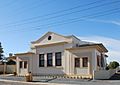
Former court house
-
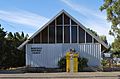
Uniting church
-
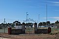
War memorial


