
Pecan Gap, Texas facts for kids
Quick facts for kids
Pecan Gap, Texas
|
|
|---|---|
.jpg)
3rd Street in Pecan Gap
|
|
| Nickname(s):
The Gap
|
|

Location of Pecan Gap, Texas
|
|
 |
|
| Country | |
| State | |
| Counties | Delta, Fannin |
| Settled | 1884 |
| Named for | Nearby pecan grove |
| Area | |
| • Total | 0.63 sq mi (1.64 km2) |
| • Land | 0.63 sq mi (1.62 km2) |
| • Water | 0.01 sq mi (0.02 km2) |
| Elevation | 568 ft (173 m) |
| Population
(2020)
|
|
| • Total | 178 |
| • Density | 314.19/sq mi (121.31/km2) |
| Time zone | UTC-6 (Central (CST)) |
| • Summer (DST) | UTC-5 (CDT) |
| ZIP code |
75469
|
| Area code(s) | 903, 430 |
| FIPS code | 48-56468 |
| GNIS feature ID | 2411394 |
Pecan Gap is a small city located in Delta and Fannin counties in the state of Texas. People who live there sometimes call it "The Gap." In 2020, about 178 people lived in Pecan Gap.
The city got its name from a space between two large pecan trees. Sadly, one of these original pecan trees was destroyed by a tornado in 1963.
Contents
History of Pecan Gap
Early Inhabitants: The Caddo People

The first people to live in the area that is now Pecan Gap were the Caddo people. They settled in large parts of eastern Texas as early as 800 CE. The Caddo were very skilled farmers and lived in big wooden homes.
Around 1750, a French explorer named François Hervey was the first European to visit this area. Over the next few decades, the Caddo people faced many challenges. Diseases brought by Europeans, attacks from other tribes, and conflicts with European settlers forced them to leave the Pecan Gap area.
Changing Lands and New Settlers
Around 1820, other Native American tribes, like the Delaware, Quapaw, and Seminole, began to settle in the region.
The land around Pecan Gap changed hands many times over the years.
- In 1836, the Republic of Texas officially made the area part of Red River County.
- In 1840, Lamar County was created and included much of the land just south of Pecan Gap.
- Just six years later, in 1846, the region became part of the newly formed Hopkins County.
- Finally, in 1870, Delta County was created. As Pecan Gap grew, it expanded westward into Fannin County.
Geography and Nature
Location and Size
Pecan Gap is located where two main roads, Farm to Market Roads 64 and 128, meet. It is one of only two official cities in Delta County. Pecan Gap is the second-largest city in the county by population, after Cooper.
The city covers a total area of about 1.64 square kilometers (0.63 square miles). A very small part of this area, about 0.02 square kilometers (0.01 square miles), is water.
Texas Blackland Prairies
Pecan Gap is part of the Texas blackland prairies region. This area is mostly flat and covered with tallgrass prairie. It stretches across a large part of north-central Texas. The land here is usually between 400 and 500 feet (122 to 152 meters) above sea level.
The soil in this region is mostly deep clay, or clay mixed with dark-colored loam. This soil is known for being very fertile, which is great for growing crops.
Pecan Gap Chalk
A special layer of soil in the region is called Pecan Gap Chalk. It was named after the city when it was found nearby in 1918. This layer is a blue-gray, sandy chalk. It is rich in fossils and can be found in many places around Pecan Gap.
Climate and Weather
Pecan Gap has a humid subtropical climate, which means it has warm, wet summers.
- In January, the average temperature is around 42°F (5.6°C).
- In July, the average temperature is around 82°F (27.8°C).
- The hottest temperature ever recorded in Pecan Gap was 115°F (46.1°C) in July 1936.
- The coldest temperature ever recorded was -5°F (-20.6°C) in January 1930.
The city does not get a lot of rain. The most rain usually falls in May and June, with about 5.5 inches (140 mm) per month. August is the driest month, with only about 2 inches (51 mm) of rain on average.
Population of Pecan Gap
| Historical population | |||
|---|---|---|---|
| Census | Pop. | %± | |
| 1940 | 409 | — | |
| 1950 | 319 | −22.0% | |
| 1960 | 278 | −12.9% | |
| 1970 | 291 | 4.7% | |
| 1980 | 250 | −14.1% | |
| 1990 | 245 | −2.0% | |
| 2000 | 214 | −12.7% | |
| 2010 | 203 | −5.1% | |
| 2020 | 178 | −12.3% | |
| U.S. Decennial Census 1940-2010 |
|||
| Race | Number | Percentage |
|---|---|---|
| White (NH) | 149 | 83.71% |
| Black or African American (NH) | 6 | 3.37% |
| Some Other Race (NH) | 1 | 0.56% |
| Mixed/Multi-Racial (NH) | 15 | 8.43% |
| Hispanic or Latino | 7 | 3.93% |
| Total | 178 |
According to the 2020 United States census, 178 people lived in Pecan Gap. There were 94 households and 79 families. The population density was about 314 people per square mile.
Pecan Festival
Every year, on the second Saturday of October, Pecan Gap hosts a special event called the Pecan Festival, or "Pecan Fest." The Pecan Gap Ladies Club organizes this fun event.
The festival has many exciting things to see and do:
- A lively parade
- A pet show
- Lawnmower races
- Lots of food and drinks
- A special gift shop that is only open during the festival
Education
Students in Pecan Gap attend schools that are part of the Fannindel Independent School District.
Images for kids
-
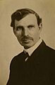
W.L. Mayo helped establish the elementary school in Pecan Gap

See also
 In Spanish: Pecan Gap (Texas) para niños
