Pennington, New Jersey facts for kids
Quick facts for kids
Pennington, New Jersey
|
||
|---|---|---|
|
Borough
|
||
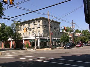
Intersection of Main Street and Delaware Avenue in central Pennington
|
||
|
||
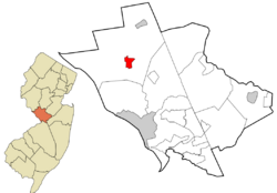
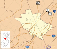
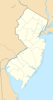
Location of Pennington in Mercer County highlighted in red (right). Inset map: Location of Mercer County in New Jersey highlighted in orange (left).
|
||
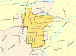
Census Bureau map of Pennington, New Jersey
|
||
| Country | ||
| State | ||
| County | Mercer | |
| Incorporated | January 31, 1890 | |
| Government | ||
| • Type | Borough | |
| • Body | Borough Council | |
| Area | ||
| • Total | 0.96 sq mi (2.50 km2) | |
| • Land | 0.96 sq mi (2.49 km2) | |
| • Water | 0.00 sq mi (0.01 km2) 0.31% | |
| Area rank | 506th of 565 in state 11th of 12 in county |
|
| Elevation | 210 ft (60 m) | |
| Population
(2020)
|
||
| • Total | 2,802 | |
| • Estimate
(2023)
|
2,840 | |
| • Rank | 454th of 565 in state 11th of 12 in county |
|
| • Density | 2,916.0/sq mi (1,125.9/km2) | |
| • Density rank | 222nd of 565 in state 3rd of 12 in county |
|
| Time zone | UTC−05:00 (Eastern (EST)) | |
| • Summer (DST) | UTC−04:00 (Eastern (EDT)) | |
| ZIP Code |
08534
|
|
| Area code(s) | 609 | |
| FIPS code | 3402157600 | |
| GNIS feature ID | 885347 | |
Pennington is a small town, called a borough, located in Mercer County, New Jersey. It sits between the Delaware Valley and the Raritan Valley regions.
In 2020, Pennington had a population of 2,802 people. This was the highest number of residents ever counted in the town.
Contents
History of Pennington
Pennington has an interesting history regarding its name. An old record from 1883 says the village was first called Queenstown, named after Queen Anne.
Later, some people jokingly called it Pennytown because it was so small. By 1747, it started to be known as Pennington. The name "Penington" was already familiar in the area. This was because Edward Penington, whose father was a Quaker leader, was a surveyor in Pennsylvania.
Pennington officially became a borough on January 31, 1890. This happened after people voted for it on January 21, 1890. It was created from parts of Hopewell Township.
Geography and Location
According to the United States Census Bureau, Pennington covers about 0.96 square miles (2.50 square kilometers). Most of this area is land.
Pennington is a unique town because it is completely surrounded by Hopewell Township. This makes it one of 21 "doughnut towns" in New Jersey, where one town is entirely inside another.
People and Population
| Historical population | |||
|---|---|---|---|
| Census | Pop. | %± | |
| 1880 | 723 | — | |
| 1890 | 588 | −18.7% | |
| 1900 | 733 | 24.7% | |
| 1910 | 722 | −1.5% | |
| 1920 | 1,335 | 84.9% | |
| 1930 | 1,335 | 0.0% | |
| 1940 | 1,492 | 11.8% | |
| 1950 | 1,682 | 12.7% | |
| 1960 | 2,063 | 22.7% | |
| 1970 | 2,151 | 4.3% | |
| 1980 | 2,109 | −2.0% | |
| 1990 | 2,537 | 20.3% | |
| 2000 | 2,696 | 6.3% | |
| 2010 | 2,585 | −4.1% | |
| 2020 | 2,802 | 8.4% | |
| 2023 (est.) | 2,840 | 9.9% | |
| Population sources: 1880–1890 1890–1920 1890–1910 1910–1930 1940–2000 2010 2020 |
|||
In 2010, Pennington had 2,585 people living in 1,031 households. The town had about 2,704 people per square mile.
Most residents (95.24%) were White. Other groups included Black or African American (1.82%) and Asian (1.78%). About 1.43% of the population was Hispanic or Latino.
Many households (34.9%) had children under 18. About 60.4% were married couples. The average household had 2.45 people.
The median age in Pennington was 45.7 years. About 26.4% of the population was under 18, and 17.8% was 65 or older.
Arts and Culture
Pennington Day Celebration
Pennington Day is a fun annual event, usually held in mid-May. Local groups and businesses set up booths on Main Street, like a big street fair.
The event started in 1980. It features local music, a parade in the morning, and other fun activities that last into the afternoon.
Education in Pennington
Students in Pennington attend public schools through the Hopewell Valley Regional School District. This district serves students from Hopewell Borough, Hopewell Township, and Pennington Borough.
The district has six schools for students from pre-kindergarten to twelfth grade. In the 2019–20 school year, there were 3,467 students and about 351 teachers. This means there were about 9.9 students for every teacher.
The schools in the district include:
- Bear Tavern Elementary School (Pre-K–5)
- Hopewell Elementary School (Pre-K–5)
- Stony Brook Elementary School (K–5)
- Toll Gate Grammar School (K–5)
- Timberlane Middle School (grades 6–8)
- Hopewell Valley Central High School (grades 9–12)
Students in eighth grade from all of Mercer County can also apply to special high school programs. These are offered by the Mercer County Technical Schools. They provide career and technical education in areas like Health Sciences, STEM, and Culinary Arts. There is no tuition fee for these programs.
The Pennington School
The Pennington School is a private school that serves students from sixth to twelfth grades. It was founded a long time ago in 1838. Back then, it started with just one teacher and three students!
Transportation
Pennington has about 12.34 miles of roads. Most of these roads are maintained by the borough itself.
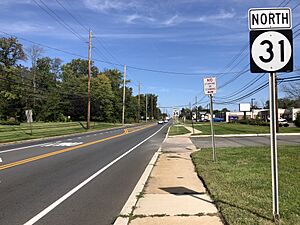
Route 31 goes through Pennington. This road connects to Interstate 295 at exit 72. Another exit, exit 73 on I-295, connects to Scotch Road North, which leads to the surrounding Hopewell Township area.
Public Transportation
NJ Transit provides bus service in Pennington. You can take the 624 bus route between the borough and Trenton.
Climate
Pennington has a climate known as a Hot-summer Humid continental climate. This means it has warm, humid summers and cold winters.
Points of Interest
- Hopewell Valley Central High School
- Hopewell Valley Vineyards
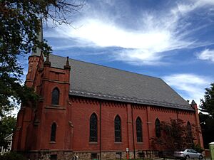
- First Presbyterian Church
- Pennington Railroad Station – This historic train station was built in 1882. It's a Victorian-style building located along the West Trenton Line. It was added to the National Register of Historic Places in 1974.
- The Pennington School
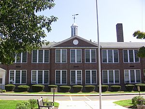
- Toll Gate Grammar school and the original Central High School. Both were built in the 1920s.
- Pennington Fire Company
Notable People
Many interesting people have lived in or are connected to Pennington:
- Val Ackerman (born 1959): The first president of the Women's National Basketball Association (WNBA).
- Svetlana Alliluyeva (born 1926): The daughter of Joseph Stalin, who became famous when she moved to the United States in 1967.
- Kwame Anthony Appiah (born 1954): A well-known philosopher.
- Nicole Baxter (born 1994): A professional soccer player.
- Peter Benchley (1940–2006): The author of the famous novel and film Jaws.
- Wendy Benchley (born 1941): An advocate for marine and environmental protection. She was married to Peter Benchley.
- Bob Bradley (born 1958): A soccer coach who has led the U.S. national team.
- Michael Bradley (born 1987): A professional soccer player for Toronto F.C. and son of Bob Bradley.
- Cassidy Hutchinson (born 1996): A former White House aide who testified about events on January 6th. She was active in the Youth Advisory Committee in Pennington.
- Kenneth G. Miller (born 1956): A geologist who studies global warming and sea level changes.
- Judith Persichilli (born 1949): A nurse and health care leader who served as the commissioner of the New Jersey Department of Health.
See also
 In Spanish: Pennington (Nueva Jersey) para niños
 | Claudette Colvin |
 | Myrlie Evers-Williams |
 | Alberta Odell Jones |


