Peyton, Colorado facts for kids
Quick facts for kids
Peyton, Colorado
|
|
|---|---|

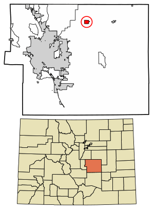
Location of the Peyton CDP in El Paso County, Colorado.
|
|
| Country | |
| State | |
| County | El Paso County |
| Government | |
| • Type | unincorporated community |
| Area | |
| • Total | 2.297 sq mi (5.950 km2) |
| • Land | 2.297 sq mi (5.950 km2) |
| • Water | 0 sq mi (0.000 km2) |
| Population
(2020)
|
|
| • Total | 214 |
| • Density | 93.15/sq mi (35.97/km2) |
| Time zone | UTC-7 (MST) |
| • Summer (DST) | UTC-6 (MDT) |
| ZIP Code |
80831
|
| Area code(s) | 719 |
| GNIS feature | Peyton CDP |
Peyton is a small community in El Paso County, Colorado, United States. It's known as an "unincorporated town," which means it doesn't have its own city government. However, it does have a post office and is recognized as a "census-designated place (CDP)" for counting people.
Peyton is part of the larger Colorado Springs area. The ZIP Code for Peyton is 80831. In 2020, about 214 people lived here. The nearby community of Falcon also uses the 80831 ZIP code. Peyton and other small towns like Falcon and Calhan are located along U.S. Highway 24. This highway connects Colorado Springs to Limon, Colorado, where it meets Interstate 70.
Contents
History of Peyton, Colorado
Peyton was founded by George Peyton in 1888. It was officially mapped out on December 25 of that year. The settlement was first called Mayfield. However, the name had to be changed to Peyton because there was already a town called Mayfield, California.
Early Settlers and Businesses
Among the first people to settle in Peyton were James and Susan McDermott. They moved to Peyton in 1890 when the Rock Island Railroad arrived. Mr. McDermott became the first postmaster and ran a general store for 25 years. His home, which is still standing today, was a popular place for people to stay.
A few years later, Russell Gates opened another store. He had already opened stores in other towns nearby. These stores sold almost everything, from small items to larger goods. At one point, Peyton had five general stores. One of them even sold gasoline!
Life in Early Peyton
By 1900, about 50 people lived in Peyton. Most people worked in farming or coal mining. The town also had important services like a blacksmith, a doctor, a creamery (where dairy products were made), and a hotel. Joseph Zimmerman built a meeting hall above a storage building. This hall was used for community dances, elections, and fundraising events.
The first telephone arrived in Peyton in 1904. It was very simple, powered by a battery, and you had to turn a crank to make a call. Phone lines were even strung along barbed wire fences! Later, a central switchboard was set up, and Mrs. George Hayes was the operator until 1922.
Challenges and Growth
In 1923, a big fire destroyed several buildings, cars, and a general store. But the town rebuilt! By the 1930s, Peyton had 13 businesses.
The original train station was taken down in 1945 and replaced with a new one. Ten years later, the new station was no longer needed. The railroad sold it to the Methodist Church in 1958, and they used its materials to build an addition to their church.
When the school house burned down in 1954, people in Peyton realized they needed their own fire protection. A group met and created the Peyton Volunteer Fire Department. Clarence Cook became the first Fire Chief. The department held events like dances and street carnivals to raise money. Eventually, they built a fire station. Today, it is still an all-volunteer department.
In June 1965, a flood caused a lot of damage to the railroad tracks near Peyton. The water washed away 500 feet of ground under the track, leaving it hanging in the air! The flood also damaged an underpass. It took many crews working hard to fix the tracks and roads.
Geography of Peyton
The Peyton CDP covers an area of about 5.950 square kilometers (2.3 square miles). All of this area is land.
Population Information
The United States Census Bureau first defined the Peyton CDP for the United States Census 2010.
| Peyton CDP, Colorado | ||
|---|---|---|
| Year | Pop. | ±% |
| 2010 | 250 | — |
| 2020 | 214 | −14.4% |
| Source: United States Census Bureau | ||
Arts and Culture in Peyton
Peyton has some interesting cultural and recreational spots.
- The Black Squirrel Creek Bridge was once a historic landmark between Peyton and Falcon. It was taken down and replaced in 2012.
- The Homestead Ranch Regional Park is located in Peyton. It has a playground and trails for hiking.
Education in Peyton
Students in the Peyton area attend schools in the Peyton School District 23JT. Students in the Falcon area and nearby parts of Colorado Springs attend schools in Falcon School District 49.
Notable People from Peyton
- Lisa Joann Thompson: A dancer and actress who appeared in TV shows like In Living Color and Fame L.A.. She lived in Peyton for five years when she was a child in the mid-1970s.
- Kalen Ballage: An NFL running back who started playing in 2018. He was born in Peyton and went to Falcon High School.
See also
 In Spanish: Peyton (Colorado) para niños


