Pichincha (volcano) facts for kids
Quick facts for kids Pichincha |
|
|---|---|

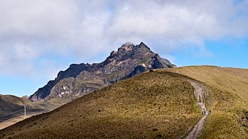
Ruku Pichincha as seen from the trail from Quito to the top
|
|
| Highest point | |
| Elevation | 4,784 m (15,696 ft) |
| Prominence | 1,652 m (5,420 ft) |
| Listing | Ultra |
| Geography | |
| Parent range | Andes |
| Geology | |
| Age of rock | Quaternary |
| Mountain type | Stratovolcano |
| Volcanic arc/belt | North Volcanic Zone |
| Last eruption | October to December 2002 |
| Climbing | |
| First ascent | 1582 by José Ortiguera and others (first recorded ascent of Guagua Pichincha). |
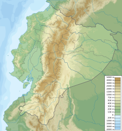
Pichincha is a large stratovolcano in Ecuador. A stratovolcano is a tall, cone-shaped volcano built up by many layers of hardened lava, ash, and rocks. The capital city of Quito is located right on its eastern slopes.
The mountain has two main peaks. These are Wawa Pichincha and Ruku Pichincha. Wawa Pichincha is the higher peak at 4,784 metres (15,696 ft). Its name means "child" or "baby" in the Kichwa language. Ruku Pichincha is 4,698 metres (15,413 ft) tall. Its name means "old person" in Kichwa. Wawa Pichincha has an active caldera. A caldera is a large, bowl-shaped hollow that forms after a volcano erupts and the ground above its magma chamber collapses.
About Pichincha
Both Wawa Pichincha and Ruku Pichincha can be seen from Quito. They are popular spots for climbers to get used to high altitudes. This is called acclimatization. Wawa Pichincha is usually reached from a village called Lloa, outside Quito. Ruku Pichincha is often reached using the TelefériQo. This is a cable car system on the western side of Quito.
In October 1999, the volcano erupted. It covered Quito with several inches of ash. Before that, big eruptions happened in 1553 and 1660. In 1660, about 30 cm (12 in) of ash fell on the city.
The province where the volcano is located is named after it. Many other provinces in Ecuador are also named after mountains. Examples include Cotopaxi and Chimborazo.
Volcano Eruptions
In 1660, Pichincha had a very powerful eruption. This type of eruption is called a Plinian eruption. It spread ash over 1,000 kilometres (621 mi). More than 30 centimetres (12 in) of ash fell on Quito.
The most recent big eruption started in August 1998. On March 12, 2000, a phreatic eruption happened. This is an eruption caused by steam, when magma heats groundwater. Sadly, two scientists studying the volcano were killed during this event.
A Look at History
For thousands of years, local people considered the volcano sacred. This was long before Europeans arrived.
The first recorded climb of Wawa Pichincha was in 1582. A group of local people led by José Ortiguera made this ascent.
In 1737, some members of the French Geodesic Mission visited. This group was trying to measure the Earth's shape near the equator. Scientists like Charles-Marie de La Condamine and Pierre Bouguer spent 23 days on Ruku Pichincha. They were doing important measurement work.
Later, in 1742, La Condamine and Bouguer climbed Wawa Pichincha. They looked into the volcano's crater. It had last erupted in 1660. La Condamine described it as looking like an underworld.
In 1802, Alexander von Humboldt climbed Pichincha. He measured its height and other volcanoes nearby. Humboldt's writings inspired artist Frederic Edwin Church. Church later visited and painted Pichincha and other mountains in the Andes.
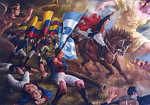
On May 24, 1822, a very important battle took place. General Antonio José de Sucre's army fought the Spanish colonial army. This happened on the volcano's southeast slopes. The battle is known as the Battle of Pichincha. It helped Ecuador gain independence from Spain.

See also
- In Spanish: Volcán Pichincha para niños


