Pitcher, New York facts for kids
Quick facts for kids
Pitcher, New York
|
|
|---|---|
 |
|
| Country | United States |
| State | New York |
| County | Chenango |
| Government | |
| • Type | Town Council |
| Area | |
| • Total | 28.48 sq mi (73.76 km2) |
| • Land | 28.46 sq mi (73.72 km2) |
| • Water | 0.01 sq mi (0.04 km2) |
| Elevation | 1,161 ft (354 m) |
| Population
(2010)
|
|
| • Total | 803 |
| • Estimate
(2019)
|
771 |
| • Density | 27.40/sq mi (10.58/km2) |
| Time zone | UTC-5 (Eastern (EST)) |
| • Summer (DST) | UTC-4 (EDT) |
| ZIP code |
13136
|
| Area code(s) | 607 |
| FIPS code | 36-017-58288 |
| GNIS feature ID | 0979370 |
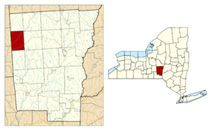
Pitcher is a small town located in Chenango County, New York, in the United States. It is named after Nathaniel Pitcher, who was the eighth governor of New York. In 2010, about 803 people lived in Pitcher. The town is found on the western edge of Chenango County, west of the city of Norwich.
Contents
History of Pitcher
The first people settled in the area that is now Pitcher around 1794. The town of Pitcher was officially created in 1827. It was formed from parts of two other towns called German and Lincklaen. A few years later, in 1833, Pitcher became a bit larger when it gained more land from Lincklaen.
Geography of Pitcher
Pitcher covers a total area of about 73.8 square kilometers (28.5 square miles). Most of this area is land, with only a tiny part (about 0.05%) being water.
The western border of Pitcher is also the border of Cortland County.
The Otselic River flows south through the town. This river is a branch of the Tioughnioga River, and both are part of the larger Susquehanna River system.
Two important roads pass through Pitcher:
- New York State Route 26 runs northeast to southwest, following the path of Otselic Creek.
- New York State Route 23 crosses the southern part of Pitcher, following Brakel Creek.
Population and People
Here's how the population of Pitcher has changed over the years:
| Historical population | |||
|---|---|---|---|
| Census | Pop. | %± | |
| 1830 | 1,214 | — | |
| 1840 | 1,562 | 28.7% | |
| 1850 | 1,403 | −10.2% | |
| 1860 | 1,276 | −9.1% | |
| 1870 | 1,124 | −11.9% | |
| 1880 | 1,075 | −4.4% | |
| 1890 | 983 | −8.6% | |
| 1900 | 751 | −23.6% | |
| 1910 | 664 | −11.6% | |
| 1920 | 609 | −8.3% | |
| 1930 | 598 | −1.8% | |
| 1940 | 643 | 7.5% | |
| 1950 | 636 | −1.1% | |
| 1960 | 650 | 2.2% | |
| 1970 | 627 | −3.5% | |
| 1980 | 735 | 17.2% | |
| 1990 | 751 | 2.2% | |
| 2000 | 848 | 12.9% | |
| 2010 | 803 | −5.3% | |
| 2019 (est.) | 771 | −4.0% | |
| U.S. Decennial Census | |||
According to the census from 2000, there were 848 people living in Pitcher. There were 293 households, and 230 of these were families. On average, there were about 2.89 people in each household.
About 40% of the households had children under 18 living with them. The average age of people in the town was 35 years old.
Places in Pitcher
Here are some of the communities and locations you can find in the town of Pitcher:
- Chandler Corners – This used to be a place in the northeastern part of the town, near Pitcher village.
- Hydeville – A small community (hamlet) located near the western town line, north of Pitcher village.
- North Pitcher – Another hamlet in the northern part of the town, located along NY-26 and the Otselic River.
- Pitcher – This is the main hamlet of Pitcher, found in the western part of the town, also along NY-26 and the Otselic River.
- Pitcher Springs – A hamlet northeast of Pitcher village. In the past, it was a popular place for people to visit for its natural springs.
- Ufford Corners – A location northwest of North Pitcher, close to the northern town line.
- Union Valley – A hamlet mostly located in Cortland County, right at the western town line.
- Waldron Corners – A location at the eastern town line.
Notable Person from Pitcher
- Jethro A. Hatch – He was the first doctor in Kentland, Indiana, and later became a congressman representing Indiana.
See also
 In Spanish: Pitcher (Nueva York) para niños
 | Audre Lorde |
 | John Berry Meachum |
 | Ferdinand Lee Barnett |


