Ponoka County facts for kids
Quick facts for kids
Ponoka County
|
|
|---|---|

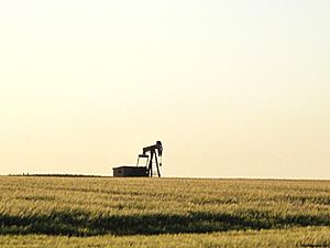
Pump jack near Ponoka
|
|

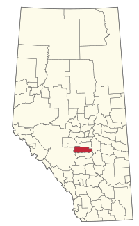
Location within Alberta
|
|
| Country | Canada |
| Province | Alberta |
| Region | Central Alberta |
| Census division | 8 |
| Established | 1944 |
| Incorporated | 1952 |
| Area
(2021)
|
|
| • Land | 2,807.99 km2 (1,084.17 sq mi) |
| Population
(2021)
|
|
| • Total | 9,998 |
| • Density | 3.6/km2 (9/sq mi) |
| Time zone | UTC−7 (MST) |
| • Summer (DST) | UTC−6 (MDT) |
Ponoka County is a special area in Alberta, Canada. It is called a municipal district. This means it's a type of local government area. The county covers about 2,808 square kilometers (or 721,396 acres). It is known for showing what rural Alberta is all about.
Contents
History of Ponoka County
Ponoka County was officially started on January 1, 1952. Before that, it was established in 1944. The first public officials helped run the county. Mr. Bruce Ramsey managed local government matters. Mr. Peter McDonald handled the money as the secretary-treasurer. Mr. L.G. Saunders was in charge of the school system. The name "Ponoka" comes from the Blackfoot word for Elk.
Geography and Communities
Ponoka County is home to several communities. These include towns, hamlets, and other small places.
Towns in Ponoka County
The following towns are completely surrounded by Ponoka County:
Hamlets and Localities
Hamlets are small communities that are part of the county. Localities are even smaller places.
Other small places, called localities, within Ponoka County include:
- Alberta Hospital
- Crestomere
- Frank Subdivision
- Homeglen
- Lavesta
- Menaik
- Morning Meadows Subdivision
- Nugent
- Paulson Pasture
- Pleasant Hill Subdivision
- Rimbey Ridge Estates
- Springdale
- Sunnyside
- Tristram
- Viewmar Estates
- Willesden Green
- Woodland Park
Population and Demographics
Understanding the population helps us learn about the people living in Ponoka County.
Population in 2021
In 2021, Statistics Canada counted the people in Ponoka County. The total population was 9,998. These people lived in 3,689 homes. This was a small increase from the population in 2016. The county has a land area of 2,807.99 square kilometers. This means there were about 3.6 people living per square kilometer.
Population in 2016
In 2016, the population of Ponoka County was 9,806. They lived in 3,535 homes. This was also an increase from the 2011 population. The land area was slightly larger at 2,814.26 square kilometers. The population density was about 3.5 people per square kilometer.
 | Delilah Pierce |
 | Gordon Parks |
 | Augusta Savage |
 | Charles Ethan Porter |

