Port Mann Bridge facts for kids
Quick facts for kids Port Mann Bridge (2012) |
|
|---|---|
 |
|
| Coordinates | 49°13′16″N 122°48′46″W / 49.221031°N 122.812697°W |
| Carries | Ten lanes of British Columbia Highway 1 (Trans-Canada Highway), pedestrians and bicycles |
| Crosses | Fraser River |
| Locale | Coquitlam Surrey |
| Maintained by | Transportation Investment Corporation (TI Corp) |
| Preceded by | Port Mann Bridge (1964) |
| Characteristics | |
| Design | Cable-stayed bridge |
| Total length | 2,020 metres (6,630 ft) |
| Width | 65 metres (213 ft) |
| Height | 163 metres (535 ft) |
| Longest span | 470 metres (1,540 ft) |
| Clearance below | 42 metres (138 ft) |
| History | |
| Designer | T.Y. Lin International |
| Construction begin | February 4, 2009 |
| Construction end | September 17, 2015 |
| Construction cost | $820 million |
| Opened | September 18, 2012 |
| Port Mann Bridge (1964) | |
|---|---|
 |
|
| Carries | Five lanes of British Columbia Highway 1 (Trans-Canada Highway) |
| Crosses | Fraser River |
| Locale | Coquitlam Surrey |
| Maintained by | British Columbia Ministry of Transportation |
| Followed by | Port Mann Bridge (second, 2012) |
| Characteristics | |
| Design | Tied-arch bridge |
| Total length | 2093 m |
| Longest span | 366 m |
| History | |
| Designer | CBA Engineering |
| Construction begin | 1957 |
| Construction end | 1963 |
| Construction cost | $25 million |
| Opened | June 12, 1964 |
| Closed | November 17, 2012 (demolished October 2015) |
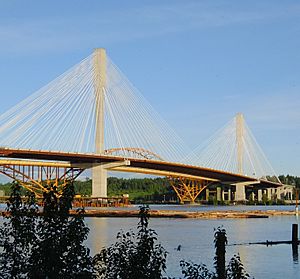
The Port Mann Bridge is a huge bridge in British Columbia, Canada. It opened in 2012 and has 10 lanes for cars, bikes, and pedestrians. This bridge is a cable-stayed bridge, which means its deck is held up by many strong cables connected to tall towers. It crosses the Fraser River, connecting the cities of Coquitlam and Surrey near Vancouver.
The current Port Mann Bridge replaced an older steel arch bridge. The new bridge is one of the longest cable-stayed bridges in North America. After the new bridge opened, the old one was carefully taken apart.
Contents
History of the Old Port Mann Bridge
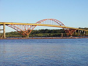
The first Port Mann Bridge opened on June 12, 1964. It was named after the community of Port Mann, located at the south end of the bridge. This old bridge was a tied-arch bridge and had five lanes for traffic.
The old bridge was very long, about 2,093 meters (6,867 feet) in total. Its main arch span was 366 meters (1,201 feet) long. When it was built, it was the longest arch bridge in Canada. It was also the third-longest arch bridge in the world at that time.
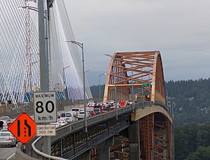
About 127,000 vehicles used the old bridge every day. A small part of this traffic, about 8%, was large trucks. In 2001, an extra lane for vehicles with multiple passengers (called an HOV lane) was added. This was done by making the bridge deck wider and updating it to be safer in an earthquake.
Building a New Bridge
By 2006, traffic was getting very heavy on the old bridge. The government of British Columbia started a plan called the "Gateway Program." This plan first thought about building a second bridge next to the old one. However, they later decided to build one brand new, much wider bridge instead. This new bridge would have 10 lanes and replace the original one entirely.
Even though the old bridge was in good condition, it had a design that could be risky. If one main part of its structure broke, the whole bridge could be in danger. This type of bridge design doesn't have "backup" parts, so a small crack could become a big problem.
Why Some People Disagreed
Not everyone thought building a new bridge was the best idea. Many groups, including city councils and environmental organizations, wanted more public transportation instead. They argued that adding more highway lanes would only cause more traffic later on. They also worried it would increase pollution and encourage cities to spread out more.
Groups like the Livable Region Coalition suggested building rapid transit lines and better bus routes. The David Suzuki Foundation also said the bridge plan went against goals for a livable region.
Construction and Costs
The Port Mann / Highway 1 project was a big undertaking. It included upgrading 37 kilometers (23 miles) of Highway 1. The total cost for the whole project was estimated at $2.46 billion. The new bridge itself cost about $820 million.
The project also added a path for bikes and pedestrians, which opened in 2015. Bus service was also brought back to the bridge after many years. Now, special bus rapid transit buses use the HOV lanes on Highway 1.
The new Port Mann Bridge opened to traffic on September 18, 2012. At 65 meters (213 feet) wide, it was once named the world's widest long-span bridge by Guinness World Records. It took this title from the famous Sydney Harbour Bridge. However, the San Francisco–Oakland Bay Bridge later became wider in 2013.
Taking Down the Old Bridge
Taking down the old bridge was a big job. They decided not to use explosives because it could harm the Fraser River, which is important for shipping and fish. Instead, they took the bridge apart piece by piece, in the reverse order it was built.
Crews started removing parts in December 2012. They took off the road deck first, then the support beams, and finally the steel arch. The old bridge was completely removed by October 21, 2015.
Features of the New Bridge
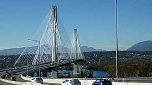
The new Port Mann Bridge is 2.02 kilometers (1.26 miles) long. It is up to 65 meters (213 feet) wide and has 10 lanes for vehicles. The bridge is 42 meters (138 feet) above the river's high water level, which is the same as the old bridge.
The bridge's towers are about 75 meters (246 feet) tall above the road. From the very bottom of their foundations, they are about 163 meters (535 feet) tall. The main section between the two towers is 470 meters (1,542 feet) long. This makes it the second-longest cable-stayed bridge span in the western hemisphere. The entire main bridge section has two towers and 288 cables. The new bridge was also built to allow for future light rapid transit lines.
Challenges During Construction and Operation
Building such a large bridge can have challenges. In February 2012, a large crane collapsed during construction. A 90-tonne concrete piece fell into the river. Luckily, no one was hurt, but it did delay the work.
In December 2012, cold weather caused ice to build up on the bridge's cables. This ice then fell onto the cars below, which people called "ice bombs." Many cars were damaged, and one driver needed medical help. The bridge had to be closed for several hours. To prevent this, special collars were installed on the cables. These collars can be released to slide down the cables and clear off snow and ice.
In December 2016, "slush bombs" also affected the bridge. The bridge was closed again at times due to falling snow and icy conditions.
Bridge Tolls (2012–2017)
When the new bridge first opened, drivers had to pay a toll to cross it. This money was meant to help pay for the bridge's construction and upkeep. The tolls were collected electronically using special decals or by taking pictures of license plates.
If drivers didn't pay their tolls, they could face penalties. For example, if someone owed more than $25 in tolls for 90 days, they would have to pay an extra fee. They also couldn't renew their vehicle insurance or driver's permits until the debt was paid.
However, on September 1, 2017, all tolls on the Port Mann Bridge were removed. This was announced by John Horgan, the Premier of British Columbia at the time. Now, crossing the bridge is free for everyone.
| Year | Annual toll revenue | Annual expenditures |
|---|---|---|
| 2012 | $15.0 million | $14.0 million |
| 2013 | $94.0 million | $20.0 million |
| 2014 | $122.0 million | $19.0 million |
| 2015 | $136.0 million | $18.0 million |
How Many Vehicles Use the Bridge?
The tables below show how many vehicles crossed the Port Mann Bridge each month. You can see how the traffic changed over the years, especially after the tolls were removed in September 2017.
Monthly Average Weekday Traffic
| 2013 | 2014 | 2015 | 2016 | 2017 | 2018 | |
|---|---|---|---|---|---|---|
| January | 95,200 | 92,200 | 96,900 | 103,000 | 112,000 | 146,000 |
| February | 100,900 | 94,300 | 101,700 | 107,500 | 111,200 | 149,000 |
| March | 104,000 | 98,200 | 104,000 | 109,900 | 118,600 | 156,000 |
| April | 106,400 | 101,400 | 105,000 | 116,600 | 122,500 | 160,000 |
| May | 107,500 | 103,700 | 108,500 | 132,700 | 123,400 | 163,000 |
| June | 108,900 | 106,300 | 112,300 | 139,100 | 127,800 | 167,000 |
| July | 111,000 | 107,700 | 111,800 | 139,200 | 130,000 | 167,100 |
| August | 112,700 | 110,600 | 112,100 | 140,400 | 133,200 | 158,127 |
| September | 107,600 | 106,600 | 110,900 | 126,300 | 153,700 | 156,443 |
| October | 107,000 | 104,700 | 110,900 | 120,500 | 156,000 | 156,632 |
| November | 102,800 | 101,500 | 107,100 | 119,000 | 151,300 | 150,627 |
| December | 95,000 | 97,500 | 104,100 | 108,700 | 142,900 | 144,223 |
Total Monthly Traffic (in millions)
| 2013 | 2014 | 2015 | 2016 | 2017 | 2018 | |
|---|---|---|---|---|---|---|
| January | 2.78 | 2.66 | 2.74 | 2.89 | 3.08 | 4.21 |
| February | 2.65 | 2.42 | 2.74 | 2.89 | 2.79 | 3.70 |
| March | 3.00 | 2.71 | 2.90 | 3.16 | 3.41 | 4.52 |
| April | 3.01 | 2.83 | 2.94 | 3.29 | 3.29 | 4.45 |
| May | 3.16 | 2.98 | 3.11 | 3.72 | 3.58 | 4.79 |
| June | 3.04 | 2.95 | 3.17 | 3.89 | 3.57 | 4.67 |
| July | 3.33 | 3.18 | 3.24 | 4.00 | 3.75 | 4.84 |
| August | 3.04 | 3.25 | 3.21 | 4.08 | 3.79 | 4.90 |
| September | 3.02 | 3.02 | 3.12 | 3.43 | 4.36 | 4.69 |
| October | 3.02 | 3.05 | 3.23 | 3.36 | 4.49 | 4.85 |
| November | 2.86 | 2.77 | 2.95 | 3.23 | 4.24 | 4.51 |
| December | 2.78 | 2.85 | 3.02 | 3.01 | 4.43 | 4.47 |
See also
 In Spanish: Puente Port Mann para niños
 | Isaac Myers |
 | D. Hamilton Jackson |
 | A. Philip Randolph |


